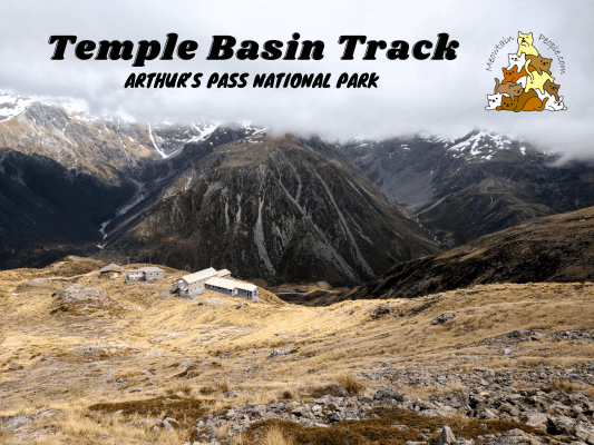
The Temple Basin Track is a 2.1km, 1.5 hours (one way) track that starts from the bottom of Temple Basin car park to Temple Basin Ski Area. It provides an eye-satisfying galore of expansive mountain views.
From the same car park starting point, the Dobson Nature Walk is a very easy 750m, 15 minutes (one way) track that takes you to Arthur’s Pass Lookout and Lake Misery Track.
Temple Basin Track
10.07am: Starting the hike at Temple Basin Car Park.
(+11)10.18am: Twin Creek Falls in the distance.
The loose stones and solid rock track zigzags steeply up the hill.
(+8)10.26am: Amazing viewpoint facing the state highway and the border of Canterbury and West Coast.
(+18)10.44am: A ravine with waterfalls and stream next to the track.
(+5)10.49am: The ski field building and lodge in sight. The path becomes less steep.
(+7)10.56am: Arrived at the ski field buildings. During ski season, the facilities are open and there’s a bar and canteen in the lodge. It’s closed during the off season.
My original plan was to attempt the climb from the end of Temple Basin Track (basically the ski area buildings) to the peak of Mt Temple (exposed and unmarked, graded as difficult). Pictured is the cloud covered, snowy Mt Temple (the peak wasn’t visible).
(+21)11.17am: Walking straight over Mt Temple (Northeast) isn’t a good option as it’s a very steep rock face. Instead, one should follow the little ridgeline up towards East, guided by the ski cables, to join the side ridge of Mt Temple, before climbing Northwards on the ridgeline to Mt Temple peak. You can study the ridgelines on the map and plan your route according to it. Do keep in mind that this is not a route for casual climbers.
Unfortunately, the messy spring weather wasn’t great for this route as it was very cloudy with no visibility at the top. Also, I was rather under-equipped and under-prepared for this attempt, so I decided not to proceed with this plan.
(+8)11.25am: Slightly disappointed, I turned back towards the ski area and voila! I was welcomed with this amazing sight of the mountainous terrain. I’ve been focusing on climbing the steep ridges to Mt Temple that I didn’t realize the spectacular scene that’s presenting behind my back. The attempt to climb higher was totally worth it!
Dobson Nature Walk (Arthur’s Pass Lookout / Lake Misery Track)
(+63)12.28pm: Back down to the car park, I proceeded to the short walk to Dobson Nature Walk. There is also a connection trailhead to Arthur’s Pass Walking Track here.
(+7)12.35pm: Beyond Dobson Nature Walk is the Lake Misery Track. The track was muddy and partially submerged. The sight of Lake Misery was, miserable (pun intended). Well, it’s not that bad but nothing really interesting and not worth getting muddy wet feet to visit Lake Misery.
(+11)12.46pm: Dobson Nature Walk ends at the Arthur Dudley Dobson Memorial, to commemorate the surveyor, after whom Arthur’s Pass is named.
Close by is the Arthur’s Pass Lookout, a good spot for taking in views of Arthur’s Pass valley.
Have this guide helped you? Tag @meowtainpeople in your hiking stories & posts!
*Captain Planet passing by* Remember, please take care of our environment, and please don’t destroy the Nature. Leave no trash behind and take back only photos and memories (and also some trash if you can). Walk on the designated path and stay in the middle as much as you can, so that the exposed soil doesn’t spread/corrode further. BE ONE WITH NATURE *flies away*
Affiliate Links to support this site:
Yay for transparency!: The links above are affiliate links, and at no additional cost to you, I earn a commission if you make a booking/purchase after clicking the links. I recommend only products and companies I use. Your support helps me keep the site going 🙂
Want to do the same affiliate marketing with your site? Use this AccessTrade platform link to receive RM5 reward.

