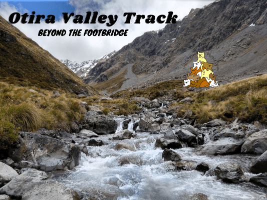
Otira Valley Track follows a deep alpine valley under the northern flank of Mount Rolleston to the Otira River footbridge. Beyond the footbridge is an unmarked route that continues further up to the dead end of the valley, where it’s possible for experienced mountaineers with route-finding skills to climb up to the peak of Mount Rolleston if the condition is right.
Note: Dangerous avalanches may cross the Otira Valley Track from May to November. Do check the avalanche advisory site or with the visitor center before using this track during these months.
Otira Valley Track Car Park & Trailhead
1.11pm: Otira Valley Track starts at the small car park right beside the state highway.
(+4)1.15pm: The track climbs over an old glacial moraine, then follows along the left (or true right) of Otira River through subalpine scrub and tussock into the valley.
(+29)1.46pm: Fed by melting snow, the Otira River flows down from the end of the valley.
(+2)1.48pm: Arriving at the Otira River footbridge marks the end of Otira Valley Track.
As mentioned before, the path beyond the footbridge is an unmarked route that ventures deeper into the valley.
Beyond Otira River Footbridge
While it is said that map-reading and route-finding skills are essential, the route is generally not too challenging to navigate as the valley actually serves as a straightforward guide for the general directions. The more essential skill here is to spot the faint paths through the rocks and rubbles that are more stable, safest and easiest to walk on.
Can you see the faint “path” through the scree slopes? You could also see similar “path” on big rocks trails but they’re less obvious, too faint to capture on camera.
(+16)2.04pm: For some parts the river gets narrower but the sides get steeper, so you would need to climb a little higher further away from the river to navigate safely.
(+3)2.07pm
(+1)2.08pm: The ice cold meltwater of Otira River.
(+3)2.11pm
Some small waterfalls flowing down the steep mountain faces along the valley.
(+5)2.16pm: Towards the end of the valley.
(+13)2.29pm: The end of the valley was still pretty snow-covered in mid spring. Experienced and well equipped climbers with route-finding and map-reading skills may attempt to summit Mount Rolleston from here.
The spectacular view on the way back to the footbridge.
(+35)3.04pm: Back to Otira River footbridge.
(+33)3.37pm: Back to the car park.
Have this guide helped you? Tag @meowtainpeople in your hiking stories & posts!
*Captain Planet passing by* Remember, please take care of our environment, and please don’t destroy the Nature. Leave no trash behind and take back only photos and memories (and also some trash if you can). Walk on the designated path and stay in the middle as much as you can, so that the exposed soil doesn’t spread/corrode further. BE ONE WITH NATURE *flies away*
Affiliate Links to support this site:
Yay for transparency!: The links above are affiliate links, and at no additional cost to you, I earn a commission if you make a booking/purchase after clicking the links. I recommend only products and companies I use. Your support helps me keep the site going 🙂
Want to do the same affiliate marketing with your site? Use this AccessTrade platform link to receive RM5 reward.

