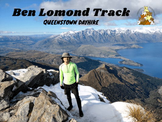
One of Queenstown’s most breathtaking alpine dayhike is the Ben Lomond Track, a 1,400 meters climb to the summit. A clear day on top of Ben Lomond, high above Queenstown, brings you a spectacular panoramic view. This hike to the summit typically takes about 6-8 hours to return. In winter, the track will be covered in snow, very icy, muddy, and slippery, only those with the right alpine gears and experience should attempt it during this time.
I did this hike in late autumn, when a few days ago the region received a sudden cold blast that brought in snow, which stays frozen on the summit.
Ben Lomond Queenstown Starting Points / Trailheads
Ben Lomond Track can be accessed via seven ways:
- Hike the Tiki Trail (2.1km, 1 hour) next to the Skyline Gondola base station and hike to the top of the gondola top complex and onwards to Ben Lomond Track. (recommended)
- Ride the Skyline Gondola cable car up to the top station if you decide to save time and energy.
- Take the Skyline Access Road (no private vehicles or downhill riding allowed) and join the One Mile Creek – Ben Lomond Track, or follow the road up to the end at gondola top complex.
- Start the Ben Lomond Track from the road end off Fernhill Road.
- Start the hike from Wynyard Drive / One Mile Creek Track near One Mile Car Park and the roundabout.
- Start from Moonlight Track in Arthur’s Point end, which joins Ben Lomond Track near the saddle. This is an advanced track and it would take around 5 hours to reach Ben Lomond Summit (10 hours return).
- Start from Moonlight Track from Moke Lake’s end, also an advanced, unmarked long route.
Tiki Trail to Skyline Gondola Top Complex (2km)
10.08am: The trailhead of Tiki Trail is just behind Queenstown Cemetery and next to Skyline Gondola base.
The trail winds its way uphill through the forest.
While the Tiki Trail is a no-bike track, it crosses a few mountain bike tracks, so watch out for bikes speeding down the hill.
One of the zipline platforms by Ziptrek Ecotours, Queenstown’s first carbon-neutral tourism business.
(+49)10.57am: Reaching the top complex of Skyline Gondola. The gondola was having major upgrades and maintenance, hence was closed during that time.
Skyline Gondola Top Complex to Ben Lomond Saddle (5km)
(+7)11.04am: Follow the Ben Lomond signs and the orange triangles to Ben Lomond Track.
(+5)11.09am: At about 800m of altitude, the track opens up with fantastic mountainous views as it goes above the bushline.
(+2)11.11am: 3km before Ben Lomond Saddle, there’s a nice viewpoint featuring views over Queenstown, Lake Wakatipu and the mountain backdrops.
From here, it’s around 45 minutes – 1 hour (in non-icy condition) of constant, mild uphill walk to the saddle.
(+23)11.34am
(+4)11.38am: 1.5km away from Ben Lomond Saddle.
(+8)11.46am: Love that snowy mountain range across Lake Wakatipu!
Just keep climbing…
(+11)11.57am: Look at the view! At this point, snow began to appear on the surrounding scrubs.
(+8)12.05pm: Hikers resting while enjoying the views near the saddle.
As you approach the saddle, the trail takes a left turn towards the saddle and summit. There’s also a narrower track ahead that brings you to Arthur’s Point or Moke Lake via Moonlight Track.
As you take the left turn, the summit stands tall in front of you.
(+3)12.08pm: There’s a public toilet 100m before the saddle.
If you look at the toilet at an angle, the wall paintings look like they’re blending in with the views. It’s like a camouflaged toilet!
(+2)12.10pm: Arrived at the top of Ben Lomond Saddle!
Ben Lomond Saddle to Ben Lomond Summit (1.5km)
12.10pm: The climb from the saddle to the summit is the tougher section. It is steeper, not maintained, and can be slippery with steep drops.
(+15)12.25pm: As you climb towards the summit, you can get refined views on both sides of the saddle.
(+18)12.43pm
(+17)1pm
(+6)1.06pm: As I got closer to the summit, the snow and ice brought in by a severe cold blast a few days ago covered the trail. The photos here are taken at safe spots so I didn’t manage to capture the dangerous sections as I was putting all my concentration into not slipping and falling off the cliff. The steep drops along these slippery icy trails mean there’s minimal room for mistakes. (A pair of microspikes would be very useful in these situations)
(+6)1.12pm: After an hour climbing from the saddle (3 hours from base), I finally reached the summit of Ben Lomond!
The spectacular panoramic views from Ben Lomond Summit.
(+68)2.20pm: Back down to the saddle.
(+39)2.59pm: Saw a few wild goats as I headed back down the mountain.
(+18)3.17pm: Down into the treeline to Tiki Track.
(+52)4.09pm: Exited the trail at the end of Tiki Track and the base of Skyline Gondola.
Have this guide helped you? Tag @meowtainpeople in your hiking stories & posts!
*Captain Planet passing by* Remember, please take care of our environment, and please don’t destroy the Nature. Leave no trash behind and take back only photos and memories (and also some trash if you can). Walk on the designated path and stay in the middle as much as you can, so that the exposed soil doesn’t spread/corrode further. BE ONE WITH NATURE *flies away*
Affiliate Links to support this site:
Yay for transparency!: The links above are affiliate links, and at no additional cost to you, I earn a commission if you make a booking/purchase after clicking the links. I recommend only products and companies I use. Your support helps me keep the site going 🙂
Want to do the same affiliate marketing with your site? Use this AccessTrade platform link to receive RM5 reward.

