
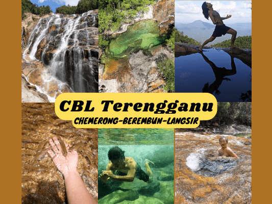
The trans Chemerong, Berembun & Langsir hike, also known as CBL hike, is one of Terengganu’s and Malaysia’s best hiking and camping journeys. It is located within Pasir Raja Forest Reserve (Hutan Simpan Pasir Raja) in the Dungun district. Featuring massive and beautiful waterfalls, crystal clear swimming holes and rivers swarming with fish, amazing campsites with views and more, the CBL trip is one that hiking and camping enthusiasts should not miss!
Chemerong-Berembun-Langsir (CBL Terengganu) 3D2N Itinerary

The typical itinerary of CBL goes like this:
- Day 1: Starting Point – Chemerong Waterfall – Camp B – Camp Y (set up camp)
- Day 2: Leave Camp Y – Berembun Peak – Camp Langsir (set up camp)
- Day 3: Leave Camp Langsir – Sungai Bangan – Starting Point (exit)
However, because it was during the low crowd period of the fasting month (Bulan Puasa), it was possible for our guide to tweak the itinerary as the campsites were not occupied. Instead, we did the reversed version of the journey and camped only at Camp Langsir for both nights (because of the amazing location):
- Day 1: Starting Point – Chemerong Waterfall – Sungai Bangan – Camp Langsir (set up camp)
- Day 2: Free & easy all day around Camp Langsir & Jerum Lesung (best swimming spot!)
- Day 3: Leave Camp Langsir – Berembun Peak – Camp Y – Camp B – Starting Point (exit)
Chemerong-Berembun-Langsir (CBL Terengganu) Permit & Guide
A permit and a guide are compulsory to enter the forest reserve. Thanks to Mr Tan who organized this trip and contacted Ms Wani (+6013 725 3825) from Pejabat Hutan Daerah Terengganu Selatan (Tel: 09-8441 404) to apply for our permits (RM5 per pax) and to get the guides’ contacts.

We then engaged our mountain guide, Syed Mohd Yasni (MGP-T1111) (contact no.: +6013 929 1090) to lead our climb. Moreover, we engaged Chili Padi, the mother-&-daughter Terengganu mountain guides duo, who were leading another group on the same itinerary as us, for their ‘mountain catering’ service. They cooked meals for the hiking groups at the campsites in addition to the mountain guide services.
Our group paid RM750 guide & permit fee (divided by 5 people in our group: RM150 per pax). While I brought and prepared my own food, the others opted for Chili Padi’s catering services (10 meals including breakfast, lunch, evening tea & dinner) for an additional RM230 per pax. Other than that, we paid RM5 per pax to camp at Chemerong Forest Eco Park the night before our trip to save on travel time.
Based on Chili Padi’s CBL packages, you could choose any preferred dates (subject to availability) if you have a group of 7 and above. For individual hikers or smaller groups, it is possible to join other open trips.
Things I packed for Gunung Baha Ayam Stong Hiking & Camping Trip (3 Days 2 Nights)
- 30 liter Hypergear waterproof backpack
- Additional waist attachments: One bottle pouch with pocket and one small phone pouch
- Ground & fly sheet (I went tent-less this time)
- PTT Outdoor’s HIGH PEAK Easy Travel Sleeping Bag
- Quechua Hiking Raincoat
- Sleeve-less tee + quick dry running shorts + Kiprun running socks + bandana (during the day)
- Long sleeves cotton shirt + pants + warm socks (as sleepwear)
- Adidas Kampung (not from Adidas, Malaysia’s trusty rubber hiking shoes)
- Flip flops (for walking around campsite)
- First Aid Kit
- 4-in-1 compass & whistler
- Rechargeable headlight
- Phone, powerbank & charging cables
- Akaso V50 Pro action camera + underwater case
- Food and snacks (Muesli, wraps, Brahim’s Beef Rendang pouches, peanuts, dried fruits), paper towels, rubbish bags
- Water bottles
- HydroBlu lightweight waterfilter
- CuloClean portable bidet, toilet paper & personal hygiene items
- Folding scissors
Chemerong-Berembun-Langsir (CBL) - Day 0

On the day before our CBL trip, we decided to arrive and camp at Chemerong Forest Eco Park, which is the starting point of CBL. By doing so, we can get ready straight away in the morning without having to rush and drive for long hours. We have pre-booked and paid (RM5 per pax) for the camping fee before arrival.

The park is well maintained with many facilities. We used the shower before and after the hike, which means clean and fresh before and after the trip!

Shallow manmade pools connected to the river with small fish swimming around.

The campground at Chemerong Forest Eco Park.


BBQ pits near the campground.

Just a short walk away is a nice waterfall with a nice pool.
Chemerong-Berembun-Langsir (CBL) - Day 1

9am: Departing from Chemerong Forest Eco Park.

(+23)9.23am: Simpang Sungai Y

(+3)9.26am


(+14)9.41am

(+3)9.44am

(+12)9.56am
Chemerong Waterfall (Kaki Air Terjun Chemerong)


(+23)10.19am: Arrived at Chemerong Waterfall for a stop.


A closer look at the huge waterfall!


Here’s me-for-scale next to the waterfall.


10.55am: Resumed our hike.

(+4)10.59am

(+16)11.15am
Keruing Besar


(+7)11.22am: Arrived at the checkpoint with a big Dipterocarpus tree called Keruing Besar.


(+22)11.44am: After Keruing Besar is the beginning of the push up Bukit Taubat. I guess the punishing incline of Bukit Taubat makes hikers ‘bertaubat’ (seek forgiveness from God and return to the path of righteousness).


Some seeds and a pill bug.
Bukit Taubat

(+5)11.49am

(+12)12.01pm: A short breather at Bukit Taubat pitstop (not the peak yet).

(+5)12.06pm

(+6)12.12pm

(+4)12.16pm: Finally at the peak of Bukit Taubat for a brief stop.

(+7)12.23pm: Moving on.
Kem B

(+7)12.30pm: A makeshift log bridge over the shallow river.

(+2)12.32pm: Rain has started. Lunch break under the existing canopy tent at Kem B.


The shallow river next to Kem B is a special spot with populous fish swimming in it.


Swarms of small fish will come to you as soon as you approach the water!

1.18pm: Back on the move after lunch.

(+11)1.29pm

(+8)1.37pm: Jeram Orkid.

(+10)1.47pm: The junction where the loop starts. The typical itinerary will go ahead to Kem Y and return from Seraya Besar. But in our reversed itinerary, we took the left turn to Seraya Besar and returned from Kem Y.


I found a lot of these cute little pitcher plants along the side of the trail.
Seraya Besar

(+18)2.05pm: Passing by the big tree called Seraya Besar, also known as dark red meranti.


(+48)2.53pm: At one point of the trail, we found fresh trails of Tapir and a big pile of Tapir poop!

(+6)2.59pm

A dried-up pitcher plant.
Dataran Pasir / Helipad

(+35)3.34pm: Arrived at the checkpoint called Helipad / Dataran Pasir.


(+35)4.09pm: It’s all downhill after the helipad.
Sungai Bangan


(+14)4.23pm: For the last stop before the campsite, we arrived at my most looked-forward Sungai Bangan. This is the river I was excited for as it is usually crystal clear, but due to the rain earlier, the visibility has reduced greatly. Still pretty cool nonetheless!


Of course we gotta take a swim here! P.S.: Swimming in Sungai Bangan is only recommended for confident swimmers (or use a floatation jacket), as the river is VERY DEEP as you can see the ‘bottomless’ depth in the snapshots taken from my action cam videos. This is also what makes Sungai Bangan so special, being rather narrow yet so deep. I would love to come here again when it’s crystal clear (no rain).


Top of the waterfall / cascades at Sungai Bangan.


4.57pm: After a satisfying swim, we left Sungai Bangan for the final push to Kem Langsir.


Another species of pitcher plants growing on tree branches.


(+20)5.17pm

(+30)5.47pm: In the end, we arrived at our campsite for the next two nights, Kem Langsir.

After settling down at the campsite, we ended our day stargazing on the rock next to the river.
Chemerong-Berembun-Langsir (CBL) - Day 2
Kem Langsir Campsite


The next day, we woke up early to catch the sunrise.


Love the golden hue in the sky and the sea of clouds forming around the mountains, accompanied by the sound of flowing rivers. I also spotted a few hornbills flying pass the mountain.

At the front section of Kem Langsir, where the guides’ quarter and Chili Padi’s kitchen are located, right in front of the nice flowing river.

The view from the front section of Kem Langsir.


The rivers with pools are easily accessible at the campsite.

My sleeping place. This time I went without a tent and used a fly cover and a ground mat. It wasn’t too cold at night with my light sleeping bag.
Jeram Lesung

10.43am: With a full day to chill around, we headed to Jeram Lesung less than 10 minutes walk from Kem Langsir.

(+2)10.45am: The trail follows the river upstream to Jeram Lesung. This is the first pool a short distance away from the campsite. Some preferred taking baths here for more privacy, instead of the main ones by the campsite.

(+3)10.48am: Arrived at the main pools of Jeram Lesung.


One of the highlights of Jeram Lesung is this deep hole below the waterfall. You could jump in and disappear, fully submerged underwater with your body straight. I was cautious at first, thinking I could go down and couldn’t easily get back up. But after trying to sink on purpose in the hole, I found it was quite buoyant, maybe due to the strong flow of the waterfall pushing the water upwards.


This is the hole underwater.


Drone shots of us by @zenethan


The not-so-effective waterslide tested by Mr Tan 😆


Another smaller hole, a relaxing spa.


Not to mention the crystal-clear swimming pools all around Jeram Lesung! Most parts are quite deep, so please take care and watch out for others.


Back to Kem Langsir. Suggested by another guide at the campsite, Mahathir, we took some evening and water reflection shots around the waterfalls.


Sunset scenery!
Chemerong-Berembun-Langsir (CBL) - Day 3

9.18am: On the last day, we reluctantly packed up and left Kem Langsir to continue the rest of our journey.

(+6)9.24am: Following the trail, we passed by Jeram Lesung again.


(+4)9.28am: On the upper stream before the trail runs away from the river, is the water filter connected to the hose that supplies water through the taps at the campsite downstream.
Bukit Lutut


(+18)9.46am: The climb on Bukit Lutut began.


A grasshopper and a bunch of tiny pitcher plants.

Bulbous-shaped pitcher plants.


(+27)10.13am: I think this hill gives people knee pain coming down from the opposite direction, hence the name Bukit Lutut (Knee Hill).
Jendela Pandang


(+22)10.35am: At Jendela Pandang, or Lookout Point. The trail becomes flat-ish / gentle incline towards Gunung Berembun peak.
Gunung Berembun (1,036m)

(+6)10.41am: We reached Gunung Berembun peak.

(+28)11.09am: Mostly downhill after that.


(+8)11.17am: Through the thinner forest canopy approaching Taman Bonzai.
Taman Bonzai

(+9)11.26am: We arrived at Taman Bonzai (Bonsai Garden).

(+3)11.28am

(+3)11.31am

(+3)11.34am: Passing over a little clear stream.

(+3)11.37am: A little bit of uphill towards Berembun Kecil.
Berembun Kecil

(+2)11.39am: Berembun Kecil (Little Berembun)

(+11)11.50am
Bukit Celcom

(+7)11.57am: Arrived at Bukit Celcom. You could probably receive mobile signal here if you are using Celcom telco service.

(+30)12.27pm
Meraga Berlubang


(+5)12.32pm: Arrived at the unique-shaped Meraga tree called Meraga Berlubang.


This is the first time I’ve seen a tree that’s hollow in the middle and holey around the trunk.

Big bright orangy fungus.

(+25)12.57pm: Passing by a small stream before arriving at Kem Y.
Kem Y

(+4)1.01pm: We arrived at Kem Y and stopped for lunch. This is where hikers stay for the first night on the normal CBL itinerary.

Kem Y toilet.

(+53)1.54pm

(+7)2.01pm: We have completed the loop and returned to the Seraya Besar / Kem Y junction.


(+5)2.06pm: Back to Jeram Orkid.

(+9)2.15pm: A crowded bunch of pitcher plants.


(+14)2.29pm: At Kem B again, we had a quick stop refilling water and playing with the fish.

(+23)2.52pm

(+6)2.58pm: Returned to Bukit Taubat peak.


The steep descent began.

We saw a few of these pvc pipes embedded at different points along the trails. When asked, the guide explained that they are installed to observe the soil erosion rate across the years. The more ground erodes, the more the length of the exposed pvc pipes.

(+30)3.28pm: Passing by Keruing Besar again.

3.28pm

(+32)4pm: A big tree.

(+13)4.13pm

(+3)4.16pm

(+2)4.18pm: Simpang Sungai Y (junction).

(+15)4.33pm: And finally, back to the starting point! We ended our CBL journey with a shower before the long drive back home.
Have this guide helped you? Tag @meowtainpeople in your hiking stories & posts!

*Captain Planet passing by* Remember, please take care of our environment, and please don’t destroy the Nature. Leave no trash behind and take back only photos and memories (and also some trash if you can). Walk on the designated path and stay in the middle as much as you can, so that the exposed soil doesn’t spread/corrode further. BE ONE WITH NATURE *flies away*
Affiliate Links to support this site:
Yay for transparency!: The links above are affiliate links, and at no additional cost to you, I earn a commission if you make a booking/purchase after clicking the links. I recommend only products and companies I use. Your support helps me keep the site going 🙂
Want to do the same affiliate marketing with your site? Use this AccessTrade platform link to receive RM5 reward.