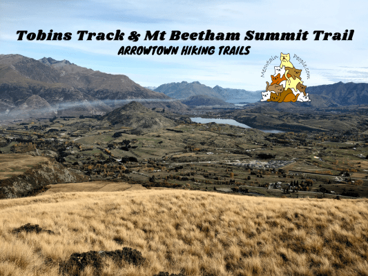
Tobins Track, named after the person who built and maintained the road in the 1870s, is one of the many easy walking tracks in Arrowtown. In Autumn seasons, the track is surrounded with bright red trees, while the sides of the track are covered with their fallen autumn leaves. At the furthest end of Tobins Track, you may continue your hike through Mt Beetham Summit Trail for a stunning 360 views of the mountain ranges surrounding Arrowtown.
Tobins Track
12.13pm: You can start your walk on Tobins Track at several points along the track, such as the trailhead at Manse Rd or O’Callaghan Park. Here, I started from the main car park / recreation park area (walking eastwards) where many trails connect or start from here.
The park is a beautiful place to relax and exercise close to nature.
(+10)12.23pm: Passing by Wilcox Green / O’Callaghan Park, the alternate starting point for Tobins Track.
(+5)12.28pm: At the junction, cross the bridge to the opposite side of Arrow River.
(+2)12.30pm: After crossing the bridge, there’s another junction. The track to the right along the river is the relaxing Arrow River Bridges Trail. Take the track ahead / to the left to start the consistent uphill walk on Tobins Track.
(+6)12.36pm: A memorial of Thomas Tobins, who built and maintained this road. The site of his family home is 50 meters off the track here from the memorial.
Aesthetic autumn leaves covered the ground.
(+6)12.42pm: As the track climbs the hill, Arrowtown’s residential houses and the distant mountain ranges come into view.
(+23)1.05pm: A rest stop with a view near the end of Tobins Track.
The views from the rest stop look just like from painting! There’s also a trailhead called Tobins Drop here, which is a steep light trail that goes down to Arrow River Bridges Trail. You could make a loop back to town center using this trail instead of the usual one-way return track.
(+2)1.07pm: Continue up towards the end of Tobins Track.
Mt Beetham Summit Trail
(+2)1.09pm: At the end of Tobins Track is the unpaved Glencoe Road. Here you’ll find the Mt Beetham Summit Trailhead.
Step over the fence with the stile installed at the trailhead.
(+3)1.12pm: Follow the track and pole markers.
(+18)1.30pm: It’s a straight line to the top, so be prepared for the constantly steep climb.
(+3)1.33pm: Near the peak.
The panoramic views over Arrowtown, Lake Hayes, and mountains at the other side of the peak.
Goats’ poops were all over the peak area, suggesting this was their hangout spot when no one was around.
1.56pm: Heading back down from Mt Beetham summit.
(+22)2.18pm: Back down onto the road and reenter Tobins Track ahead.
On Tobins Track back to Arrowtown.
(+40)2.58pm: I exited the track at Wilcox Green / O’Callaghan Park.
Have this guide helped you? Tag @meowtainpeople in your hiking stories & posts!
*Captain Planet passing by* Remember, please take care of our environment, and please don’t destroy the Nature. Leave no trash behind and take back only photos and memories (and also some trash if you can). Walk on the designated path and stay in the middle as much as you can, so that the exposed soil doesn’t spread/corrode further. BE ONE WITH NATURE *flies away*
Affiliate Links to support this site:
Yay for transparency!: The links above are affiliate links, and at no additional cost to you, I earn a commission if you make a booking/purchase after clicking the links. I recommend only products and companies I use. Your support helps me keep the site going 🙂
Want to do the same affiliate marketing with your site? Use this AccessTrade platform link to receive RM5 reward.


