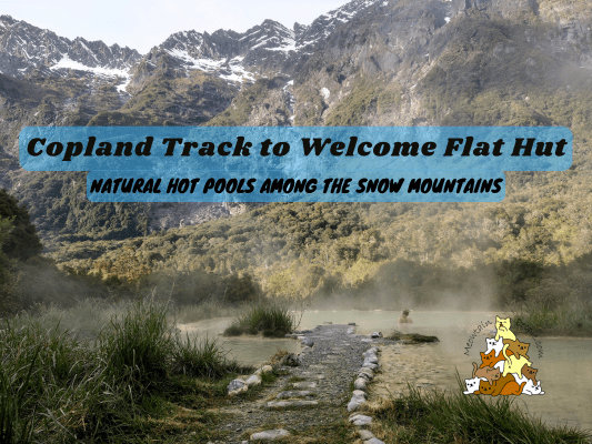
Copland Track to Welcome Flat Hut is an iconic overnight hiking track in the Westland. Sitting west of Mount Cook and the Main Divide of the Southern Alps, Copland Valley offers spectacular sceneries of the forest, rivers and mountains. Furthermore, one of the main highlights is to relax after a long hike, and soak in the natural hot pools near the hut, surrounded by untouched wilderness.
Welcome Flat Hut Booking
Welcome Flat Hut & Campsite need to be booked in advance 这里. As the West Coast is prone to receive heavy downpours, making some streams on the track impassable, you need to check the forecast close to your hiking dates. The track will be closed when the weather makes the track unsafe. If you are at the hut when this happens, the hut warden may ask you to wait it out for another day until the water level returns to safe level (bringing extra supplies is essential).
Things I Packed For Copland Track to Welcome Flat Hut:
- 40L Hiking Backpack from Decathlon with rain cover and a large strong rubbish bag lined inside as additional water protection
- PTT Outdoor 的 HIGH PEAK 便捷旅行睡袋
- TOMSHOO sleeping bag liner
- Quechua 登山雨衣
- Sun Protect 长袖跑步 T 恤, 速干跑步短裤 + Kiprun 跑步袜 (for the day)
- Quechua 登山抓绒夹克
- Ski base layers top + pants + warm hiking socks + gloves from Decathlon (as sleepwear)
- Extra 羽绒服 (didn’t use but important to bring, just in case)
- Adidas Kampung (not from Adidas, Malaysia’s trusty rubber hiking shoes)
- Flip flops (for walking around the hut)
- Sun hat (Quite some exposed parts of the track, but I didn’t use it as it was cloudy the whole time)
- 急救箱,指南针和哨子
- 充电头灯
- Phone (with booking confirmation pdf file), powerbank & charging cables
- Food, snacks and extra supplies for emergency (hard-boiled eggs, peanut butter sandwiches, muesli, mixed nuts, energy bars, crackers)
- Paper towels, rubbish bags
- Water bottles (1L; stream water is abundant on track)
- HydroBlu 轻型滤水器
- CuloClean 便携式射水头, some toilet paper
- Toothbrush, toothpaste, hand sanitizer, soap, hairbrush
- Fire lighter (just for emergency, not needed if staying on campsite as you can’t light a fire. Useful for lighting fire wood if staying in a hut)
- 折叠剪刀
Copland Track Carpark & Trailhead: A Gamble For Your Car?
The trailhead to Copland Track to Welcome Flat Hut starts at Copland Track Car Park. Just like any car park in the world, there’s always a certain risk to leave your vehicle unattended. However, this car park, along with other few places in New Zealand, present a ‘unique’ kind of risk: Keas. These curious alpine parrots are ‘famous’ for their inquisitive acts of tearing up vehicle parts and camping tents. Their favorite objects include motorbike seats, plastic parts, car window rubber seals and side mirrors.
Lacking the alternatives to get to this place, you might just have to ‘gamble’ with your luck, hoping the keas to have mercy and spare your vehicle from their powerful beaks. Fortunately for me, my car was undamaged when I was back the next day, I also did not see any sign of kea damage from other vehicles parked there.
Car break-ins are uncommon but some locations may be the hot-spots for it. It is advised not to leave any valuables in your car, and to ‘show’ (eg. open up the glove box / show the inside of car boot) there’s nothing worth stealing in the car. Since there’s no DoC or visitor center in the area, I dropped off my laptop and valuables at the nearest Pine Grove Motel, 8 minutes drive away. The motel owner was lovely and happy to store my things for a day, even though I did not stay there. For appreciation and courtesy, I bought some trail snacks from her mini shop (there were local fresh walnuts still in the shell for sales too).
Day 1 of Copland Track to Welcome Flat Hut (18km)
Rough Creek - River Crossing
12.06pm: The track starts immediately with crossing the wide Rough Creek just next to the car park. At normal level, the water is ankle-deep with large patches of dry land in between the banks. Do not cross if signs of flooding are present. Locate the orange triangle marker on the opposite bank before crossing to get into the correct trail.
(+7)12.13pm: After crossing Rough Creek, the track enters the well formed forest path that runs along the Karangarua River.
Some birdlife can be spotted or heard along the track, such as keas and this chubby Kererū.
The forest track involves some constant gentle to moderate uphill walks.
(+6)12.19pm
(+1)12.20pm: Some stairs to tackle.
(+2)12.22pm: First mini stream crossing.
Beautiful forest track
(+27)12.49pm: View of the wide, blue Karangarua River.
(+8)12.57pm: Another stream crossing.
(+4)1.01pm: The track temporarily enters an open scrubland.
(+4)1.05pm: And then it reenters the forest.
(+1)1.06pm: Next stream on the way.
(+0)1.06pm: Uphill walk.
(+3)1.09pm
(+18)1.26pm: Interesting passage with elevated mossy walls of land on both sides.
(+11)1.37pm: A very short side track to two rivers view point.
(+1)1.38pm: The viewpoint of which Copland River joins Karangarua River.
Copland River
(+28)2.06pm: Then the track joins up with Copland River, where you’ll be walking along the bank, mostly boulder hopping on rocky riverbeds and passing through some forest tracks. Absolutely stunning!
(+7)2.13pm: Make sure to keep an eye out for the orange triangle markers and follow them. Most part of this river trail walks you close to the water along the riverside, but some sections will enter the forest as a few sections of the riverside are not suitable to walk safely.
(+2)2.15pm: Crossing Katam Creek that flows into Copland River.
(+3)2.18pm: Back to the riverside. As you walk on the boulders, pay attention to your footing to prevent sprains and injuries.
(+10)2.28pm: Passing by a relatively new landslide.
(+6)2.34pm: Back into the forest trail.
(+2)2.36pm: Crossing Komarupeka Creek.
(+6)2.42pm: Walking through Pick & Shovel Flat. These picks and shovel remains highlight the history of the construction of Copland Track. This track was built by the tourism department (dated back in 1901, New Zealand is the first country in the world to form a government department to develop and promote tourism) to provide a tourist route across the Southern Alps linking the West Coast with a lodge at Mount Cook.
(+13)2.55pm: Crossing McPhee Creek Swing Bridge.
(+16)3.11pm
(+4)3.15pm: Back to boulder hopping the riverside trail.
Architect Creek Hut
(+6)3.21pm: Architect Creek Hut is a small basic hut with only two bunks. The bunks were occupied by two DoC workers during my visit. A track maintenance team was actively clearing the overgrown grass and chainsawing fallen trees as I walked past them.
(+22)3.43pm: Continuing on, I arrived at the first impressive (and fun) swing bridge to cross Architect Creek.
Architect Creek
(+10)3.53pm: Tatawhaka Creek
(+28)4.21pm
(+15)4.36pm: Palaver Creek
(+6)4.42pm
(+18)5pm
(+7)5.07pm
A kererū.
Final Swingbridge To Welcome Flat Hut
(+27)5.34pm: Arrived at the longest, most fun swingbridge before Welcome Flat Hut.
Shiels Creek at the bottom of the swingbridge.
(+3)5.37pm
(+7)5.44pm
(+6)5.50pm: The snowy mountains are close.
Welcome Flat Hut Hot Pools
(+8)5.58pm: Finally, I arrived at the nice Welcome Flat Hut!
Interiors of the spacious Welcome Flat Hut. In the evening, a short safety talk and sharing was conducted by the lovely pairs of hut wardens, Herwig and Monika.
Flush toilets, a luxury.
Marvelous mountains around the hut.
Nearby river access.
Welcome Flat Campsite
The main highlight of Welcome Flat Hut is definitely the natural hot pools.
Dipping in the muscle relaxing hot pools surrounded by the snow-capped Sierra Range after a long hike in the wilderness is the bomb! Just make sure to keep your head above any hot pools to avoid the risk of the very rare but deadly amoebic meningitis. These pools are a fragile environment so please do not use soaps or shampoo or dig more pools.
Nearby the hot pools and hut is a spot called the rock bivouac, originally used as a bivy shelter by track workers around 1912. It’s a small flat spot with damp ground and a diagonal ceiling of the huge rock overhead.
I slept in one of the big bunk rooms upstairs.
Dinner before bed with my sleeping bag from PTT Outdoors.
Day 2 of Copland Track to Welcome Flat Hut - Return to car park (18km)
8am: Next morning after breakfast, I left Welcome Flat Hut and headed back to the car park.
From Welcome Flat Hut, advanced hikers can continue the hike 7km up the Upper Copland Valley Track to Douglas Rock Hut. Due to storms frequently changing the landscape on the track beyond Welcome Flat Hut on a much larger scale, with risks of rock falls, floods, and landslides, this is suitable only for well-equipped and experienced backcountry trampers only.
Crossing the swing bridges again.
As always, keep an eye out for the orange triangle markers as some paths can be easily missed, especially the ones that enter the bush from the riverside. Do not try to walk the river or climb the huge boulders if you think you are stuck and couldn’t see the markers, instead, try to backtrack and locate the track markers.
1.45pm: 5 hours and 45 minutes later, I returned to the car park and drove to Franz Josef town. I stayed in the homely Glow Worm Accommodation before leaving for my next adventure. They have this convenient instant popcorn maker with free popcorn!
帖子有帮到您吗?在您的登山故事和帖子中标记 @meowtainpeople 吧!
*地球队长经过* 记住,请保护我们的环境,请勿破坏大自然。不要留下任何垃圾,只带回照片和回忆(如果可以的话,还可以捡走一些垃圾)。请在指定的路径上行走,并尽量保持在中间行走,以使裸露的土壤不会进一步扩散/腐蚀。与大自然融为一体吧 *飞走了*
支持本网站的附属链接:
透明度万岁!:以上链接是会员链接,如果您用此链接购买或预订的话,我可以赚取佣金, 而你也不会被收取额外费用。 我只推荐我使用的产品和公司。您的支持可以帮助我保持网站的运行,让我继续用心分享🙂
想在您的网站进行相同的联属网络营销吗?用这个 AccessTrade 平台链接 获取 RM5 奖励。

