
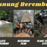
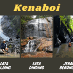
Not many are aware that Gunung Besar Hantu (1,462m) is the highest mountain in Negeri Sembilan. Gunung Besar Hantu is situated in Taman Negeri Kenaboi in Jelebu district. Within the same state forest park are other interesting nature spots, such as Lata Kijang and Lata Dinding waterfalls, Jeram Berungut river, and camping grounds. They are mostly done in separate trips due to the long hours involved to hike to the different locations.
一只华丽的昆虫 permit is required for all the hikes in Taman Negeri Kenaboi. You can easily buy the permit (RM5 per pax) on-the-spot from the office in the park (office opens at 8am) or online at N9PAY platform. Gunung Besar Hantu hike takes around 8 hours (return).
From 1st of October 2025 onwards, a mountain guide is mandatory to hike Gunung Hantu Besar.
Gunung Besar Hantu Trailheads & Starting Point


9.08am: From Taman Negeri Kenaboi parking area, look for this entrance pointing to Gunung Besar Hantu. This is the same entrance for Lata Kijang and Lata Dinding.

(+9)9.17am: Passing by orang asli settlements beside the trail.

(+5)9.22am: Wide tarmac trail that can be a challenge due to its non-stop uphill climb. The first half of the hike is exposed to the sun, so sun protection is recommended.

(+4)9.26am: A section of shaded bamboo forest.


(+1)9.27am: At the first intersection. The left goes to Lata Kijang. Take the right to go to Lata Dinding and Gunung Besar Hantu.


(+12)9.39am: The trail changes to a red dirt path.

(+27)10.06am: The second junction. The left brings you to Sungai Kering river, it also connects to Gunung Besar Hantu trail but the path to the right is shorter. We took the trail on the right. When in doubt, check your map.
Kem Sungai Kering

(+18)10.24am: Arrived at Kem Sungai Kering campsite next to Sungai Kering river. Here is a junction to Lata Dinding / Gunung Besar Hantu. The hikers in the picture are crossing the river to go to Lata Dinding.

To go Gunung Besar Hantu, don’t cross the river but take the obvious path on the right.

(+8)10.32am

(+5)10.37am: Crossing Sungai Kering stream.


(+10)10.47am
Kem Orkid


(+45)11.32am: Arrived at Kem Orkid campsite.


There is a water point near Kem Orkid. It is a 5-minute steep hike down to a pretty nice mini waterfall.


We spotted a hornbill on a tree below the campground.


(+15)11.47am: Onwards to Gunung Besar Hantu, the trail starts to get very steep and slippery. Some parts were quite eroded.


Unknown plants along the trail.


(+5)11.52am: A big tree on the trail.

(+5)11.57am

(+16)12.13pm

(+27)12.40pm

(+12)12.52pm
Gunung Besar Hantu Summit (1,462m)


(+2)12.54pm: We reached Gunung Besar Hantu peak.

It was cloudy so there wasn’t much to see here. There used to be a junction to Gunung Kecil Hantu trail but it was closed due to some unsafe sections.


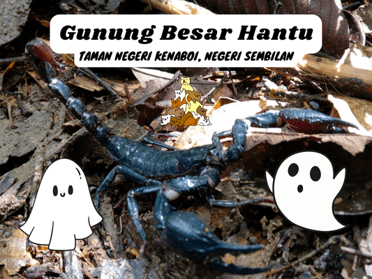
I spotted some weird plants and critters on the way back.

A scorpion on the path.

(+250)5.04pm: Back to the exit at the car park.

For a post-hike dinner, I recommend giving Jelebu’s special bone satay a try. I have tried a few places and ABM Sate Tulang Jelebu is the best one so far.
帖子有帮到您吗?在您的登山故事和帖子中标记 @meowtainpeople 吧!

*地球队长经过* 记住,请保护我们的环境,请勿破坏大自然。不要留下任何垃圾,只带回照片和回忆(如果可以的话,还可以捡走一些垃圾)。请在指定的路径上行走,并尽量保持在中间行走,以使裸露的土壤不会进一步扩散/腐蚀。与大自然融为一体吧 *飞走了*
支持本网站的附属链接:
透明度万岁!:以上链接是会员链接,如果您用此链接购买或预订的话,我可以赚取佣金, 而你也不会被收取额外费用。 我只推荐我使用的产品和公司。您的支持可以帮助我保持网站的运行,让我继续用心分享🙂
想在您的网站进行相同的联属网络营销吗?用这个 AccessTrade 平台链接 获取 RM5 奖励。