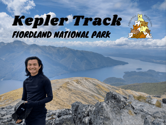
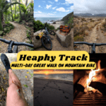
Kepler Track is one of the top 3 most popular great walks in New Zealand. The track features spectacular tussock-covered alpine views and the lush green forest of Fiordland National Park. The Kepler Track great walk season opens from mid Spring to Autumn (late October to April). During winter and early spring, there are high risks of avalanches and floods, and only experienced and well-equipped alpine hikers should attempt it during these periods. Watch the following video to get to know Kepler Track:
Kepler Track Great Walk Booking
All Great Walks in New Zealand require booking in advance for the huts and campsites. Off-site camping is not allowed on the Great Walk tracks. Here is the online booking site for all Great Walk accommodations. Lookout for the opening dates of bookings for each season as the popular great walks tend to get fully booked pretty fast, Kepler Track is one of the most popular ones.
If the slots are fully booked and you are flexible with your dates, you can run through the site’s booking calendar regularly to lookout for any new slots, as people often cancel their booking days/weeks/months before the trip. Don’t simply book and cancel though, here are the cancellation fees in detail.
Things I packed for Kepler Track
- 40L Hiking Backpack from Decathlon with rain cover and a large strong rubbish bag lined inside as additional water protection (plus a separate sackpack to carry my tent)
- Forclaz Trek 100 三季圆顶帐篷 (比大多数帐篷重,但抗风性和防水性非常好)
- PTT Outdoor 的 HIGH PEAK 便捷旅行睡袋 (首次购买最低 RM100 即可优惠 RM10,优惠码“MEOW”,仅限马来西亚境内)
- TOMSHOO sleeping bag liner
- 充气床垫和枕头
- Quechua 登山雨衣
- This time I wore a warm ski base layer instead of my usual Sun Protect 长袖跑步 T 恤, but it turned out to be too hot on a calm, cloudless summer day. However, it can be very different on a cloudy or windy day.
- 速干跑步短裤 + Kiprun 跑步袜 (for the day)
- Quechua 登山抓绒夹克
- Ski base layers top + pants + warm hiking socks + gloves from Decathlon (as sleepwear)
- Extra 羽绒服 (didn’t use but important to bring, just in case)
- Adidas Kampung (not from Adidas, Malaysia’s trusty rubber hiking shoes)
- Flip flops (for walking around campsites / huts)
- Sun hat (Kepler Track is very exposed most part of the track, so sun protection is necessary)
- 急救箱,指南针和哨子
- 充电头灯 (red light recommended for kiwi bird spotting)
- Phone (with booking confirmation pdf file), powerbank & charging cables
- Food and snacks (chicken ciabatta rolls, muesli, trail mix, energy bars), paper towels, rubbish bags
- Water bottles (2-3L)
- HydroBlu 轻型滤水器
- CuloClean 便携式射水头, some toilet paper
- Toothbrush, toothpaste, hand sanitizer, soap, hairbrush
- Fire lighter (just for emergency, not needed if staying on campsite as you can’t light a fire. Useful for lighting fire wood if staying in a hut)
- 折叠剪刀
Before you go, check the weather forecast for Kepler Track. Located in the ‘roaring forties’, the alpine terrain is very exposed to the strong Westerlies, and the freezing Southerlies coming from Antarctica. Weather on Kepler Track can be extreme when these winds occur.
Kepler Track Day 1
Most hikers complete the full 60km loop of Kepler Track (around 1200m of elevation). Due to the limited availability, I managed to book only the Iris Burn Campsite situated right at the middle of the whole journey, hence I completed Kepler Track in two long days.
P.s. The first and last huts, Luxmore Hut and Moturau Hut, are often fully booked as many hikers do an overnight hike to the hut and back to the exit without doing the full Kepler Track.

The Kepler Track loop typically starts and ends at Kepler Car Park, but other options such as via Rainbow Reach car park 或 Brod Bay (by water taxi) are possible. If you don’t have a car, Fiordland Outdoors 和 Tracknet provide transportation services to Kepler Track.
Kepler Track Car Park to Brod Bay Campsite - 5.6km
8.37am: Checking out from Parklands Motel after a good night’s rest (just one day of rest after my Stewart Island journey) and dropping my valuables at the motel office, I drove to Kepler Track Car Park and started my great walk journey.
(+7)8.44am: Walking along Lake Te Anau shore.
(+2)8.46am: The walk starts with a pleasant flat walk in the beech forest of Fiordland National Park.
(+63)9.49am: Arrived at Brod Bay Campsite. The campsite is by the shore and it is also accessible by water taxi for those who want to cut some distance off their walk.
Brod Bay to Luxmore Hut - 8.2km
(+2)9.51am
(+22)10.13am: The track goes uphill and gets steeper as you leave Brod Bay.
(+63)11.16am: Walking under the impressive limestone bluffs.
(+34)11.50am: Two hours after leaving Brod Bay, I climb over the bushline where the bush opens up to the panoramic views along the track. The uphill track here gets less steeper compared to the forest section.
(+5)11.55am: The first wide shot view from the track, overlooking Lake Te Anau, Australasia’s largest body of freshwater.
(+20)12.15pm: A long boardwalk section.
(+8)12.23pm: The neighboring mountain range including Mount Lyall and Te Anau basin.
(+3)12.26pm: Arrived at Luxmore Hut.
The side trip to Luxmore Cave, 10 minutes away from the main track.
Side Trip: Luxmore Cave
Luxmore Cave entrance. Make sure you bring your light.
Cave softly: The cave is a sensitive environment where the impacts of your passing may last for centuries. Keep to obvious routes, avoid spreading mud into clean areas, and refrain from touching cave formations.
Luxmore Hut to Iris Burn Hut / Campsite - 14.6km
1.30pm: Leaving Luxmore Hut after lunch break to Iris Burn Hut. (Refill your water at the hut before moving on, as there is no reliable water source until the lower forest near Iris Burn Hut)
A further view of Luxmore Hut with the amazing backdrop.
(+17)1.47pm
(+4)1.51pm
(+9)2.01pm
(+25)2.26pm: Lake Te Anau
Mountains beyond mountains!
The stunning views from Lake Te Anau to the Murchison Mountains.
(+11)2.37pm: You’ll be climbing along the ridge line below Mount Luxmore. The exposed terrain means you’ll be facing the full force of any weather conditions that come your way, with very few shelters and no alternative routes. Look at the horizon far ahead to check for any oncoming weather. If it looks pretty bad, it’s better to turn around and try again another day. The alpine slopes pose a high risk of avalanche, so if snow is present, do not push forward if you do not have experience in off-track navigation, avalanche awareness and winter climbing, plus the proper equipment for traveling on snow. You may also consult the warden in Luxmore Hut before starting your journey.
The same mountains just get better views the further you go!
Side Trip: Mount Luxmore Summit
(+10)2.47pm: The junction to Mount Luxmore summit, the highest point on the track.
(+1)2.48pm: A steep but short rock scrambling to the summit.
(+13)3.01pm: Arrived at the summit of Mount Luxmore with the best panoramic views on the track!
(+5)3.06pm: On the way back down from Mt Luxmore summit, you could see the tiny lines of Kepler Track, extended far beyond the mountain slopes and ridges.
(+26)3.28pm: Back on the main track.
(+2)3.30pm
(+2)3.32pm
(+8)3.40pm
Forest Burn Shelter
(+13)3.53pm: Arrived at Forest Burn Emergency Shelter, with a kea hanging out on the roof.
The featherly shelter warden.
The endangered keas are the only alpine parrot species and they are found only in New Zealand. They are curious and intelligent. Please do not feed the keas, even if they ask.
Look at the green hued wings with bright orange underwings! They sound really cute too!
Emergency avalanche rescue equipment in the shelter.
(+29)4.21pm: Views along the track as I continued on.
(+6)4.26pm
(+16)4.42pm
(+7)4.49pm: Weaving up and down along the ridge lines towards Hanging Valley Shelter.
(+7)4.56pm
(+2)4.58pm
(+3)5.01pm
(+2)5.03pm: There was an unmarked junction with one that goes up to a small peak, then goes down from the other side and rejoins the main track. I recommend skipping this extra uphill track to save energy, as the views on this peak are not better than the ones from the main track.
(+5)5.08pm
(+11)5.19pm
(+7)5.26pm
(+14)5.41pm
Hanging Valley Shelter
(+2)5.43pm: Arrived at Hanging Valley Emergency Shelter.
(+13)5.56pm: Some series of stairs after the shelter. The track goes downhill steeply all the way to Iris Burn Hut and Campsite.
(+18)6.14pm
(+6)6.20pm: A short side trip to a lookout rock.
(+3)6.23pm: The view from the lookout.
(+9)6.32pm: Once you descend below the bushline, the track endlessly zig-zags steeply down into the forest.
(+46)7.18pm: After a series of zigzagging, you’ll arrive at the bottom with some cool water spots.
(+9)7.27pm
(+5)7.32pm
Iris Burn Hut / Campsite
(+28)8.10pm: Finally, I arrived at Iris Burn Hut after a long hike of almost 12 hours! Luckily it is summer with longer daylight hours, or else I would be arriving after dark.
Iris Burn Campsite is a couple minutes away from the hut.
The campsite was pretty full with other tents already, so I picked a quiet spot slightly further away from the facilities. Beware of cheeky keas, they can rip your tent when you’re not looking.
The chilly Iris Burn river by the camping ground. There are also some cool swimming holes nearby, as long as you don’t mind the cold.
Of all the locations I’ve been in New Zealand, I would say Iris Burn campsite had the most vicious swamp of sandflies. Somehow, their bites were more painful than the others and they were super aggressive in getting every hikers’ blood. I had to keep moving around and sweeping them off my legs and face while being outside my tent. Too scary to leave my tent before dark as I could see a swamp landing outside my tent, waiting for the taste of blood.
Luckily, sandflies stop hunting as soon as it gets dark. During the night, I listened to the calls of Kiwi birds and when I heard a call, I headed out quietly on the track towards the sound. And here was my first wild kiwi encounter! It was a male kiwi doing a series of loud mating calls (listen to my sound recording of this kiwi here). I used a low powered red light to avoid hurting their eyes or scarring the kiwi away (they are less sensitive to red light).
Kepler Track Day 2
Side Trip: Iris Burn Falls
9.27am: A well rested (with a bit of sore feet) morning started with a side trip to Iris Burn Waterfall, 20 minutes away from Iris Burn Hut.
A curious South Island Robin.
(+23)9.50: Iris Burn Waterfall
Iris Burn Hut / Campsite to Moturau Hut - 16.2km
(+25)10.15am: Back to Iris Burn Hut and continued on to the main track through the low saddle.
(+32)10.47am: Passing through the Big Slip area, caused by heavy rain in 1984.
(+1)10.48am: You could still see the scars left by the big slip even after 40 years since the event.
(+9)10.57am
(+4)11.01am
(+8)11.09am: Gentle descent along Iris Burn Valley, with Iris Burn River to the right.
A kea in the forest.
Rocky Point Shelter
(+78)12.27pm: Rocky Point Workcamp (staff only)
(+1)12.28pm: Rocky Point Shelter, a midpoint between Iris Burn Hut and Moturau Hut. Also a popular spot for lunch break.
(+36)1.04pm: Some zigzaggy downhill tracks and more gentle downhill tracks.
(+27)1.31pm: Crown Fern galore as you descend to the sea level, walking along the shore of Lake Manapouri. These are an endemic species of fern in New Zealand.
(+13)1.44pm
(+19)2.03pm
Shroom!
Moturau Hut
(+39)2.42pm: Arrived at Moturau Hut.
Right in front of Moturau Hut is a stunning lake beach with mountainous surroundings. It is a popular swimming spot for hikers who stay in the hut.
Moturau Hut to Rainbow Reach - 6km
(+30)3.12pm: The rest of the track is relatively flat but long.
(+79)4.31pm: Waiau River viewpoint
(+18)4.49pm: Rainbow Reach car park junction point. Some hikers start and/or end their Kepler Track great walk here.
(+3)4.52pm: Side trip to Rainbow Reach Bridge.
The Lord of the Rings fans will love to visit this place as this part of Waiau River is the filming location for Anduin River, where the Fellowship paddled south from Lothlórien, passing between the two enormous statues.
Rainbow Reach to Kepler Track Car Park (Control Gates) - 9.5km
(+25)5.17pm: The well maintained track between Rainbow Reach and Te Anau Control Gate is pleasantly flat and effortless. However, it felt like a long hard journey with my sore feet that had walked for two long days.
(+31)5.48pm
(+2h3m)7.51pm: Finally arrived at Lake Te Anau control gate. These gates are used for the dam to generate electricity. What I find special about these dams is the power company helps migrating eels to move past these structures that are blocking their paths, allowing them to continue their migration.
(+6)7.57pm: Ended my Kepler Track great walk at the car park. I drove to Camp Taringatura Backpackers to have a nice couple days of rest in a relaxing stay (free use of washing machine and dryer!) far from the urban towns before my onward journey to Queenstown region.
帖子有帮到您吗?在您的登山故事和帖子中标记 @meowtainpeople 吧!
*地球队长经过* 记住,请保护我们的环境,请勿破坏大自然。不要留下任何垃圾,只带回照片和回忆(如果可以的话,还可以捡走一些垃圾)。请在指定的路径上行走,并尽量保持在中间行走,以使裸露的土壤不会进一步扩散/腐蚀。与大自然融为一体吧 *飞走了*
支持本网站的附属链接:
透明度万岁!:以上链接是会员链接,如果您用此链接购买或预订的话,我可以赚取佣金, 而你也不会被收取额外费用。 我只推荐我使用的产品和公司。您的支持可以帮助我保持网站的运行,让我继续用心分享🙂
想在您的网站进行相同的联属网络营销吗?用这个 AccessTrade 平台链接 获取 RM5 奖励。

