
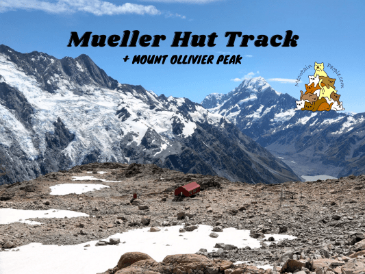
Mueller Hut is an epic backcountry alpine hut situated 1,800 meters on the Sealy Range. The track of Mueller Hut Route offers spectacular 360-degree views of ice cliffs, glaciers, and the highest peak in New Zealand, Aoraki / Mount Cook. Level up your journey by following the footsteps of young Edmund Hillary on his very first peak at Mount Ollivier, which led him and his Sherpa to be the first climbers confirmed to summit Mount Everest.
The weather can drastically affect the route, winter conditions can also appear in spring/autumn, which require proper alpine gears and experience. Check Mueller Hut weather forecast 和 avalanche risk before you go. (My trip was done during a calm sunny day in mid summer)
Kea Point Track (via Aoraki / Mount Cook Village or White Horse Hill) to Sealy Tarns

7.42am: The hike to Mueller Hut starts from outside of Aoraki/Mount Cook National Park Visitor Centre to Kea Point Track. Alternatively, if you camp or park at White Horse Hill Campground / parking, which was where I started my hike (for Hooker Valley Track and this Mueller Hut Route).

(+11)7.53am: Not long after joining Kea Point Track from White Horse Hill campground, you will find the junction to Kea Point or Mueller Hut.

(+2)7.55am: I first took the side trip to Kea Point.
Side Trip: Kea Point

(+9)8.04am: The track involves slight elevation through subalpine grasslands to the Mueller Glacier moraine wall.

The track ends at a viewing deck with stunning views of Mueller Glacier lake, Aoraki/Mount Cook, Hooker Valley, Mount Sefton, and The Footstool (mountain).

I think this is a part of the Mueller Glacier, or perhaps of the glaciers from Mount Sefton or The Footstool.
Back to Mueller Hut Route

(+23)8.27am: Back to the main track to Mueller Hut.

(+10)8.37am: The stairs on Sealy Tarn Track zigzag steeply and narrow as it approaches the tarns.

(+8)8.45am

(+7)8.52am: Some amazing views on the way up as you look back to the flatland.

(+30)9.22am: After climbing around 2000 steps and ascending 520 meters, I arrived at Sealy Tarns. This is the halfway point to Mueller Hut.
Sealy Tarns

On a calm day, the tarn reflects the image of the mountains just like a mirror.

From Sealy Tarns, other than the Mueller Lake, you could also see Hooker Lake further away, behind the moraine wall.

Did you know: The height of the moraine wall is the height of the Mueller glaciers where it used to be. Now, the glaciers remain only on the higher section of the alps.


A large picnic table at Sealy Tarns. This is a good spot to take a break and to access the weather and your team’s condition, before deciding to proceed for the next half of the track to the top.
Sealy Tarns to Mueller Hut


9.31am: Start the ascent through zigzagging the alpine scrubs.


(+10)9.41am: Some rocky sections to climb. These can be slippery when wet or icy.


(+20)10.01am

(+10)10.11am: As you gain altitude, you’ll start seeing snow poles. Follow the poles to stay on track.

(+8)10.19am: It is common for snow to present throughout the year here. Even during the peak of summer.

(+2)10.21am: Some big boulders to climb over.

(+2)10.23am: Passing by a thick patch of snow.


(+2)10.25am: A bit of ice walking here.

(+3)10.28am

(+2)10.30am

An endemic pipit bird.

(+11)10.41am: Approaching the mind-blowing corner into a whole new scenery.
Mueller Glacier Viewpoint


(+2)10.43am: After climbing the steep section onto the saddle, you’ll be welcomed with the amazing views of Mueller Glacier on the other side!


Occasionally, you can hear the rumbling sound of mini avalanches. Sometimes I could see snow and chunks of ice falling down from the steep rock face.


Melting ice formed some waterfalls on the rock face.


Some kind of alpine plant growing on the rock surface.


11am: From the viewpoint to Mueller Hut, the terrain is less steep as you have climbed up steeply onto the saddle, and now gently ascending along the rocky (or icy / snow covered in winter condition) ridge.

(+14)11.14am

(+1)11.15am: Mueller Hut spotted!

(+2)11.17am: A snow/ice covered path to walk across. It was quite surprising that the ice still remained under the strong summer sun!


Mueller Hut (1,800m)

(+11)11.28am: Arrived at Mueller Hut!


The interior of Mueller Hut. If you want to stay here for the night, you need to book online in advance.

The view from the deck of Mueller Hut! I had lunch here before heading up to Mount Ollivier.
Mueller Hut to Mount Ollivier


12.03pm: Behind (South of) Mueller Hut is the track Mount Ollivier. It is unmarked but you may find many helpful cairns leading the way to the peak. Generally it’s best to start from the far left side of the hill as it climbs steadily up the ridge. The right side looked closer but was very steep and more dangerous with large unbalanced boulders as I found out. I took the right side up as I didn’t know about the easier left side up, and noticed the cairns on the left side as I headed down via the correct path.

(+13)12.16pm


(+22)12.39pm: The views along the way to Mount Ollivier peak.


(+3)12.42pm: Cairns (stacks of rocks) of various shapes and sizes lead the way to the peak.
Mount Ollivier (1,933m)


(+25)1.03pm: Finally, a big cairn marks the peak of Mount Ollivier. Do not go further unless you have experience, it is very steep and exposed beyond this point.


The views from the peak of Mount Ollivier gives you better panoramic views of the distant surroundings of Aoraki / Mount Cook National Park!
Did you know? Mount Ollivier is the first major peak Sir Edmund Hillary (first recorded person who reached the top of Mount Everest, along with his Sherpa, Tenzing Norgay) climbed while in secondary school. This experience triggers his interest in climbing, leading to his climbing career culminating in the first ascent of Everest.

Heading back down to Mueller Hut. It took me a long time as I have yet to notice the easier path up from the left. I first tried heading straight down directly to the hut’s direction, but it was too dangerous with unstable big rocks and random deep holes from huge gaps between the boulders (one fall and people might not find me). After making not much progress, I decided to head back up and finally found the safer way down.

2.04pm: Back to the hut.

(+32)2.36pm: On the way back down to the car park. Some climbers were just heading up as they were staying in the hut for the night.

(+120)4.36pm: Back to White Horse Hill car park.
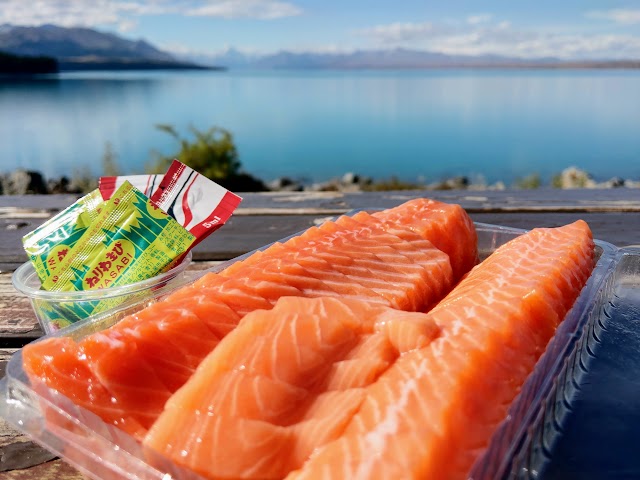
Just in time to drive to Lake Pukaki for the most satisfactory salmon sashimi I’ve ever had!


帖子有帮到您吗?在您的登山故事和帖子中标记 @meowtainpeople 吧!

*地球队长经过* 记住,请保护我们的环境,请勿破坏大自然。不要留下任何垃圾,只带回照片和回忆(如果可以的话,还可以捡走一些垃圾)。请在指定的路径上行走,并尽量保持在中间行走,以使裸露的土壤不会进一步扩散/腐蚀。与大自然融为一体吧 *飞走了*
支持本网站的附属链接:
透明度万岁!:以上链接是会员链接,如果您用此链接购买或预订的话,我可以赚取佣金, 而你也不会被收取额外费用。 我只推荐我使用的产品和公司。您的支持可以帮助我保持网站的运行,让我继续用心分享🙂
想在您的网站进行相同的联属网络营销吗?用这个 AccessTrade 平台链接 获取 RM5 奖励。