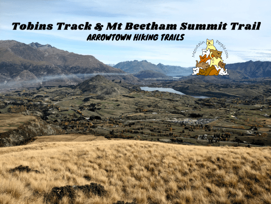
Tobins Track, named after the person who built and maintained the road in the 1870s, is one of the many easy walking tracks in Arrowtown. In Autumn seasons, the track is surrounded with bright red trees, while the sides of the track are covered with their fallen autumn leaves. At the furthest end of Tobins Track, you may continue your hike through Mt Beetham Summit Trail for a stunning 360 views of the mountain ranges surrounding Arrowtown.
Tobins Track
12.13pm: You can start your walk on Tobins Track at several points along the track, such as the trailhead at Manse Rd 或 O’Callaghan Park. Here, I started from the main car park / recreation park area (walking eastwards) where many trails connect or start from here.
The park is a beautiful place to relax and exercise close to nature.
(+10)12.23pm: Passing by Wilcox Green / O’Callaghan Park, the alternate starting point for Tobins Track.
(+5)12.28pm: At the junction, cross the bridge to the opposite side of Arrow River.
(+2)12.30pm: After crossing the bridge, there’s another junction. The track to the right along the river is the relaxing Arrow River Bridges Trail. Take the track ahead / to the left to start the consistent uphill walk on Tobins Track.
(+6)12.36pm: A memorial of Thomas Tobins, who built and maintained this road. The site of his family home is 50 meters off the track here from the memorial.
Aesthetic autumn leaves covered the ground.
(+6)12.42pm: As the track climbs the hill, Arrowtown’s residential houses and the distant mountain ranges come into view.
(+23)1.05pm: A rest stop with a view near the end of Tobins Track.
The views from the rest stop look just like from painting! There’s also a trailhead called Tobins Drop here, which is a steep light trail that goes down to Arrow River Bridges Trail. You could make a loop back to town center using this trail instead of the usual one-way return track.
(+2)1.07pm: Continue up towards the end of Tobins Track.
Mt Beetham Summit Trail
(+2)1.09pm: At the end of Tobins Track is the unpaved Glencoe Road. Here you’ll find the Mt Beetham Summit Trailhead.
Step over the fence with the stile installed at the trailhead.
(+3)1.12pm: Follow the track and pole markers.
(+18)1.30pm: It’s a straight line to the top, so be prepared for the constantly steep climb.
(+3)1.33pm: Near the peak.
The panoramic views over Arrowtown, Lake Hayes, and mountains at the other side of the peak.
Goats’ poops were all over the peak area, suggesting this was their hangout spot when no one was around.
1.56pm: Heading back down from Mt Beetham summit.
(+22)2.18pm: Back down onto the road and reenter Tobins Track ahead.
On Tobins Track back to Arrowtown.
(+40)2.58pm: I exited the track at Wilcox Green / O’Callaghan Park.
帖子有帮到您吗?在您的登山故事和帖子中标记 @meowtainpeople 吧!
*地球队长经过* 记住,请保护我们的环境,请勿破坏大自然。不要留下任何垃圾,只带回照片和回忆(如果可以的话,还可以捡走一些垃圾)。请在指定的路径上行走,并尽量保持在中间行走,以使裸露的土壤不会进一步扩散/腐蚀。与大自然融为一体吧 *飞走了*
支持本网站的附属链接:
透明度万岁!:以上链接是会员链接,如果您用此链接购买或预订的话,我可以赚取佣金, 而你也不会被收取额外费用。 我只推荐我使用的产品和公司。您的支持可以帮助我保持网站的运行,让我继续用心分享🙂
想在您的网站进行相同的联属网络营销吗?用这个 AccessTrade 平台链接 获取 RM5 奖励。


