Bukit Kopungit Hiking Trail is one of Kota Kinabalu hiking trails that are very easy to explore. It is also a favorite spot for airplane watchers to see closeup of planes taking off from Kota Kinabalu International Airport, just by the side of the hill. Other than that, multiple tunnels believed to be dug by Japanese soldiers during World War II were discovered around the area. Here is the guide to find them!
Bukit Kopungit Hiking Trail Starting Point
The main trailhead is by the roadside of Jalan Pintas here. There are also other small trailheads on the opposite site of the hill.
The starting trail.
Some ‘bumps’ to go over but they were pretty easy to walk on.
Bukit Kopungit Hiking Trail - WW2 Japanese Tunnels (Small)
There are many split paths to go, but if you take the left paths, you’ll come across this wall on your right side, where one of the tunnels is at. Continue walking toward the left, and walk up onto this wall from the trail on the left side of the wall.
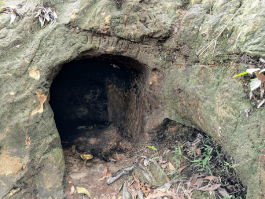
To find the first tunnel, use the tree above it as a hint, as you cannot see the tunnel when standing on top of it.
The next tunnel is very near, just by the back of the first one. Both tunnels are probably connected.
Viewpoint 1
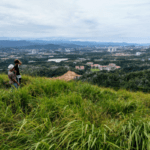
Continue hiking toward the middle, you’ll reach a wide area with an airport view. There is another better spot for spotting planes taking off, which will be shown later.
A little hill to climb.
Bukit Kopungit Peak
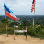
To find the big Japanese tunnel, you first have to go to the peak by the South and you’ll find this structure.
Take this trail towards the direction of the airport surveillance radar.
Follow the trail and you’ll see this spinning radar on the right side.
Walk below this structure by its wall.
Half way through, there is a path from another less common trailhead from the West side. Just continue walking to the other end of the wall.
Bukit Kopungit Hiking Trail - WW2 Japanese Tunnel (Big)
Cross over a drain, a few more steps ahead and you’ll find the big tunnel on your right.
It is the largest tunnel discovered so far, where it could fit a person standing in it. It is said that while the smaller tunnels were used by the Japanese in World War II as shelters, this large one was used as an underground hospital. After decades of soil erosion, however, the path into the large tunnel is blocked.
Airplane Takeoff Viewpoint
Heading back and passing by the first viewpoint earlier, I headed North to the other viewpoint.
Met a playful puppy.
Here’s the best viewpoint to see the airport on the West side. If your timing is right, you’ll get to witness the takeoff of the planes or even helicopters!
A nice view on the East side, with the great Mount Kinabalu in sight.
Have this guide helped you? Tag @meowtainpeople in your hiking stories & posts!
Affiliate Links to support this site:
Yay for transparency!: The links above are affiliate links, and at no additional cost to you, I earn a commission if you make a booking/purchase after clicking the links. I recommend only products and companies I use. Your support helps me keep the site going 🙂
Want to do the same affiliate marketing with your site? Use this AccessTrade platform link to receive RM5 reward.
*Captain Planet passing by* Remember, please take care of our environment, and please don’t destroy the Nature. Leave no trash behind and take back only photos and memories (and also some trash if you can). Walk on the designated path and stay in the middle as much as you can, so that the exposed soil doesn’t spread/corrode further. BE ONE WITH NATURE *flies away*

