
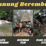
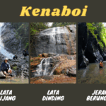
Not many are aware that Gunung Besar Hantu (1,462m) is the highest mountain in Negeri Sembilan. Gunung Besar Hantu is situated in Taman Negeri Kenaboi in Jelebu district. Within the same state forest park are other interesting nature spots, such as Lata Kijang and Lata Dinding waterfalls, Jeram Berungut river, and camping grounds. They are mostly done in separate trips due to the long hours involved to hike to the different locations.
A permit is required for all the hikes in Taman Negeri Kenaboi. You can easily buy the permit (RM5 per pax) on-the-spot from the office in the park (office opens at 8am) or online at N9PAY platform. Gunung Besar Hantu hike takes around 8 hours (return).
From 1st of October 2025 onwards, a mountain guide is mandatory to hike Gunung Hantu Besar.
Gunung Besar Hantu Trailheads & Starting Point


9.08am: From Taman Negeri Kenaboi parking area, look for this entrance pointing to Gunung Besar Hantu. This is the same entrance for Lata Kijang and Lata Dinding.

(+9)9.17am: Passing by orang asli settlements beside the trail.

(+5)9.22am: Wide tarmac trail that can be a challenge due to its non-stop uphill climb. The first half of the hike is exposed to the sun, so sun protection is recommended.

(+4)9.26am: A section of shaded bamboo forest.


(+1)9.27am: At the first intersection. The left goes to Lata Kijang. Take the right to go to Lata Dinding and Gunung Besar Hantu.


(+12)9.39am: The trail changes to a red dirt path.

(+27)10.06am: The second junction. The left brings you to Sungai Kering river, it also connects to Gunung Besar Hantu trail but the path to the right is shorter. We took the trail on the right. When in doubt, check your map.
Kem Sungai Kering

(+18)10.24am: Arrived at Kem Sungai Kering campsite next to Sungai Kering river. Here is a junction to Lata Dinding / Gunung Besar Hantu. The hikers in the picture are crossing the river to go to Lata Dinding.

To go Gunung Besar Hantu, don’t cross the river but take the obvious path on the right.

(+8)10.32am

(+5)10.37am: Crossing Sungai Kering stream.


(+10)10.47am
Kem Orkid


(+45)11.32am: Arrived at Kem Orkid campsite.


There is a water point near Kem Orkid. It is a 5-minute steep hike down to a pretty nice mini waterfall.


We spotted a hornbill on a tree below the campground.


(+15)11.47am: Onwards to Gunung Besar Hantu, the trail starts to get very steep and slippery. Some parts were quite eroded.


Unknown plants along the trail.


(+5)11.52am: A big tree on the trail.

(+5)11.57am

(+16)12.13pm

(+27)12.40pm

(+12)12.52pm
Gunung Besar Hantu Summit (1,462m)


(+2)12.54pm: We reached Gunung Besar Hantu peak.

It was cloudy so there wasn’t much to see here. There used to be a junction to Gunung Kecil Hantu trail but it was closed due to some unsafe sections.


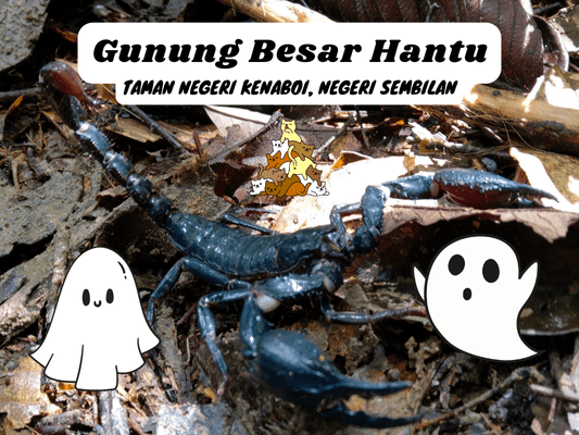
I spotted some weird plants and critters on the way back.

A scorpion on the path.

(+250)5.04pm: Back to the exit at the car park.

For a post-hike dinner, I recommend giving Jelebu’s special bone satay a try. I have tried a few places and ABM Sate Tulang Jelebu is the best one so far.
Have this guide helped you? Tag @meowtainpeople in your hiking stories & posts!

*Captain Planet passing by* Remember, please take care of our environment, and please don’t destroy the Nature. Leave no trash behind and take back only photos and memories (and also some trash if you can). Walk on the designated path and stay in the middle as much as you can, so that the exposed soil doesn’t spread/corrode further. BE ONE WITH NATURE *flies away*
Affiliate Links to support this site:
Yay for transparency!: The links above are affiliate links, and at no additional cost to you, I earn a commission if you make a booking/purchase after clicking the links. I recommend only products and companies I use. Your support helps me keep the site going 🙂
Want to do the same affiliate marketing with your site? Use this AccessTrade platform link to receive RM5 reward.