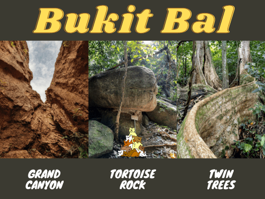
Bukit Bal is located in Labu, Negeri Sembilan, right beside Seremban and the more popular Bukit Kepayang. It is a less known area to hike, though it gained popularity for the Grand Canyon, Green Lake, and Twin Trees. There is another point of interest, which is the Tortoise Rock many hikers couldn’t seem to find. This guide will present the optimal routes and junctions to reach these checkpoints.
Check out the mapping image below, and click here to see the map markers with GPS coordinates.
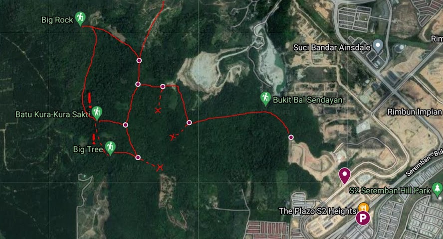
Bukit Bal Hiking Starting Point

The main starting point is here. It is a no parking area, so you should park your vehicle near Petron S2 Height, just 300 meters away, which has ample parking space.

Some hikers take the tacmac road and walk all the way up to the end. Do note that there is a ‘no trespassing’ sign and a boom gate, trespassing private land is a risk.
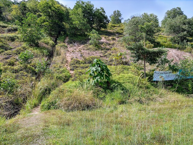
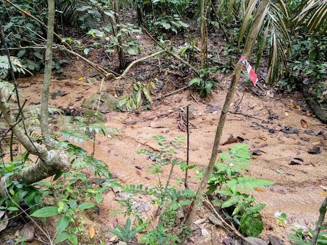
Alternatively, look for a trail near the drainage on the left side. This is a shortcut going up to the Grand Canyon area.

This is how the shortcut trail looks, it is pretty steep but doable.
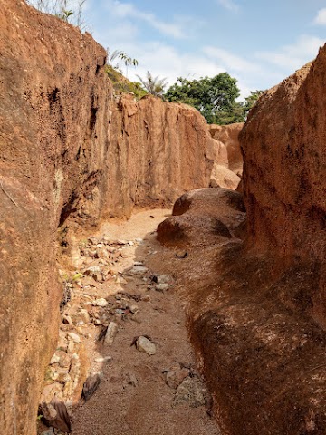
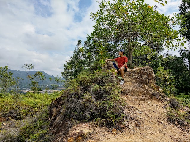
Bukit Bal ‘Grand Canyon’

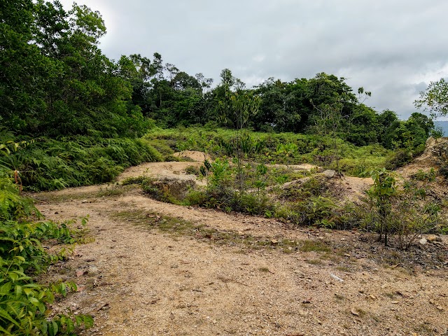
At the top, you will first find yourself on some wide land clearings.
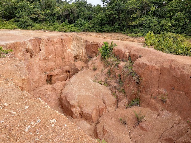
Just continue forward and you will find the ‘Grand Canyon’ down the area to your right.

There are some steep shortcuts down the Grand Canyon area. The safest way is to walk further and make a u-turn to the right, for a steady descent. Just be careful as the soil can be slippery due to the loose dry sand.
At one end of the deepest ‘valley’, you can easily walk down into it. Walking in the valley, the walls could be up to 5 meters high. Be cautious for any loose soil overhead.
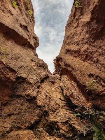
The ‘valley’ ends with a deep v-shaped dead end.
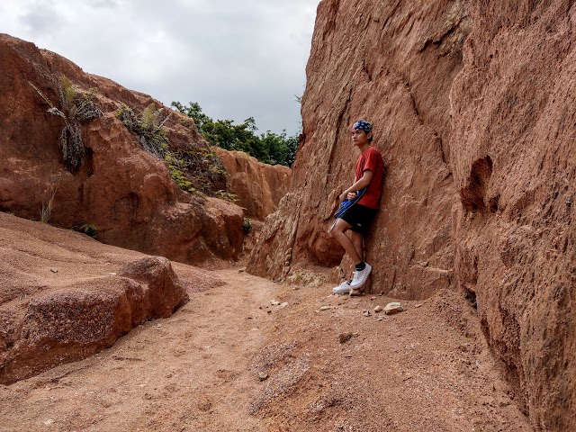
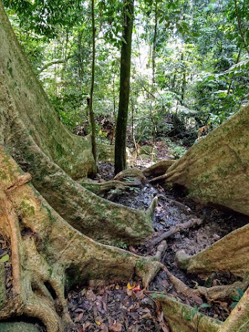
A quick photo snap before moving on to the forest trail.
Bukit Bal Forest Trailhead

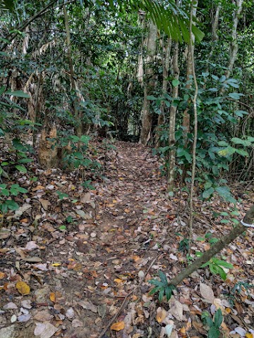
Continue walking a short distant Northwest away from the Grand Canyon. You would spot this trail somewhere up the hill. Enter the trailhead and you will quickly find yourself in the cool shaded forest trail.
Bukit Bal ‘Green Lake’
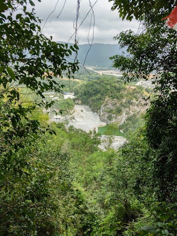

Follow the trail for 5 minutes and you will reach a place overlooking the ‘Green Lake’. It is actually a man made lake created from the rock quarry activity.

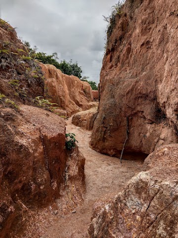
Continue to follow the trail after the Green Lake overlook point. The trail is straightforward and easy to follow up to this point.
1st Junction

Walk the trail for another 15 minutes, and you will encounter the first junction. Keep to the right to reach the trail highlights. I tried the path to the left but the trail eventually disappeared.
After following the path to the right, you should reach an open area by the hillside in 5-6 minutes.
There is a nice mini peak for photoshoots and some views here.


Keep a lookout for an opening nearby the viewpoint to re-enter the forest trail.
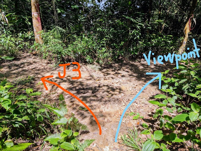
Viewpoint Junction
Very soon, you will find a junction. Keep to the right to reach all the Points of Interest. I tried taking the left which led to a not-so-obvious trail and saw a glimpse of a few Orang Asli doing gardening activities. I turned back as I did not want to intrude their private territory.


Taking the path to the right, I passed by some groups of bamboos to my right. It was here that I started to attract a swarm of mosquitoes.
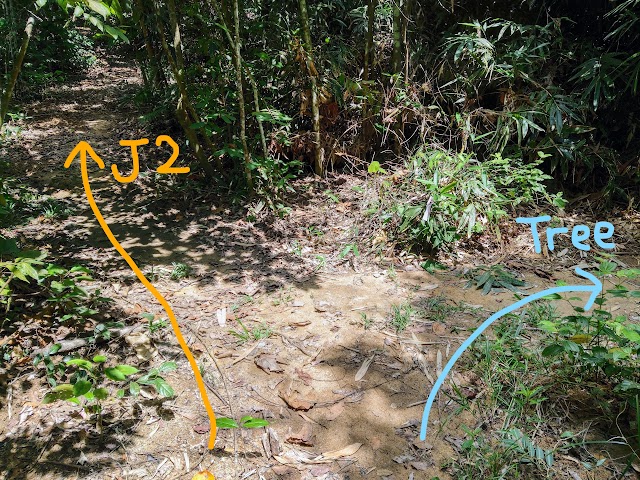
Junction 2
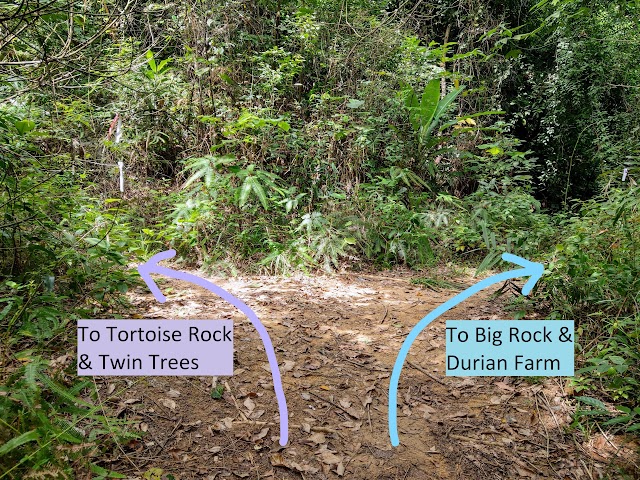
After 5-6 minutes, you will find Junction 2. Here, it is time to decide where you want to go. Turn right toward the North to go to the Big Rock. In contrast, turn left toward the South to go to the Tortoise Rock and Twin Trees. For me, I went to the right to reach Big Rock first, and made a loop through the durian farm to Tortoise Rock.
Continue to Big Rock - 3rd Junction
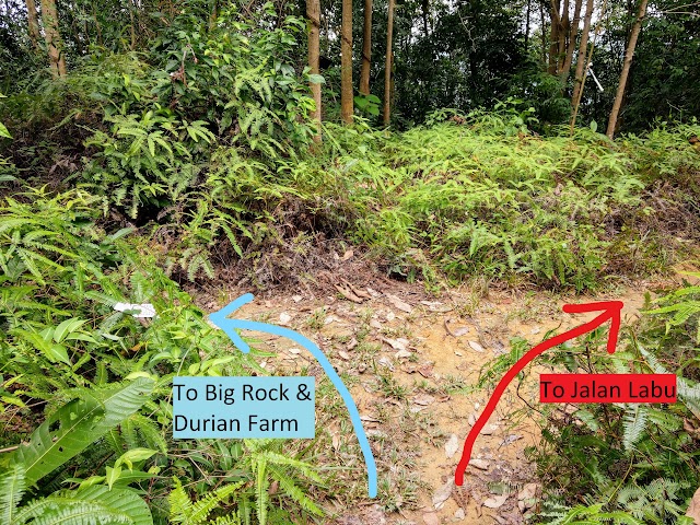
Then, I encountered the third junction before reaching the Big Rock. Here, you need to take the left turn. I tried to turn right and it led me a long way to Jalan Labu in the North.


Following the trail and passing over a couple of fallen trees.

Along the trail, you would encounter two makeshift huts on each side.

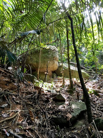
Eventually, you will reach a messy area without any clear trail. Keep to the right where it is slightly uphill, that is where the Big Rock is located at. The slightly downhill path on the left is some kind of old rubber tapping trail.
Bukit Bal Big Rock

Two minutes later, I found the Big Rock. To me, it is nothing special here, and it wasn’t a pleasant hike because of the swamp of mosquitoes in this part of the forest.
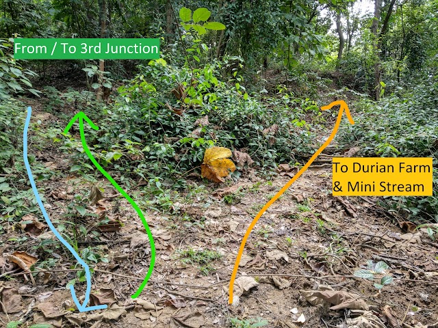
After visiting the Big Rock, you have to turn back. You would then notice a split path. The path to the left with a slight uphill is where you came from junction 3. The path to the right leads to the durian farm. Both ways can bring you to the Tortoise Rock and Twin Trees, but the durian farm path is more risky and challenging due to steep slippery disappearing trails. The safest way is to head back to junction 3, turn right toward junction 2, and then keep right to the Tortoise Rock and Twin Tree junction. If you want to challenge your jungle navigation skill, you could try taking the durian farm path but it is best to have someone who knows the way.
Bukit Bal Durian Farm & Mini Stream

For me, I took the durian farm path and passed through the farm. Attention: I am not sure if this is trespassing. Do it at your own risk.
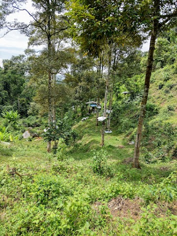
I walked past the farm and a small hut that stores farming equipment.

Eventually, I reached a palm oil area.


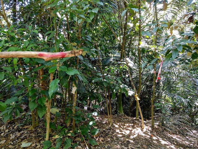
Here is the tricky part to find the way. Along the oil palm path, you need to find a trail leading downward, away from the main plantation path. Keep a lookout for the scarce and tiny bits of red and white tapes, and follow them along the trail.
Follow the marked trail all the way down to a mini stream.

Cross the mini stream where you would find another tape marker.

Follow along the not-so-obvious trail. You need to look far and around you to spot the tiny bits of markings on the tree or on the ground.

Passing through some rocks.

Going downhill a little.


Then, you would see some huge rocks uphill and would need to climb up the slippery slope.
At this point, there weren’t any visible markers to guide me anymore. I had to rely on my compass and Google Maps. From my GPS position, I knew I was not far from Tortoise Rock and it was in the Southeast direction of me. The journey was not easy, I followed my compass Southeast, up the slippery slope, finding safe and walkable paths.

I had to ‘commando crawl’ through this bamboo overgrowth.
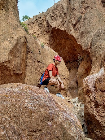
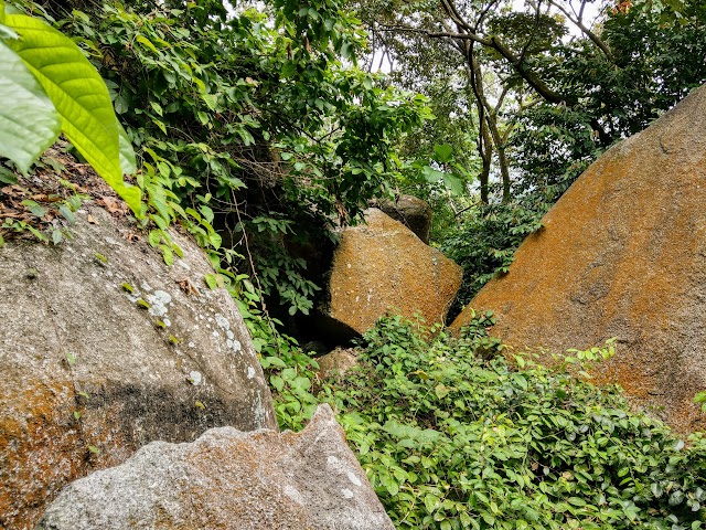
Bukit Bal Tortoise Rock (Batu Kura-Kura Sakti)
After 40 minutes (from the mini stream) of finding the way and being lost, I finally caught a glimpse of the Tortoise Rock!
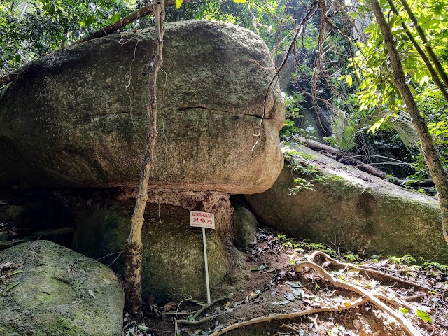
As you can see, the shape of this rock represents a tortoise head. I immediately thought of Master Oogway from Kung Fu Panda!
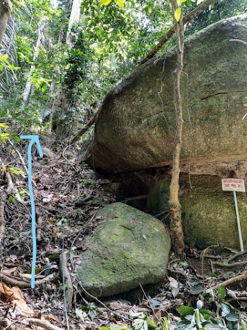
After you are done with the Tortoise Rock, head up the trail by the side to Tortoise Rock junction.

It is a pretty steep but brief climb. For those climbing down to the Tortoise Rock from the easier path, expect a steep downhill trail here.

The trail took me to an unshaded open area.

I had to wander around the open area a bit before finding the next trail here with a marker.
Tortoise Rock Junction
About 5 minutes of walking the trail, I reached this junction. I called this the Tortoise Rock junction. If you face the junction when coming from the Tortoise Rock, the left takes you to Junction 2, and the right takes you to Twin Tree Junction. Since I was heading to the Twin Trees, I headed to the right.

Guide to Tortoise Rock if you enter from this junction: Turning towards Tortoise Rock, you will pass through this path with significantly less markers. Most markers are placed for the Twin Trees trail.

Walk to the end until reaching the open shadeless area.
Keep mostly to the right to find this opening to re-enter the shaded jungle trail toward the Tortoise Rock.
Twin Trees Junction

I walked about 7 minutes to reach the Twin Trees Junction. Turn to the right, where there was a red paint arrow marking.

A red painted word on a tree: ‘双’, with an arrow. It means ‘double’, which is referring to the Twin Trees.
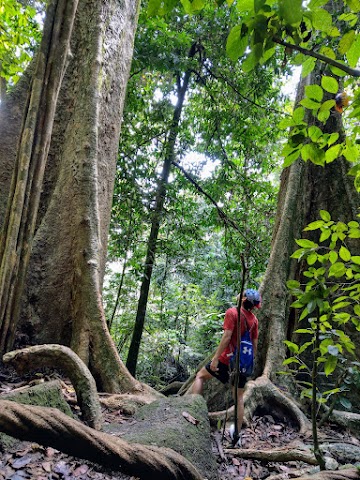
Bukit Bal Twin Trees
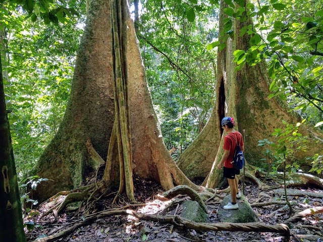
It took me 8 minutes of tired pace to reach the Twin Trees.


I saw a marker about 15 meters away from the Twin Trees. It is a path that connects between Twin Trees and Tortoise Rock. The path goes uphill from the Twin Trees area with some thin ropes tied on some small wobbly trees. I tried to use this trail but the soil was too loose and slippery. With the ropes tied on small trees and I do not want to damage them or risk sliding down the slope, so I did not continue.
Going Back

I went back to the Tortoise Rock Junction, headed right toward Junction 2.


The path between Tortoise Rock Junction and Junction 2.
At Junction 2, I turn to the right, toward the viewpoint area and then to Junction 1.

After almost 6 hours of exploring and getting lost, I finished the trail by exiting via the shortcut down the road.
Epilogue
Bukit Bal is less popular than its neighbor, Bukit Kepayang. Bukit Bal can be both a 2-4 hours leisure hike, or a challenging 5-7 hours exploration. It depends on the paths you choose to take. The beginning trail from the forest trailhead, up to Junction 2, was a very comfortable walk for me. This is because the trail was well shaded, and it was pretty cool and windy on that day.
In my opinion, the path to the Big Rock is not worth it if your goal is just to reach and see the rocks. However, it is a good one if you would like to challenge yourself on the rarely travelled trail. Just make sure to bring extra water, a compass, and allocate extra time for pathfinding. Stay safe and enjoy your hike!
Have this guide helped you? Tag @meowtainpeople in your hiking stories & posts!
Affiliate Links to support this site:
Yay for transparency!: The links above are affiliate links, and at no additional cost to you, I earn a commission if you make a booking/purchase after clicking the links. I recommend only products and companies I use. Your support helps me keep the site going 🙂
Want to do the same affiliate marketing with your site? Use this AccessTrade platform link to receive RM5 reward.

*Captain Planet passing by* Remember, please take care of our environment, and please don’t destroy the Nature. Leave no trash behind and take back only photos and memories (and also some trash if you can). Walk on the designated path and stay in the middle as much as you can, so that the exposed soil doesn’t spread/corrode further. BE ONE WITH NATURE *flies away*