Located at Puncak Alam, Bukit Cherakah and Bukit Botak are two hills sitting side by side. Technically, if you look at the terrain, it is actually just one hill, which is Bukit Cherakah. Bukit Botak is just the side of the hill that had been affected by deforestation.
Bukit Cherakah: not to be confused with the nearby Bukit Cerakah in Shah Alam Botanical Garden
Bukit Botak: not to be confused with the Bukit Botak in Sabah
Bukit Cherakah Hiking Guide
Set your destination and drive to Bukit Cherakah Trailhead. There would be cars parking along the roadside on weekends.
Start the hike here.
Passing by the water tank on the right.
Follow the main trail through some oil palm plantations.
In ten minutes, you’ll reach an open area with a wide view and a transmission tower at the front.
Continue the hike via the trail
There’s this short steep climb with some ropes to assist you.
After the steep climb, there’s this signboard on a tree. The arrows are pointing to the exit, you came up from the hiker route. As you can see, this hill is a popular spot for mountain bikers too.
Continue up to the path and there’s this stretch of trail on the hill ridge.
Panorama view from here.
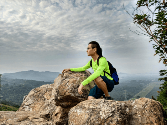
There’s also an area with rocks where you can take some good shots.
Walk to the end of the ridge and continue the trail. There’s a bike jump platform on the path.
You’ll encounter a couple of split paths, just keep left or follow the main trail.
Then, you need to climb this rocky part. It looks intimidating but worry not, the rocks were easy to step and climb. It was actually much easier than the earlier steep part.
Some vines along the trail, what can you do with it?
Tree bender? Or wood style jutsu?
Here’s the peak of Bukit Cherakah, with some makeshift benches
Bukit Botak Hiking Guide
To reach Bukit Botak, continue on with the trail from Bukit Cherakah.
Passing by a unique looking tree after ten minutes.
Soon, you’ll reach Bukit Botak.
It’s a rather sad sight to see.
If you want to explore a little further, there’s a short path on the right.
It leads to the right side with a narrow path. Just be extra careful.
This explains the name ‘Bukit Botak’. Botak means bald.
Epilogue
This was an easy hike with a couple of short steep paths that might intimidate some beginners. Just climb and descent slowly on the steep paths using the ropes and you’ll be fine. Many parts of the areas are not shaded, so it is advisable to come early in the morning when it is not so hot. Or you can prepare some sun protections such as sunscreen, head cover or long sleeves clothes.
If you are visiting in the evening, you may plan to visit Kampung Kuantan Fireflies Park, which is just 35 minutes drive away. You might also want to stop by Cendol Bakar Kuala Selangor to get a refreshing bowl of sweet ice cold cendol and delicious snacks.
*Captain Planet passing by* Remember, please take care of our environment, and please don’t destroy the Nature. Leave no trash behind and take back only photos and memories (and also some trash if you can). Walk on the designated path and stay in the middle as much as you can, so that the exposed soil doesn’t spread/corrode further. BE ONE WITH NATURE *flies away*
Affiliate Links to support this site:
Yay for transparency!: The links above are affiliate links, and at no additional cost to you, I earn a commission if you make a booking/purchase after clicking the links. I recommend only products and companies I use. Your support helps me keep the site going 🙂
Want to do the same affiliate marketing with your site? Use this AccessTrade platform link to receive RM5 reward.


Very useful info Tq
Thanks~ You are welcome!
Its okay to hike alone?
Yes, Arif. Through proper preparation, knowledge and the ability to make good choices, it is safe to hike alone. Also, inform someone about your intended trip before you go.
HI thanks for the helpful info and photos…Are things still the same as in the location and trails? Been wanting to try this hill for a while now.. Just wondering whtr can still hike up in Sept 2023? Thanks again
Hi Suresh, thanks for the comment! Yes, it is still accessible from what I know. However, a big part of the forest and the famous ‘octopus tree’ have been cut down 🙁 So it would be quite different from my photos taken before the deforestation.