
Last update: June 2024
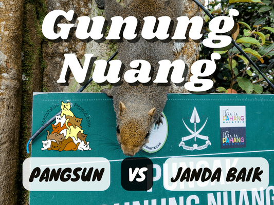
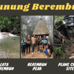
If you’ve been hiking, you’ll definitely know and have heard of Gunung Nuang. You’ve probably heard that it is the highest peak in Selangor, but Gunung Nuang is actually the second highest peak in Selangor. The highest in Selangor is Gunung Semangkok. Nevertheless, Mount Nuang is considered a challenging hike, yet popular as a training ground for hikers getting ready for their Mount Kinabalu or Mount Tahan climb.
There are multiple trailheads you can choose to enter to reach the peak. The two most common trails are via Pangsun and via Janda Baik. Nuang via Pangsun trail is known as the harder among the two, with about 9 km one way (+5 river crossings) with more intense elevation (including a false peak). Gunung Nuang via Janda Baik trail is shorter at around 6 km one way, yet is not a trail to be taken lightly of. There are also other more hardcore trails, such as Gunung Nuang via Kemensah (that passes through Lubuk Tedung, Bukit Repin and Gunung Lentang Legong), or via Lepoh Waterfall (passes through Lentang Legong.
The guide below will be comparing the trails between Nuang via Pangsun and Janda Baik, which I did separately on two different days.
Hiking Permit for Gunung Nuang
Via Pangsun Permit


For Gunung Nuang via Pangsun, the hiking permit is to be applied through Pejabat Hutan Daerah Selangor Tengah by hiring a mountain guide.
Before your hike, you (or your guide will most likely do it for you) are required to submit a copy of the permit to Balai Polis Batu 18. You may submit it a day or two before the hike, or early in the morning on the hike day itself. Do note that this police station does not open 24 hours, but there was a white board with the instruction to leave your permit there if the station is closed. After you end your hike, you (or your guide) are required to call the police station to report that you have safely exited the forest. Another copy is to be submitted to the guards at Gunung Nuang Recreational Forest before the hike.
Via Janda Baik Permit

For Gunung Nuang via Janda Baik, you apply for the permit through Pahang state forestry online portal called e-Ekopark. You may leave the guide details empty, and the forestry will assign a local mountain guide (compulsory) for you upon approval.
The fee is RM10 per permit and can be paid online after approval. In addition, the standard guide fee was RM170 per guide. The hiking permits and police report were submitted and kept by the guide, so all my group had to do was to meet our guide at the parking/starting point on the hike day itself.
Gunung Nuang Hiking: What To Bring
This list consists of some essential items but you may customize your loadouts based on your needs and preference:
- At least 3 liters of water (or more). For the Pangsun route, you may also bring a water filter such as HydroBlu Versa Flow to filter drinking water at the river of Kem Lolo.
- Snacks and lunch (something easy to eat on trails, rest stop, and on the peak without causing a mess). Some like to bring stoves and cookware to cook their food at the peak but it takes more space and the peak can be pretty crowded.
- Basic Hiking First Aid Kits
- Lightweight hiking raincoat: Just bring it with you, even if you think you’re fine hiking wet under the rain. I didn’t use it during my hike in the rain, but it got really cold when I stopped for lunch at the peak.
- Torchlight / Headlamp: You’ll need it when you start your hike before sunrise. Also to have it just in case you don’t manage to exit the forest by sunset. (Cheap & Rechargeable Headlight)
- Usual compass & whistler (eg. 4-in-1 compass & whistler)
- Leech and mosquito repellent, or mixtures such as dettol or Minyak Cap Kapak.
- A good pair of hiking shoes or Adidas Kampung is a must!
- Optional gloves for grabbing ropes and stuff.
- Optional hiking stick
- A set of clothes and slippers in the car to change after the hike.
Yay for transparency!: Some of the links here are affiliate links, and at no additional cost to you, I earn a commission if you make a booking. I recommend only products and companies I use. Your support helps me keep the site going 🙂
Gunung Nuang via Pangsun (Hulu Langat)
Pangsun Trailhead to the Never Ending Road


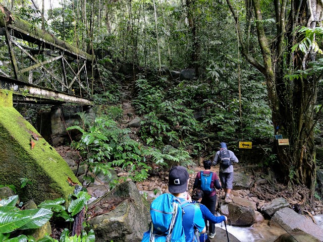
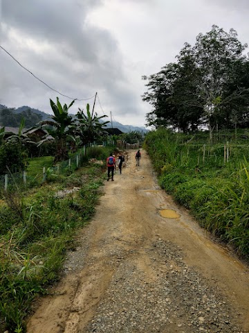
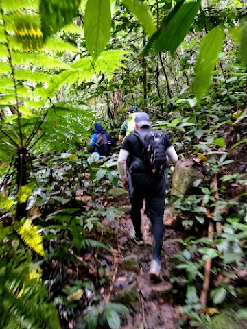
6.25am: Starting our hike in the dark at the trailhead of Gunung Nuang Recreational Forest (RM3 parking fee). Right on the concrete trail I spotted some big leeches wiggling when I shine the light on the ground. Damn, we just got started!
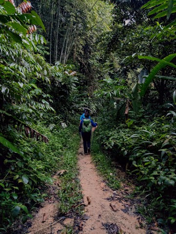
(+37)7.03am: Sun’s out. The concrete road eventually turns into a dirt trail but turns back into concrete sections along the way. This starting part of the trail is called the ‘Never Ending Road’ because it does feel like it, especially during the return trip. It is a steady incline trail for 4km to Lolo Falls (not Camp Lolo, that’s like 6km). The inclination isn’t very steep, but was enough to make one of our members struggle in this constant climb. There were some small trails created by the natives to their plantations or houses, but it was easy to follow the main trail. There was only one split path here that was a little confusing, you have to take the trail on the right. Anyway, the good thing about this trail is you can view the path in Google Map, all the way to the peak, so you’ll know if you stray too far away from the correct trail.

Multiple rest huts (about 5) like these are built along the Never Ending Road.
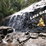
Lolo Falls


(+54)7.57am: When you reach this area with two huts and a trail map signboard, you are at ‘the end’ of the ‘never ending road’. Here you’ll find the Lolo river below.


Not sure why this is being built here, it looks like a changing room without a door.

This signboard roughly guides you on the path ahead.

8.10am: After our team regrouped and removed a few leeches, we continued on to the Lolo Falls trail.

To the right of the trail is the river, and a hut on the opposite side, but you do not have to cross it.
(+2)8.12am: The first river crossing by an old water pipe bridge structure. There are rocks to step on and there’s no need to wet your feet yet.

(+3)8.15am: Follow the big pipe up the trail.
(+4)8.19am: The 2nd river crossing, also enough rocks to keep your feet dry.

(+5)8.24am: Crossing under the big pipe before the old dam waterfall.

(+2)8.26am: Reaching Lolo’s Old Hydro Dam and the 3rd river crossing.


The old hydro dam gate valve and the waterfall.


(+5)8.31am: This 3rd river crossing involves a couple of river crossings. You have a 50/50 chance of getting your feet wet.

Some wild figs by the river.

(+5)8.36am

(+3)8.39am: The 4th river crossing, you may be able to cross by stepping on the rocks.

(+3)8.42am: Leave your problem behind, keep calm and hike.
Kem Lolo

(+3)8.45am: The main area of Lolo campsites.

(+2)8.47am: Right after Kem Lolo, is the 5th and last river crossing. You would probably wet your feet here.

(+4)8.51am: Follow Gunung Nuang’s signboard up the trail.

On the right side after Kem Lolo, there’s a hut and a Kiblat (Qibla) direction signage for Muslim prayers.

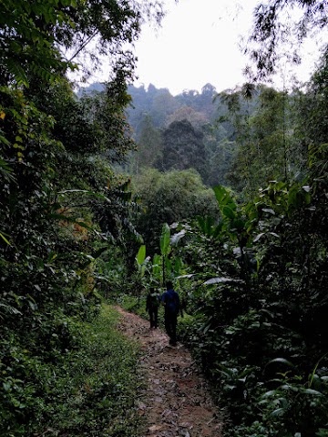
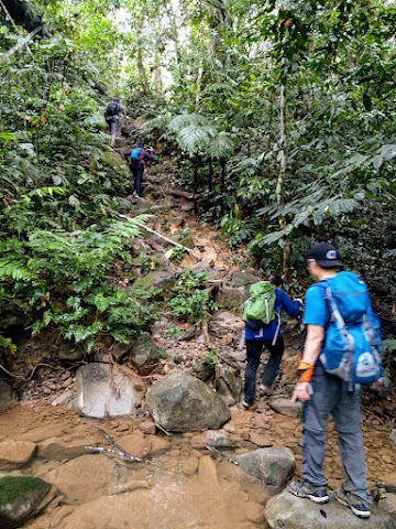
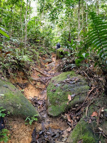
(+30)9.21am: The nice forest trail towards Kem Pacat eventually turned into a not-so-fun eroded soil, and it’s a constant steep incline.

Dogs’ footprints, indicating there were hikers up ahead, as these furry friends tend to follow the first batch of hikers.

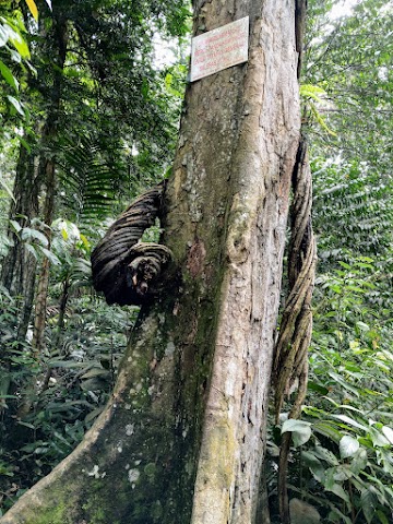
(+18)9.39am: A huge tree with some kind of spiritual paper stuck on its massive trunk.

Some kind of wood dwelling critter’s hole on a log.


(+12)9.51am: These kinds of eroded trails always make me think of the future struggle of having to come back down via the same path.
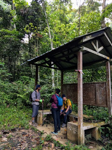
Kem Pacat

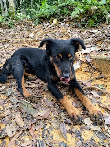
(+18)10.09am: We reached Kem Pacat (directly translated as Leech Camp) and met the first doggo chilling here. I did find some big leeches crawling here.

A very sad sight of nature being ruined by humans. Once a unique attraction on Kem Pacat, the signature giant tree vines are now destroyed by humans climbing/sitting on them. All this just for the egoistic Instagramable ‘nature model’ wannabes. Don’t be like them.

10.30am: After a break and a quick light meal. I continued on towards the false peak called Puncak Pengasih. All my other team members decided to end their trip here so I hiked solo from here onwards. It is recommended to hike with someone here but I know there were more hikers and dogs ahead of me.

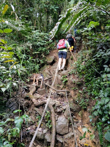
The climb from Kem Pacat onwards, all the way to the peak, will be the true challenge of Nuang via Pangsun. There will be steep 50° angle climbs, loose rocks and slippery paths. Accidents often happened within this section. Everyone should practice a 12pm cut-off time, if anyone does not reach the peak by 12pm, they should turn back and start heading back to the exit. This is to avoid being stuck too long in the forest and not being able to exit the forest by nighttime.

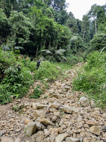
(+25)10.55am: Most parts of the trail from Kem Pacat to Puncak Pengasih looked like this. You often need to use both hands to climb over the rocks and roots. I noticed some rocks were on the verge of breaking off from the loose soil. So, make sure the rocks are secured before you place your full weight on it, especially when going down.
Meeting up with a group of hikers ahead. Three dogs were following/leading them.

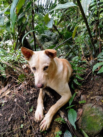

The doggos, ‘mountain guide’ of Pangsun. Climbing these steep forest trails is no challenge for them. They’ll climb up in seconds and wait patiently for us slow humans to close the gaps, before springing into action again.


(+19)11.14am: Approaching the false peak, the scene changes into a misty mossy highland feel.

(+3)11.17am: Due to a recent landslide, the original path to the final stretch of Puncak Pengasih was closed off. A new path led us around it.

Two of the doggos from the earlier team decided to tag along with me when I took over them. This one casually sitting there at the front waiting for me to catch up.

(+5)11.22am: Passing over the landslip area where the old trail was.

A signage of Batu Sempadan 3 Negeri (3 States Boundary Stone) ahead.
Puncak Pengasih (Nuang False Peak)


(+2)11.24am: Here is the false peak called Puncak Pengasih. Follow the arrow and tape markers to Gunung Nuang. The trail was pretty muddy around here.

(+2)11.26am: A few split paths right after Puncak Pengasih but joined back in a short while.

(+3)11.29am: I noticed a few of these boundary stones along the trail near Puncak Pengasih. I wasn’t sure which exact one is the Batu Sempadan Tiga Negeri that marks the three boundaries of Selangor – Pahang – Negeri Sembilan. Based on the map, the actual 3 states boundary line is somewhere 1km+ away from the false peak.

(+14)11.43am: Because it is a false peak, you have to hike downhill for a while towards Gunung Nuang peak.

(+11)11.54am: And of course, you have to climb up again.
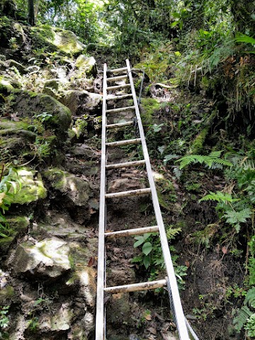
(+6)12pm: When you see the first ladder, it’s time to get happy, as the peak of Gunung Nuang is just a few minutes ahead!

(+2)12.02pm: Another two sets of ladders ahead.

(+1)12.03pm: The last few sets of wobbly ladders toward the peak.
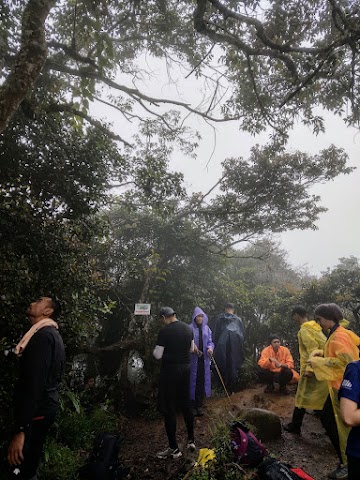
Gunung Nuang Peak (1,493 meters above sea level)

(+3)12.06pm: Finally, I reached the peak of Mount Nuang, just a few minutes late from my 12pm cut off time. A group of hikers who climbed via Janda Baik with a guide were already there. It was during Puasa month so there wasn’t a big crowd.

Spot the squirrel.
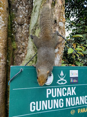

A chubby squirrel would usually hangout around this tree trunk waiting for food, though it is strongly not advisable to feed the wildlife.


Trees cover the views but you can peek through the gaps. Usually there is not much to see on cloudy or hazy days. You may be able to spot Genting Highland buildings on a very clear day.
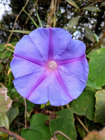

It is also common to find flowers blooming around the peak.

Over there is the trail down to Janda Baik.

12.28am: And the trail here beside the trig station is the Pangson trail, which I’ll be heading back down here. Don’t stay too long at the peak as the journey back down is as long as you know coming up.
The Journey Back Down to Pangsun Exit

(+56)1.24pm: Going down will always require more caution.

Especially on slopes like this, not all rocks sticking out of the soil are safe to step on. Some could break off from the soil if you stand on it.

Some fauna and flora spotted along the way down.

(+42)2.06pm: Returned to Kem Pacat.

(+80)3.26pm: Back to the river at Kem Lolo.

(+29)3.55pm: Passed the Lolo Falls and started the dreaded ‘Never Ending Road’. This is where the constant and long minor downhill road would make your already worn knees hurt more than it should. The effect of this ‘never ending’ road is real on the way back. I was wishing I had brought a bicycle up here so I could ride smoothly down to the exit. On some days, the natives here would take advantage of hikers’ fatigue, offering them a ride on their motorbike for a price. Also, the mosquitos at that hour were the worst! Swarm of mozzies were chasing after me. When I slapped my tricep, there would be three or more dead mosquitos on it. A few seconds later, another batch of mozzies would take over the dead ones, that’s how crazy it was! Even though I had applied a thick layer of Minyak Cap Kapak, I got at least a bite every few seconds directly on the applied areas!

(+50)4.45pm: When you see the trail turning into this white path of smooth cement, it’s time to feel relieved. The road is ending soon.
(+14)4.59pm: Finally, I ended my Nuang via Pangsun journey, half an hour before the storm hit. Total time was about 10 hours and 30 minutes.
Gunung Nuang via Janda Baik (Bentong)
Gunung Nuang via Janda Baik Parking & Trailhead


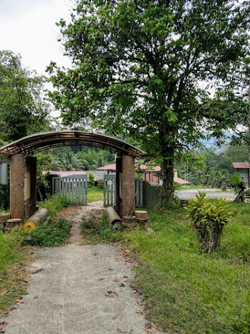
7.55am: One month after my Pangsun hike, I did Gunung Nuang via Janda Baik trail with my other group, plus our mountain guide, Apai. We started our journey from the car park with toilets and washing area (RM7 per car).

Passing by some passion fruit farms.

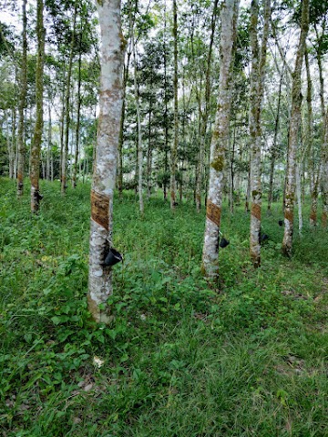
(+3)7.58am: The first trailhead to Mount Nuang from Janda Baik. It passes through a rubber tree plantation.

(+4)8.02am: We brushed through some thick bushes and got wet from the morning dews.
(+7)8.09am: After passing through more farms and durian trees, we were on a long uphill trail under the open sky.


(+18)8.27am: At the end of the open sky trail is the real trailhead to Gunung Nuang.

(+11)8.38am: Due to a serious flood and waterhead that happened earlier in the year, a new route has been created to bypass the buried original trail. In general the trail was very slippery.
(+3)8.41am: One of the paths of a waterhead (kepala air) that occurred during the last monsoon season. We cut through it and connected back to the original trail.

(+5)8.46am: Back into the jungle trail.


(+15)9.01am: Crossing another more serious waterhead path. It was usually just a very tiny stream here. Just imagine the power of the kepala air.


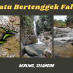
(+16)9.17am: Walking through the trail and crossing the river near Chemperoh Waterfall.
Chemperoh Waterfall

After crossing the river, there is a T-Junction. Turning left will continue on to the peak of Mount Nuang. Turning right will bring you to the Chemperoh Waterfall in just a minute.
9.47am: We regrouped near the waterfall and continued our hike 30 minutes later.

(+10)9.57am: Overall steep trail but not as intense as Pangsun. However, I think Janda Baik’s trail was much more slippery. (Probably can’t say the same if I did Pangsun trail on a rainy day)

(+26)10.23am: A quick stop at a rest stop area.

(+9)10.32am
(+25)10.57am

(+11)11.08am: A signboard for Trans Nuang to Lentang Legong & Bukit Repin. This showed us that we have 1km more to reach the peak of Mount Nuang.

(+7)11.15am: Rain clouds were starting to hit the mountain.

(+15)11.30am: Passing by a rock with a face.

(+11)11.41am: The last stretch before reaching the peak.
Peak of Mount Nuang

(+2)11.43am: A small open sky viewpoint before the peak. Total whiteout!
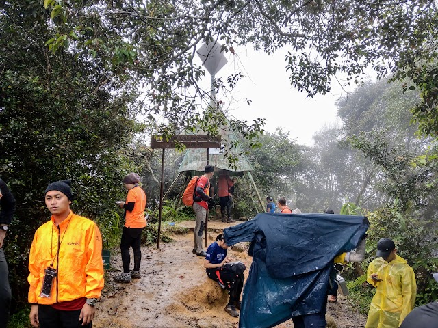
(+2)11.45am: We reached the peak under the rain.

We had lunch with our packed food at the peak. Because my body was wet and I stopped moving to eat my meal, I started to shiver. After finishing our food, we started our journey back down at 12.13pm to regain body heat by moving again. The rain got really heavy. I had a leg cramp at one point when I used the wrong muscle trying to stop myself from slipping down a muddy slope.

(+153)2.46pm: Arrived back to the Chemperoh Waterfall area.

(+70)3.56pm: Reached the passion fruit farms.

(+5)4.01pm: Exited the rubber trees plantation trailhead. Total time was about 8 hours.
When we were on the way heading down from the peak, we passed by some group still trying to reach the peak. During our hike to Bukit Repin the next day, the guide told us the other group ended up exiting the forest after 8pm in the dark with a super slippery trail under the heavy rain. This is why you should practice the 12pm cut off time, or at least be well prepared with proper equipment and enough rations for the unexpected delays.
Gunung Nuang via Pangsun VS via Janda Baik VS Kinabalu & Tahan
Via Pangsun | Via Janda Baik | |
Distance | Around 9km | Around 6km |
Time Required | 10-12 hours | 8-10 hours |
Major Difficulties | Long and Steep Climb | Slippery Trail |
River Crossings | 5 times (possible wet feet) | 1 time (dry feet) |
Leeches | More | Less |
Perks | Variety of trails & views | Lower intensity |
Since many people see Nuang as a training ground for Mount Kinabalu and Mount Tahan, I should also compare these trails together. I shall say that Mount Kinabalu is easier than Mount Nuang due to its trail. Kinabalu’s trail is less steep and less slippery. For Mount Tahan, I could say Tahan is harder than Nuang in terms of distance and mental determination, but it also could be seen as easier as the Tahan’s journey is separated by days. Also, I would say that the climb for Nuang via Pangsun from Kem Pacat to the peak, is similar to the climb of Tahan via Merapoh from Kem Kor to Bonsai.
Have this guide helped you? Tag @meowtainpeople in your hiking stories & posts!

*Captain Planet passing by* Remember, please take care of our environment, and please don’t destroy the Nature. Leave no trash behind and take back only photos and memories (and also some trash if you can). Walk on the designated path and stay in the middle as much as you can, so that the exposed soil doesn’t spread/corrode further. BE ONE WITH NATURE *flies away*
Affiliate Links to support this site:
Yay for transparency!: The links above are affiliate links, and at no additional cost to you, I earn a commission if you make a booking/purchase after clicking the links. I recommend only products and companies I use. Your support helps me keep the site going 🙂
Want to do the same affiliate marketing with your site? Use this AccessTrade platform link to receive RM5 reward.
Hi I intend to go on 21 or 22 aug from pangsun. Is it ok to do the hiking without a guide? Is the trail quite clear?
I live in Singapore. Any possible way or easier way to get the permit since it may be difficult to be there personally.
Thank you
Hi MeiYing, sorry for the late reply. Officially a qualified nature guide is required for all the hikes but it isn’t enforce unless the locations emphasize on having a guide (such as Nuang via Janda Baik and other hikes in Pahang state). Though, take my word with a grain of salt.
As for the permit application, unfortunately the forestry is not making the process easy for anyone. You could ask someone you know nearby to help with the application, or you could try to find a runner who provides service for permit application.
All the best! 🙂
WOW sounds like Janda Baik is not a piece of cake either! Thx for the share!
Hi, do you know of any contact to get a permit and even a guide if its needed?
Hi Farhan, I have made a minor update in this post for a better answer to your question. Please see the Permit section for the explanation. Thanks!
Hi. Applied permit thru a guide.
The hike to Gunung Nuang is thru Pangsun on the 24th August 2024 which is today.
Paid guide in full. Decided to cancel when it rained continously on the eve of the hike.
Is it normal for a guide to ask for compensation when the hike cancelled despite paying in full.
Hi Anson, based on my experience, if the guides decide to cancel the trip due to adverse or unsafe weather conditions, they would refund the guide fee (permit fee is usually not refundable as it is paid to the forestry department). However, if it’s the hikers’ side that decide to cancel the trip, then usually the cost is on the hikers’ (most of the time you would pay for the deposit amount and get back the rest).
Hi there, recently conqured nuang via pangsun and it was hell for me, took a lot of mental strength hahaha. Started at 4am and ended at 8pm at night.
Not sure if you’ve done Mount Kinabalu, but do you think ill be able to do well for Mount Kinabalu after facing Nuang? Any tips for when climbing to the summit and descending on the next day with the muscle soreness? Tips on reducing those aches and cramps?
Hey Jonathan, well done! Nuang via Pangsun is no joke.
Yes, I’ve done Mt Kinabalu, you can find the detailed guide about it from my homepage. It’s definitely easier than Nuang via Pangsun in terms of technical difficulties, but the keyword is “training, training, training” for any big hikes. Go for more hikes (perhaps carrying a load, although for Mt Kinabalu you don’t really need to carry much) prior to the big ones to let your body get used to it without getting hurt.
Tips for summiting & descending: don’t rush but take consistent, smaller steps when going uphill (more covered in Mt Kinabalu post).
Regarding the next day’s muscle soreness, I usually just “tahan je” but it can be reduced by prior trainings, protein intakes during dinner for muscle recovery, and a good night’s rest.
I had a cramp once during the descent from Nuang via Janda Baik, when I used the wrong leg muscle trying to stop myself slipping down the muddy trail, and a friend sprayed some kind of cold compressed canned air on my leg and right away the cramp was gone, so that could be useful.
All the best!