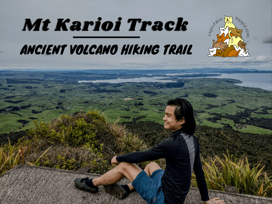
Mount Karioi is a 2.4 million years old ancient volcano with a summit rising over 756 meters tall. Karioi summit can be reached via two routes: Wairake Track and Mt Karioi Track.
The Wairake Track is a shorter, easier hiking trail to the summit, starting from Karioi Road Car Park. The track involves passing through a private farmland at the start, which is only accessible during daylight hours. The Mt Karioi Track is a steeper but more scenic trail to the summit. It starts from Karioi Summit Track Parking at Whaanga Road.
This post covers my hike via the scenic Mt Karioi Track, which took me 2 hours and 10 minutes to summit Mount Karioi (DOC suggests 3 hours and 30 minutes one way).
Karioi Hiking Trailhead - via Mt Karioi Track
10.12am: Mt Karioi Track’s trailhead can be found across the road from the car park.
Firstly, the track first passes through a grove of kānuka.
(+15)10.27am: Secondly, the track climbs up a grassy slope before reaching the main ridge.
Be sure to look back and enjoy the scenic hills and ocean view behind you.
(+11)10.38am: Thirdly, once reaching the main ridge, the track enters the shades of the forest trail.
(+14)10.52am: Next, the track reaches the open sky area along the ridges.
(+2)10.54am: There is a metal staircase over here to help hikers climb down the rocks.
(+5)10.59am: More views of the other ridges along the track. Looking closely, you can see the vegetation along the ridge has been sculptured by the strong prevailing westerly wind.
(+5)11.04am: Back into the shades, the track goes up another ridge.
(+4)11.08am: At some point, chains are installed to help negotiate the occasional rocky outcrop.
(+3)11.11am: More uphill climbs.
Lookout Point
(+11)11.22am: A 5-minute side track to a lookout point with views across Raglan Harbor.
To the right, you could see the peak of Karioi with a long metal pole on it.
(+5)11.27am: Back to the main track, it is ⅔ of the progress from here to the summit.
(+2)11.29am: Turns out, there is also a good lookout point on the main track itself, which provides a similar view to the previous lookout.
Most parts of the track are undulating, which is nice as you wouldn’t feel too tired going just up for too long (and vice versa).
(+37)12.06pm: More coastal views along the track.
(+5)12.11pm: A view of the false peak and the actual summit’s pole behind it.
As the track ascents higher, it turns into a little mossy forest.
Mount Karioi Summit
(+7)12.18pm: Before reaching the summit, the track runs across the narrow side of the rock wall.
(+4)12.22pm: Then, the last climb up the ladder to the peak.
(+1)12.23pm: Turns out, the pole is actually a part of the radio equipment, used for search and rescue purposes.
The scenic views around Karioi Summit.
Continue climbing over to the other side of the peak, you’ll find a mini helipad with another wide angle view of the west coast of New Zealand North Island.
On a super clear day, you could even see Mount Taranaki from here!
3.04pm: Back to the car park.
At the back of the parking area, there is a lookout platform for a pretty dramatic view of the cliff and ocean!
Have this guide helped you? Tag @meowtainpeople in your hiking stories & posts!
*Captain Planet passing by* Remember, please take care of our environment, and please don’t destroy the Nature. Leave no trash behind and take back only photos and memories (and also some trash if you can). Walk on the designated path and stay in the middle as much as you can, so that the exposed soil doesn’t spread/corrode further. BE ONE WITH NATURE *flies away*
Affiliate Links to support this site:
Yay for transparency!: The links above are affiliate links, and at no additional cost to you, I earn a commission if you make a booking/purchase after clicking the links. I recommend only products and companies I use. Your support helps me keep the site going 🙂
Want to do the same affiliate marketing with your site? Use this AccessTrade platform link to receive RM5 reward.

