
One of the most popular walks in the Coromandel Peninsula of New Zealand’s North Island is the Kauaeranga Kauri Trail (Pinnacles Walk). Coromandel Peninsula was once a chain of volcanoes extended along the landform. After erupting for millions of years, the volcanic activity ceased around one million years ago. Since then, erosion slowly worked on the landscape, exposing the remains of the volcanic peaks.
This walk in the Coromandel Forest Park can be done as a day hike, or an overnight walk. For overnight walks, you have the option to stay at the deluxe Pinnacles Hut, or the peaceful, historic Dancing Camp Campsite. Both hut and campsite require online booking in advance.
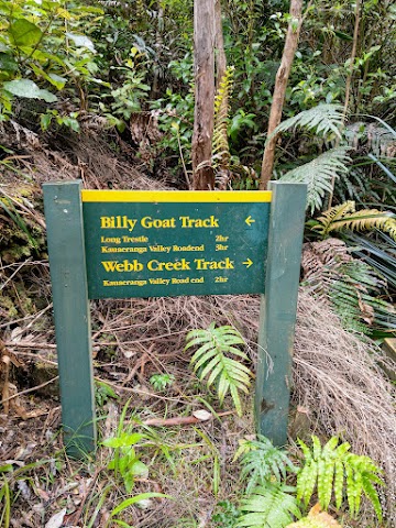
In my following journey, I took the Webb Creek Track, which is the default track, toward the Pinnacles. On the journey back, I took the Billygoat Track back to the carpark.
Pinnacles Walk / Kauaeranga Kauri Trail - Starting Point


9.40am: The trailhead of the Pinnacles Walk begins at Kauaeranga Valley Road End, where you can easily drive and park your vehicle there.

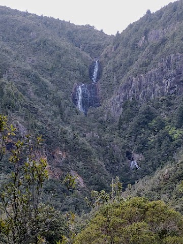
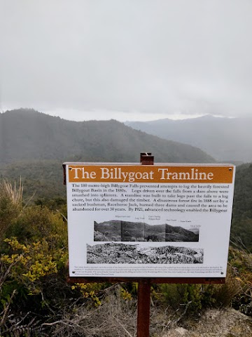
(+9)9.49am: A short sidetrack to the Billygoat Landing and Billygoat Falls lookout. The steep waterfalls had protected much of the forest from kauri logging in the early 1900s.
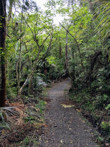
(+7)9.56am: Continuing on the track, you will first have a serene walk in the forest with a well paved track.
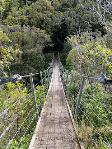
(+17)10.13am: Crossing the Webb Creek Swing Bridge.
The Rock Staircase
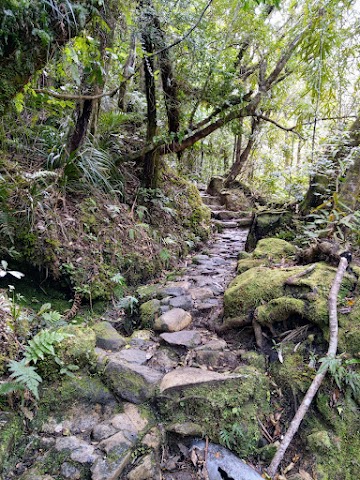
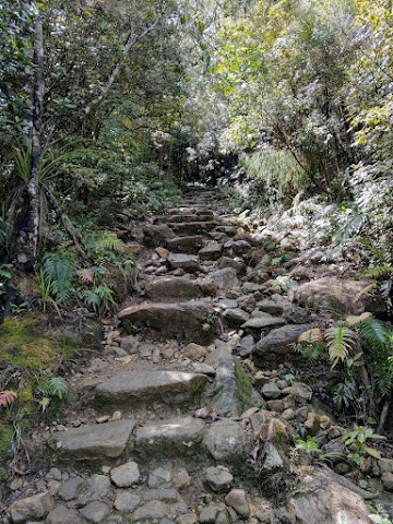
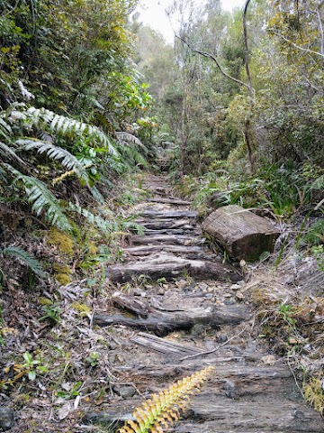
(+1)10.14am: After the swing bridge, you’ll walk on steps cut into solid rock by bushmen and gumdiggers during the 1920s. It provided horses with better grip on weekly supply trips to bush camps above the Kauaeranga Gorge. As the rock steps were worn by horses hooves, battens were spiked to some of them to improve the foothold.
During the last kauri logging period (1928 – 1928), contractors and their bushmen lived for periods up to six months in the forest. A train of up to eight packhorses made weekly trips to the bush camps with flour, fresh meat, tinned food, potatoes, tea, sugar, tools, clothing and mail.
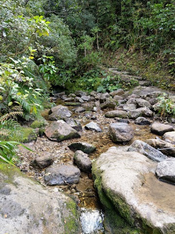
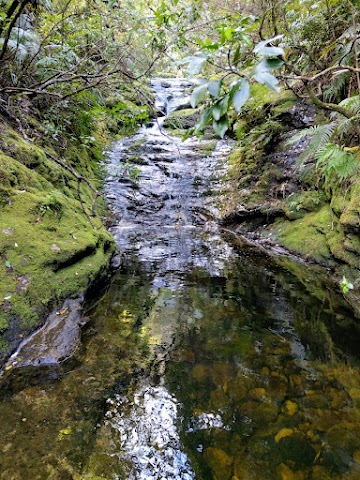
(+7)10.21am: Shortly after, there is a stream crossing with some mini waterfalls along the flow. You can easily step on the rocks to cross the stream. There is also a flood detour path when the water level rises during periods of rain.

(+37)10.58am: After some uphill walk on the rock staircases, you’ll reach this crossroad. Both directions are the same. The left provides a short flood detour when the river level rises. The right passes by Hydro Camp and the Billygoat Track, which is an alternative route I am taking on the way back.
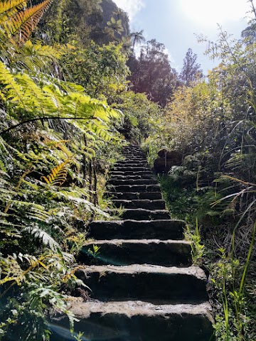
(+8)11.06am: More rock staircases.

(+13)11.19am: A massive hollow log on the side of the track.

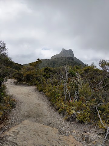
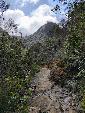
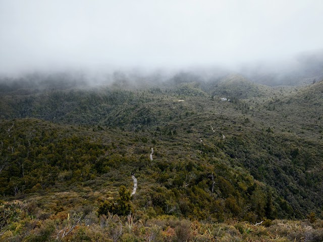
(+1)11.20am: Once you reach a higher altitude, the trees change into smaller species and the sky opens up. Here you will get the first view of the Pinnacles.
Rangihau / Pinnacles Walk Junction
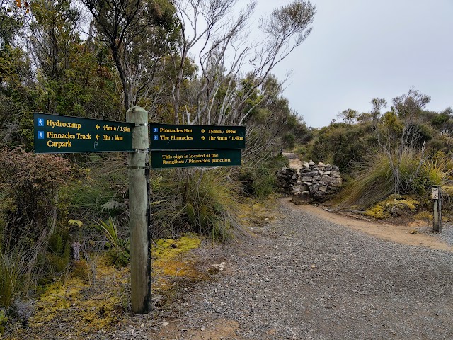
(+14)11.34am: A directional signboard at Rangihau / Pinnacles Junction. 15 minutes (400m) to the Pinnacles Hut, and 1 hour-ish (1.4km) to the Pinnacles. The more advanced Rangihau Track entrance/exit is 5 hours (10.3km) away.


Some misty views surrounding the track.
Pinnacles Hut

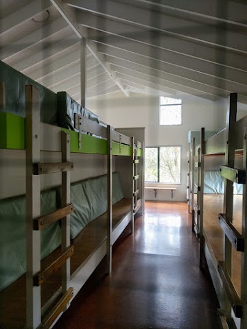

(+11)11.45am: The Pinnacles Hut is a well furnished and pretty ‘luxury’ looking compared to other huts.
Dancing Camp Campsite

(+10)11.55am: The historic Dancing Camp Campsite is just a 5-minute walk from the Pinnacles Hut. The Dancing Camp Kauri Dam, built in 1924, was one of the 100+ dams built across the streams in the valley. They were the only way of getting timber out of steeper country: Water is stored and released in a flood to drive felled logs downstream.
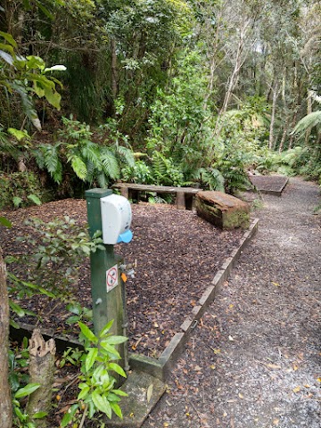
The campsite has four raised platforms. Each platform can take up to 4 people. Both the Pinnacles Hut and Dancing Camp Campsite require booking in advance here.
Ascent to the Pinnacles Summit (759m)
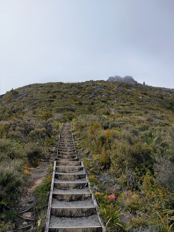
(+16)12.11pm: The climb towards the peak from the hut starts with steep paths and long stretches of wooden stairs to get your cardio up and running.
(+7)12.18pm: Half way up and looking back, you’ll see the tiny hut and stairways among the vast bushland.
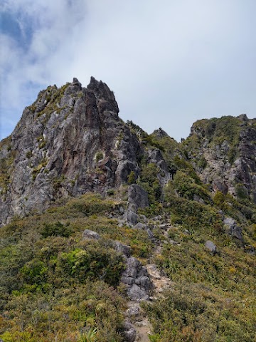
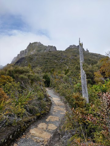
(+3)12.21pm: The last section involves climbing the narrow path up the rocky peak. The Pinnacles are plugs of rock which solidified inside volcanoes around 8 million years ago. The volcanoes themselves have eroded away, leaving the plugs exposed.
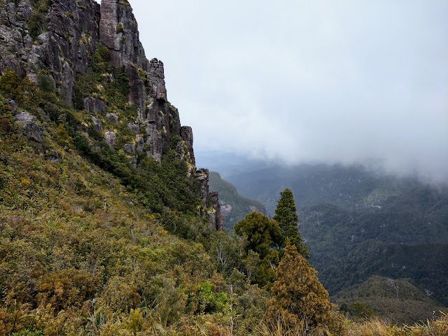
On the climb up, enjoy the scenery such as the majestic rock walls and the passing thick clouds.

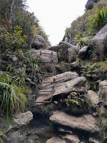
Metal stairs and handlebars are installed onto the rock face to help climbers to get through the steeper parts.


(+12)12.33pm: On the fenced summit platform of the Pinnacles. Enjoy the spectacular views of the bush, mountains and coastline of the eastern Coromandel.

During misty days, witness the clouds approaching toward you and the summit, before rising up at the last second and curving down to the other side of the mountain. Check out the short video here!
Pinnacles Walk Return via Billygoat Track
(+1 hour 16 minutes)1.49pm: Back to Hydro Camp with the junction. Here, you may decide to return to Kauaeranga Road using the same route via Webb Creek Track, or explore the longer Billygoat Track which offers views of the surrounding countryside and evidence of the logging era.

Look for this trailhead across Hydro Camp to the Billygoat Track.
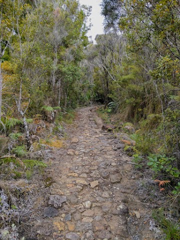
(+2)1.51pm: The track starts with an aesthetic looking cobblestone-like trail (though it’s hard on the feet).
(+32)2.23pm: You will also walk through the remains of some smaller skidded roads, made from small logs. These ‘skids’ were used to pull logs using bullock teams or steam haulers.

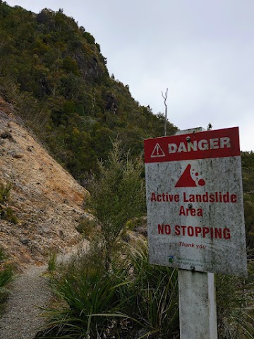
A couple of landslide areas along the way.

(+2)2.25pm: A huge stump of a felled log by the track (feet for scale).
(+23)2.48pm: The climb leads to a saddle with excellent views down the Kauaeranga Valley to the Hauraki Plains.


(+24)3.12pm: Dropping down into Billygoat Basin and crossing the Billygoat Stream via a bridge.
Billygoat Campsite
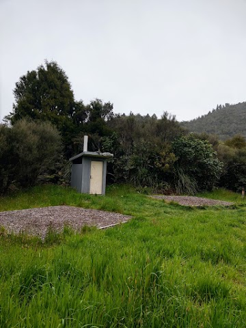
(+5)3.17pm: This basic campsite has eight raised platforms. Each platform can take up to four people (booking required).
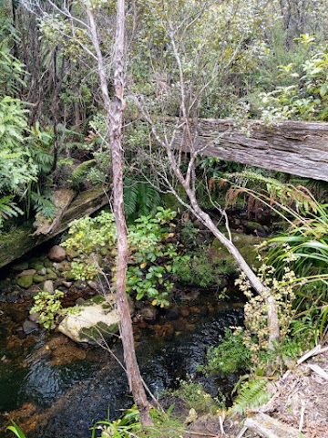
(+3)3.20pm: A 2-minute sidetrack to the ‘Long Trestle’: remains of a trestle bridge, once part of the bush tramline.

(+2)3.22pm: A remnant of some kind of stone structure, near the junction for the Tarawaere and Hihi tramping tracks.
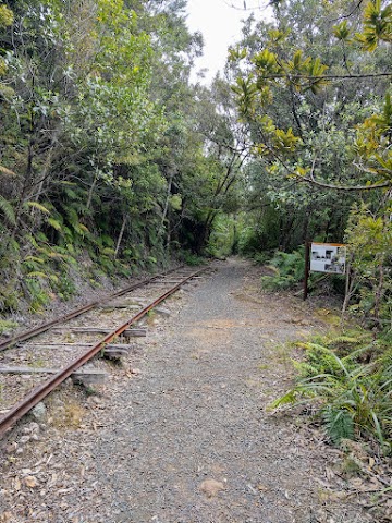
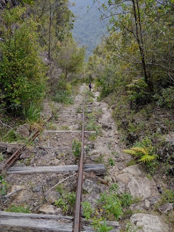
(+11)3.33pm: The track follows along the remains of rails of the Billygoat Incline Hauler. Steam haulers were used in the later period of kauri logging from the early 1900s. They were stationary steam engines driving a winch which could pull logs by steel cable for a distance of over a kilometer. The Billygoat Incline Hauler was used instead to lower two sets of rail trucks at a time down to the log skids at Billygoat Landing.
Because of the very steep grade, the lowering hauler used a Judd steam winch which had extra braking power to control the descent. A brakeman also rode on the rear rail truck. To get around curves in the line, the steel cable was automatically fed by a bracket under the rail trucks into a series of rollers at ground level.
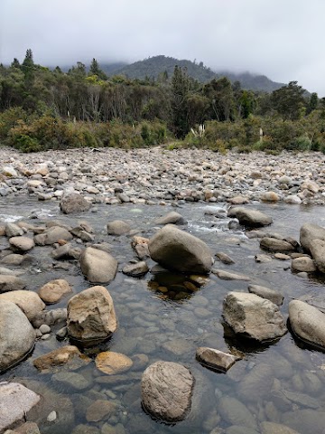
(+39)4.12pm: Before reaching the end of the walk via Billygoat Track, you have to get your feet wet to walk across the river.
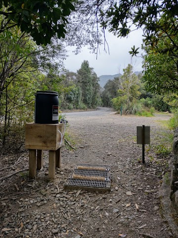
(+7)4.19am: At the end of Billygoat Track is a few minutes walk back to the Kauaeranga Valley Road car park.
Have this guide helped you? Tag @meowtainpeople in your hiking stories & posts!


*Captain Planet passing by* Remember, please take care of our environment, and please don’t destroy the Nature. Leave no trash behind and take back only photos and memories (and also some trash if you can). Walk on the designated path and stay in the middle as much as you can, so that the exposed soil doesn’t spread/corrode further. BE ONE WITH NATURE *flies away*
Affiliate Links to support this site:
Yay for transparency!: The links above are affiliate links, and at no additional cost to you, I earn a commission if you make a booking/purchase after clicking the links. I recommend only products and companies I use. Your support helps me keep the site going 🙂
Want to do the same affiliate marketing with your site? Use this AccessTrade platform link to receive RM5 reward.