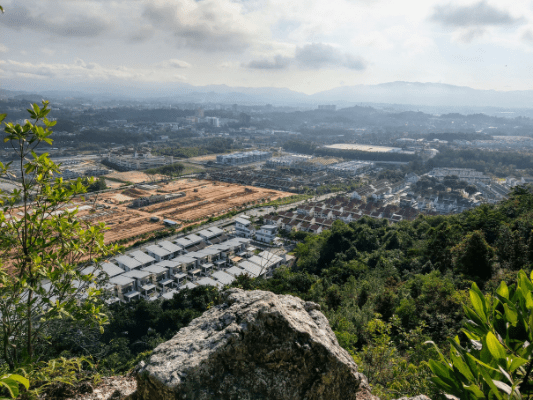
Kepayang Hill or Bukit Kepayang is a small hill area (205 meter above sea level) in Seremban, next to another hiking spot which is Bukit Bal. Even though it is just a small area, exploring all the subtrails here could take hours with high elevation gain due to going up and down the small hill.
There are more than 30 trails, all with unique names.
With so many trails to choose from, Kepayang Hill is suitable for beginners and intermediate alike. While there are easy paths to hike up to the peak, most of the subtrails are pretty steep, considerably challenging but short. Worry not, as most of the trails are tied with ropes to assist your climb.
For me, I entered the trailhead for Bukit Kepayang hiking trail here (entrance 3), made a circle trip over the hill and exited from Kepayang Hill Hiking Trail, Start Point A (entrance 2). You can park your vehicle around the Kepayang Business Centre but not on the main road beside the trailhead.
The most straightforward way to reach the peak is to choose the steepest path toward the hill. So, I took the Super Way Trail and it was steep! But it is also very short so I reached to the top in no time.
Using the Super Way Trail I arrived at the North West side of the hilltop, with a mini temple on it.
The panorama view to the West for sunset watchers.
Kepayang Hill Peak
Walking Southeast along the hilltop, I reached the popular spot where visitors like to take photos posing on this rock. Here you can see the view to the East.
Down the path, there is this spot where people usually hang out. Here has the panorama view to the East for sunrise catchers.
At this same spot, you can try to do some ‘rock climbing’. A couple rock climbing paths lead to the peak I showed just now. Just be extra careful and make sure the ropes are still in good condition!
The intimidating view looking down from the top.
After stopping at the hilltop, I went down via the steep Dog Trail, to Station 3 Khoo Junction.
Then, I followed the easy path (suitable for mountain biking) along the Southeast direction. Along this main path, you will encounter many trails leading back up to the hilltop.
First, I tried to go all the way to Station 8 Goat Farm / Highway Exit, but a part of the trail has sunk in due to soil erosion.
So, I backtracked and took the nearest split path, leading to Rainbow Trail’s steep exit to the tarmac road.
Next I followed the tarmac road down to the exit.
Instead of exiting to the hot main road and walking back along the highway, I found this trail by the side of the houses.
As a result, I was glad to find this as the path is nice and shady. It brought me to the trailhead entrance 2 (starting point A).
Finally, this is Kepayang Hill trailhead entrance 2 (starting point A).
On the road of Jalan Taman Bukit Kepayang Besar 1, you can actually see the peak and the flags.
Have this guide helped you? Tag @meowtainpeople in your hiking stories & posts!
Affiliate Links to support this site:
Yay for transparency!: The links above are affiliate links, and at no additional cost to you, I earn a commission if you make a booking/purchase after clicking the links. I recommend only products and companies I use. Your support helps me keep the site going 🙂
Want to do the same affiliate marketing with your site? Use this AccessTrade platform link to receive RM5 reward.
*Captain Planet passing by* Remember, please take care of our environment, and please don’t destroy the Nature. Leave no trash behind and take back only photos and memories (and also some trash if you can). Walk on the designated path and stay in the middle as much as you can, so that the exposed soil doesn’t spread/corrode further. BE ONE WITH NATURE *flies away*


