
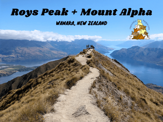
Roys Peak is probably the most touristic hiking track in Wanaka, New Zealand. Visitors are attracted by the breathtaking panoramic views over Lake Wanaka and the surrounding snow-capped peaks of the Southern Alps. While rarely overcrowded, it is expected to see some groups of people most of the time.
Mount Alpha, on the other hand, often gets ignored or unnoticed most of the time. Yet, it is a wonderful peak that offers next-level scenery compared to the lower Roys Peak. Mount Alpha can be accessed from Roys Peak Track, passing Roys Peak. Adventurous hikers can also walk the full length of Skyline Track (7-10 hours one way), starting from Roys Peak Track car park to Cardrona Valley Road Skyline Ridge car park (you have to sort out your transport).
In this trip, I am doing about half of the Skyline Track, starting from Roys Peak Track parking, to Roys Peaks, then to Mount Alpha, back to Roys Peak and finally back to Roys Peak Track car park. (Time taken: ~7.5 hours return)
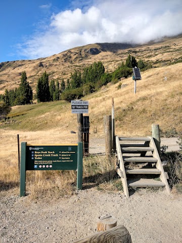
Roys Peak Track
Car Park & Trailhead
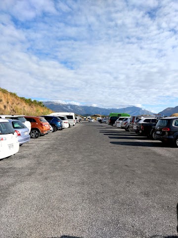
9.24am: Starting from the car park. It can be quite full most of the time. If it’s fully occupied, you may park at Waterfall Creek Track car park and walk/cycle the track that connects to Roys Peak Track car park.
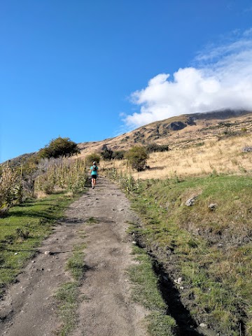

Be ready to climb through hours of constant uphill, well-formed wide track. I find this mentally more tiring than the usual hiking trails. Note: Take proper sun & weather protection as the track is 100% exposed to the elements.

(+15)9.39am

(+18)9.57am


As you pass through the farmland, you would see some sheep roaming/feeding in the area.

(+30)10.27am

(+5)10.32am

(+12)10.44am


Along the side of the track, there were plenty of these plants with spiky pods and dandelion-like seeds (probably jimsonweed?).
The Stack Conservation Area

(+8)10.52am: Walking over stile, leaving the farmland boundary into The Stack Conservation Area.
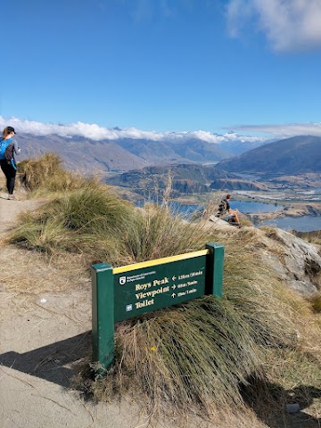
(+17)11.19am: Junction to the viewpoint.
Roys Peak Track Lookout / Viewpoint

A short side track to the viewpoint.
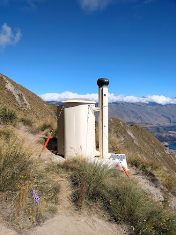
There is a toilet here.
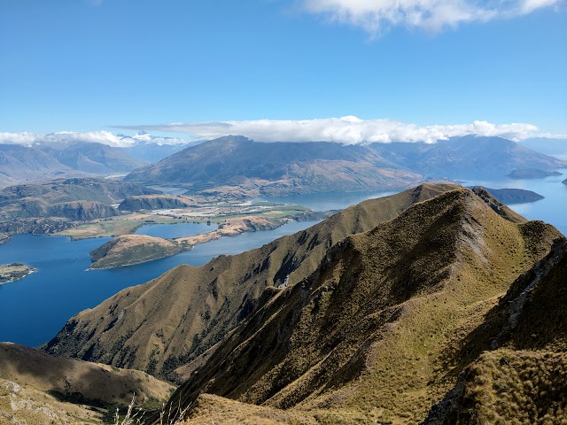

The views from the lookout point. You could also see Coromandel Peak, a popular wedding photoshoot location accessed by helicopters (possible on foot too but the it’s steep and overgrown with tall grass)

You can also see the track where you come from.

Mount Aspiring peak

(+19)11.28am: Continued towards Roys Peak.

(+12)11.40am: The view from above the viewpoint (bottom right).
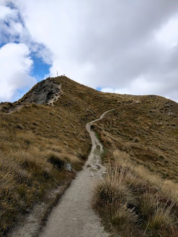
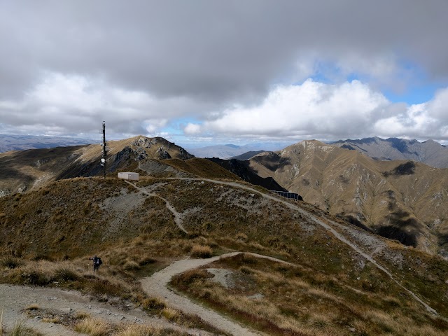
(+21)12.01pm: The pole is where the peak is at.

(+6)12.07pm: Arrived at Roys Peak!
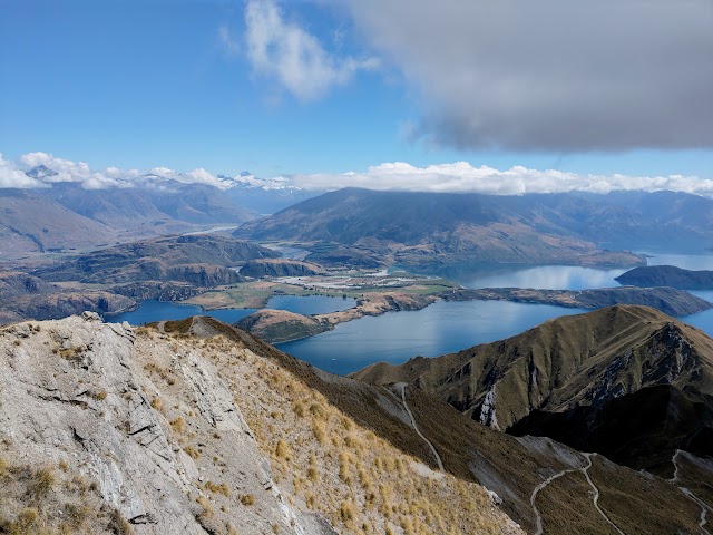
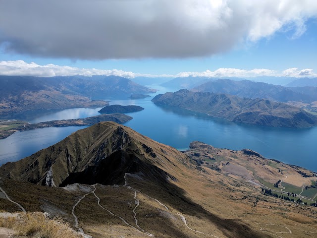
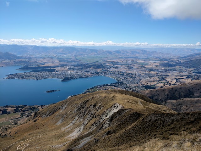
Roys Peak Summit (1,578m)
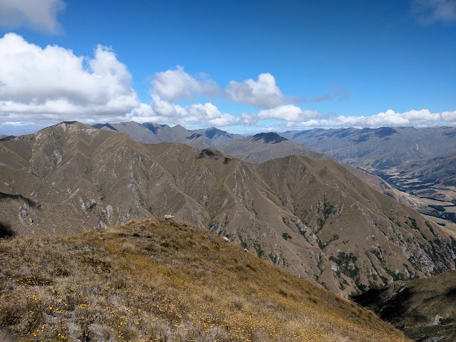
The panoramic views from Roys Peak Summit:


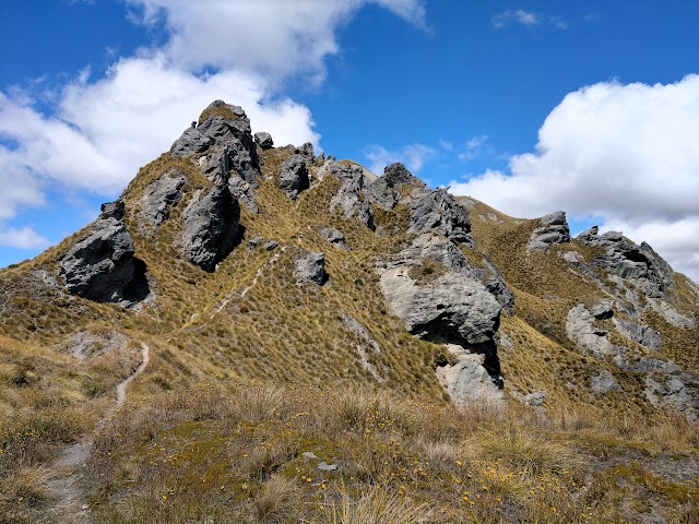
Roys Peak to Mount Alpha (Skyline Track)
12.29pm: After having a couple sandwiches for lunch, I headed Southward to Skyline Track for Mount Alpha.

(+3)12.32pm:Some solar panels.
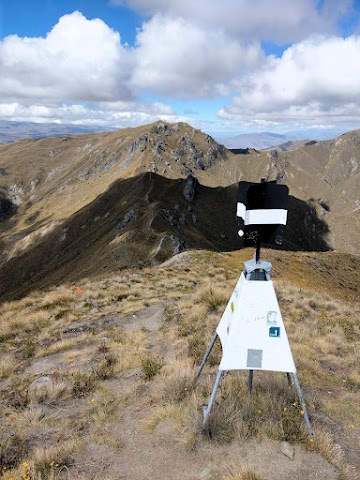
(+4)12.36pm: Passing a small trig structure.
(+1)12.37pm: This is where it gets really quiet and peaceful as the track heads away from the crowds.


(+3)12.40pm: Mount Alpha is only slightly higher than Roys Peak, but there are multiple, steep ups and downs along the ridges between the two summits.

(+7)12.47pm: Unlike Roys Peak wide track, the track to Mount Alpha is rather narrow with steep drop offs, especially to the right side.
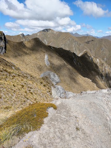
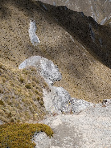
(+6)12.53pm: Keep a lookout for this rock face that looks like a human (sideway face and chest).

(+8)1.01pm

(+4)1.05pm

(+6)1.11pm

(+6)1.17pm: Be careful not to fall off to the side. The sandy track can be quite slippery when dry, the grass even slipperier.
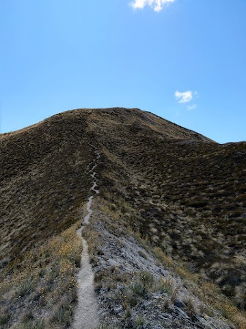
(+4)1.21pm: That’s not the peak but another ridge hill to climb over.


(+10)1.31pm

A group of chamois (a species of mountain goat-antelope) chilling on a peak.

Can you see the track? (tip: find the pole marker)

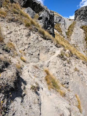
(+6)1.37pm: Just before Mount Alpha summit is the scariest part of the narrow track around rocks with loose sand and a steep drop-off below. #TrailsThatMakeYouGoHmm

(+11)1.48pm: Final push to Mount Alpha Summit!
Mount Alpha Summit (1,630m)

(+1)1.49pm: Finally, I arrived at the summit of Mount Alpha, the highest point on Skyline Ridge Track! From here you could continue down through snow tussock to a 4WD farm track to Spotts Creek and exit at Cardrona Valley Road. I didn’t walk that way as I didn’t sort out the transport back to my car. (Thinking back, I could have done a key swap with that only one hiker I met on this track) (Key swap is a common practice in New Zealand where two hikers start the hike on different ends of the track, meet in between and swap the car keys to regroup after the hike)
Another scenic panoramic galore from Mount Alpha peak:


Mount Alpha to Roys Peak Parking

2.10pm: After taking in the views from Mount Alpha, I headed the same way back to Roys Peak and to the car park.

(+26)2.36pm
(+14)2.50pm


(+15)3.05pm: Back to the trig structure and Roys Peak Summit area.
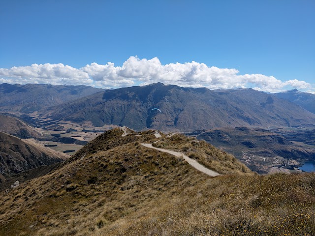
A paraglider flew over the track.

(+116)5.01pm: Back to Roys Peak Parking.
Have this guide helped you? Tag @meowtainpeople in your hiking stories & posts!

*Captain Planet passing by* Remember, please take care of our environment, and please don’t destroy the Nature. Leave no trash behind and take back only photos and memories (and also some trash if you can). Walk on the designated path and stay in the middle as much as you can, so that the exposed soil doesn’t spread/corrode further. BE ONE WITH NATURE *flies away*
Affiliate Links to support this site:
Yay for transparency!: The links above are affiliate links, and at no additional cost to you, I earn a commission if you make a booking/purchase after clicking the links. I recommend only products and companies I use. Your support helps me keep the site going 🙂
Want to do the same affiliate marketing with your site? Use this AccessTrade platform link to receive RM5 reward.