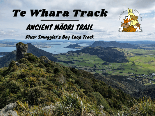
Te Whare Track is one of the best hiking trails in Northland, New Zealand, passing through the beautiful coastal forest of Whangarei Heads. This 7.5km (one way) trail passes through some WWII ruins, including a radar station and power house, and a scenic panorama lookout peak. It took me about 4 hours to complete Te Whara Track (standard estimation: 5-6 hours).
In addition to Te Whara Track itself, I spent an addition of 1.5 hours exploring the interesting Smuggler’s Bay Loop Track. This 3km loop track passes by a WWII Gun Emplacement, some grazing cows, Busby Head, and of course, Smuggler’s Bay.
Te Whara Track Trailheads
Te Whara’s one way track starts/ends either from Ocean Beach car park, or Urquharts Bay car park. If you do not want to walk the whole track or the long return journey (via trail / road), you can switch to Peach Cove Track at the first ⅓ of Te Whara Track from Ocean Beach and exit via Peach Cove car park.
10.58am: I started my hike via the Ocean Beach car park trailhead.
(+7)11.05am: A little sidetrack in the beginning takes you to the tempting Ocean Beach.
(+3)11.08am: To get to Te Whara Track, follow these metal bars with a red arrow.
(+3)11.11am: You will pass through this cleaning station, where you need to clean your footwear to protect New Zealand’s precious Kauri trees from dieback disease.
(+4)11.15am: Climbing the somewhat exhausting grassy hills.
(+3)11.18am: Some coastal views from the hill.
(+3)11.21am: The hills get pretty steep and exposed to the sun and wind.
(+13)11.34am: The hill trail leads to the start of the forest ridges.
(+4)11.38am: As soon as I reached the forest trail, the trail changed to a series of well-built concrete stairways.
Te Whara Track - WWII Radar Station & Ruins
(+4)11.42am: The first rest stop with a picnic table. The radar station is just nearby.
From here, you can view the headland of Bream Head.
(+2)11.44am: Walking down the stairs gets you to the WWII radar station.
(+2)11.46am: Further down the trail, is a short sidetrack to the WWII Power House.
(+3)11.49am: More remains of the WWII ruins are found shortly along Te Whara Track: Laundry & Ablutions, Mess & Quarters (not the picnic table haha).
(+4)11.53am: The stairway continues to climb up the steep trail along the ridge, till you find a sidetrack to the rock outcrop for the scenic lookout point.
Bream Head / Te Whara Track Scenic Lookout
(+27)12.20am: To get to the lookout point, there is this intimidating rock outcrop to climb. Climbing up to the rocky lookout is only recommended if you feel confident climbing it, and only during dry and calm weather. There is a risk of falling down the rock edge.
(+3)12.23pm: Scenic 360 panoramic view of the coastal forest!
From the lookout point, you might be able to spot Cape Brett in the north, Cape Rodney and the Poor Knights islands in the south, and the Hen and Chickens Islands group in the far east.
You could see the amazing ridgeline and where you are expecting to travel across it to the other end.
One bad mistake and it’s a long way down.
(+41)1.04pm: Peach Cove Track joins Te Whara Track along the way. You can take that track for a shorter return loop.
(+1)1.05pm: After passing the ridges, the remaining trail becomes relatively easygoing and undulating.
(+1)1.06pm: A random scenic lookout point at a point of the trail.
(+5)1.11pm: A tree with multiple huge bird’s nest ferns.
Quite a number of these chubby Kereru (New Zealand Wood Pigeons) were encountered along the woods, along with North Island Robins and Fantails.
(+3)1.14pm: Here’s the entrance/sidetrack to Peach Cove. There is a hut at Peach Cove if you plan to stay for a night (must be booked online in advance), or if you need to go to the toilet there is a longdrop toilet near the hut. It’s a 20-minute steep stairway down to the cove. I did not go there in order to save time and energy. Follow the Smuggler’s Bay direction towards the other end of Te Whara Track.
(+8)1.22pm: At some points you’ll get to spot the ridges and the lookout peak you came from, and get astonished by the journey you’ve done so far. Thanks to New Zealand’s Department of Conservation’s work on the track, the walk takes less time and is less difficult than it would be.
There are a mixture of dirt paths, rooty trails, and stairs. Stairs seem to be the majority of the track. The remaining undulating trails go up and down without too much inclination/declination.
(+13)1.35pm: Another random viewpoint.
(+40)2.15pm: When you reach this different kind of wooden stairs, you are going through the last section of Te Whara Track.
(+1)2.16pm: This unique looking rock looks like it’s balancing on top of another rock.
(+19)2.35pm: The last remaining track involves a long and steep stairway down to the trailhead. Imagine climbing up from this side!
(+4)2.39pm: On the way down, you’ll get to view Busby Head and Smuggler’s Bay from afar.
(+7)2.46pm: And the farm hills from parts of Smuggler’s Bay Loop Track.
(+1)2.47pm: Here’s the trailhead / other end of Te Whare Track, which connects to the Smuggler’s Bay Loop Track. You can take the path to your right for the shortest way to Urquharts Bay car park exit, or take a longer loop to your left for more interesting sites, which I will go through next.
Smuggler’s Bay Loop Track
Smuggler’s Bay
(+12)2.59pm: By taking the big loop, I first reached the beautiful beach of Smuggler’s Bay.
Seagulls!
Busby Head
(+18)3.17pm: The sidetrack to Busby Head is steep and short, though there wasn’t much view at the peak.
WWII Gun Emplacement & Battery Observation Post
(+40)3.57pm: The last point of interest is the magnificent grassy hill with WWII era buildings.
This was the battery observation post, designed to disguise as a rocky outcrop, used during the WWII era, with something very special inside.
What’s so special about this observation post is the mural on the concrete above the window, painted not by artists but by the soldiers. The painting is a precise panorama snapshot of the harbor and coastline outside the window, in 1942. Its purpose was to allow those directing fire to quickly estimate the bearing of a sighting. The flags symbols right below the painting were used to aid with semaphore signaling – a communication system using hand-held flags to represent particular letters or numbers.
The interior and the view from the window inside the observation post.
Further to the right is the WWII Gun Emplacement, also known as Bream Head Gun Battery. It was built as a defense as Japanese forces cut swatches through the Pacific, moving southward at an alarming rate. Fortunately, no battle ever happened here, and the Bream Head gun had only ever fired three testing shots. (Fact: The battery was originally allocated a US 155mm field gun, which ended up at the bottom of the Mediterranean Sea, inside the ship that was carrying it. As a replacement, a 5 inch caliber US naval gun was installed instead.)
The gun battery was designed to look like a harmless farmhouse, where it was in reality an armory and accommodation for the officers. Unfortunately, the complex could not escape the acts of graffiti vandalism.
(+9)4.06pm: While completing the loop to the car park exit, the track passes through some sections of private farmland, with cows grazing by the trails.
(+13)4.19pm: Exit to Urquharts Bay car park.
It’s not the end of the walk yet, as now I had to walk back to my starting point at Ocean Beach car park via the road. You can choose to head back through the forest track, which would take another 5-6 hours with a tired body.
5.24pm: After an hour and 5 minutes of walking on tarmac road, I have finally returned to my starting point at Ocean Beach car park.
Looking for some more leisure or shorter trips around Northland? Check out The Places To Visit In Northland
Have this guide helped you? Tag @meowtainpeople in your hiking stories & posts!
*Captain Planet passing by* Remember, please take care of our environment, and please don’t destroy the Nature. Leave no trash behind and take back only photos and memories (and also some trash if you can). Walk on the designated path and stay in the middle as much as you can, so that the exposed soil doesn’t spread/corrode further. BE ONE WITH NATURE *flies away*
Affiliate Links to support this site:
Yay for transparency!: The links above are affiliate links, and at no additional cost to you, I earn a commission if you make a booking/purchase after clicking the links. I recommend only products and companies I use. Your support helps me keep the site going 🙂
Want to do the same affiliate marketing with your site? Use this AccessTrade platform link to receive RM5 reward.

