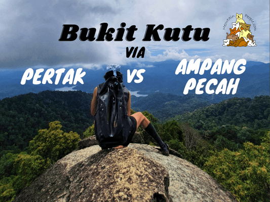
Bukit Kutu, used to be known as Treacher’s Hill, is one of the most popular hiking spots in Kuala Kubu Bharu, Selangor. Not to be fooled by its name as a ‘Bukit’, its height and distance often catch new hikers off guard, thinking it’s ‘just a hill’. Due to its somewhat lengthy journey (around 6 km+ and 3-4 hours to peak) and constant uphill climb, Bukit Kutu is often the preliminary training ground for hikers before taking on Mount Nuang.
Bukit Kutu Hiking Permit Application
A permit from Pejabat Hutan Daerah Hulu Selangor is required to hike Bukit Kutu. The procedures are the same for both Bukit Kutu via Ampang Pecah and Bukit Kutu via Kampung Pertak. Do apply early in advance as they have a quota of 100 pax per day. The spots often get filled in very quickly by both hiking groups and event organizers.
To apply, fill up this hiking permit application form and either send it to phdhuluselangor@yahoo.com, or print them out in three copies and do a walk-in submission and payment at Pejabat Hutan Daerah Hulu Selangor. For the email method, once they reply to you with the approval, you will still need to make the payment (RM5 per pax, minimum 2 pax) either through counter walk-in, or by sending money through bank draft or postal order (wang pos).
After receiving the permit and receipt, you need to submit a copy to Kuala Kubu Bharu Police Station before your hike. The police station is open 24 hours, so you can submit the copy early in the morning on the day of your hike. After your hike, you have to call the police station to inform them that you have safely exited the forest.
What to bring for Bukit Kutu hiking trip
- At least 2 liters of water
- Snacks and lunch (something easy to eat on the peak without causing a mess). Some like to bring stoves and cookware to cook their food at the peak but it takes more space and the peak can be pretty crowded
- Basic Hiking First Aid Kits
- Compass & whistler (eg. 4-in-1 compass & whistler)
- Appropriate hiking shoes / Adidas Kampung
- Optional leech repellent such as dettol or Minyak Cap Kapak, or leech socks (leech count was at minimal during my last two trips)
- Optional gloves
- Optional hiking stick
- A set of clothes and slippers in the car to change after the hike
Bukit Kutu via Kampung Pertak
Parking at Kampung Pertak & Starting Point


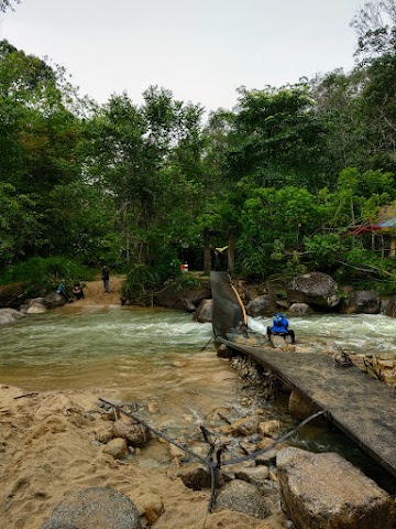
Just like the hike to Lata Medang and Mount Rajah via KKB, set your driving location to Tapak Berkelah Sungai Pertak. You will pass through an Orang Asli village and just before the entrance, there will be a post where the Orang Asli would be collecting a fee of RM1 per pax to enter. I am not sure if this fee collection is authorized but since the area is being taken care of by them, I think it is pretty justifiable. After making your payment, drive right in and you will find a parking area just by the river. During crowded times, you may have to park at the spacious Bukit Kutu Parking field just to the left of the Orang Asli’s post.

Just a few meters down the parking area is the beautiful river and rapids of Sungai Pertak. Here is where you can chill and take a swim if you do not have a hiking permit.

To start your hike to Kutu Hill, Lata Medang, Mount Rajah, walk along the road from the parking area above the river site.

The road takes you to the first stream crossing bridge.

9.17am: Second crossing with partially collapsed bridge. Due to the rainy weather, the bridge was partially submerged in the fast flowing river.
Trailhead to Bukit Kutu via Pertak
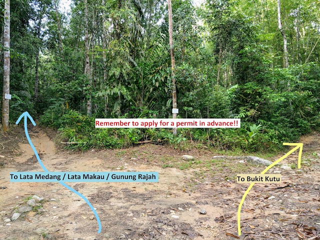
After crossing the second bridge, is the trailhead junction to various hiking destinations. Keep to the left to Lata Medang, Lata Makau and Gunung Rajah. For Bukit Kutu, turn right.

(+7)9.24am: Keep to the right for all the split paths to Bukit Kutu.
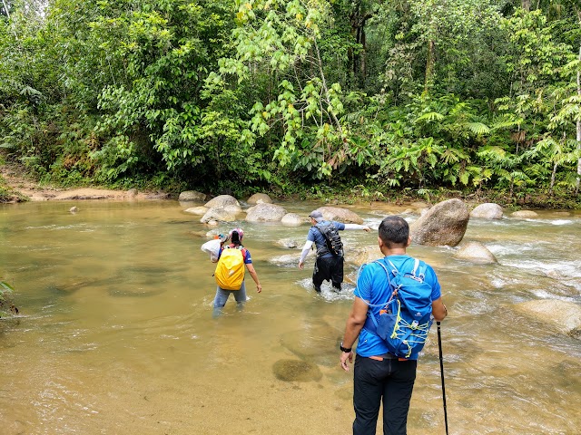
(+4)9.28am: The last river crossing to the opposite bank.

+13)9.41am
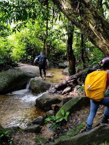
(+9)9.50am: Crossing a stream by stepping on the rocks.


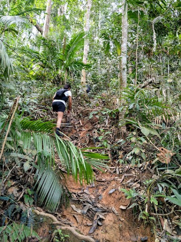
(+7)9.57am: When you reach this giant strangler fig covered with roots, you’ll know it’s the start of the continuous steep uphill climb.

(+1)9.58am: Continuous uphill climb.

(+6)10.04am: The first checkpoint with flat ground to catch your breath.

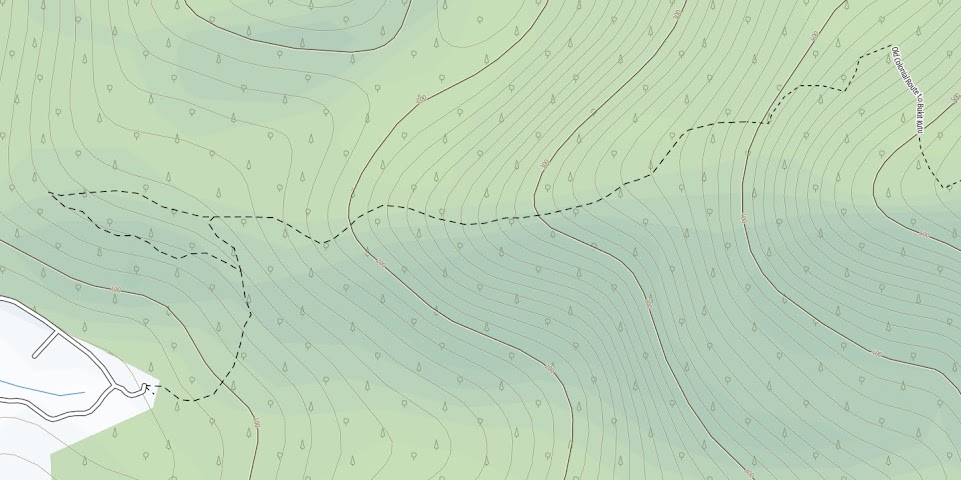
(+26)10.30am: There was a split path here, one going up on the left, another was a flat trail to the right. Take the left trail going up to reach Bukit Kutu peak.

(+13)10.43am: Checkpoint 2 with a huge rock wall beside it.


+2)10.45am: Continue on the trail by the rock wall, through some bamboo groves.
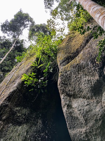
Batu Tedung (Checkpoint 3)

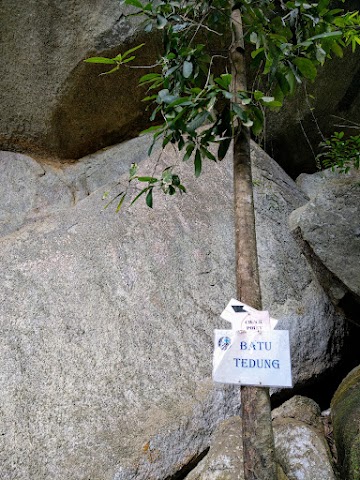
(+5)10.50am: When you see a marvelously shaped mammoth rock wall above, you are reaching the massive Batu Tedung.


The rock face of Batu Tedung is so huge, I couldn’t find a spot to frame the whole thing. You need to be there to feel the ‘wow’!

(+5)10.55am: Head on back to the trail from Batu Tedung.

(+6)11.01am: More steep uphill climbs.

(+1)11.02am: Checkpoint 4.

(+7)11.09am: A little bit of downhill trails and muddy flat trails.

(+16)11.25am: Checkpoint 6, not sure where I missed checkpoint 5.

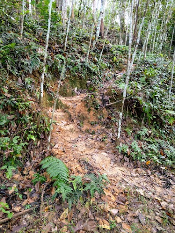
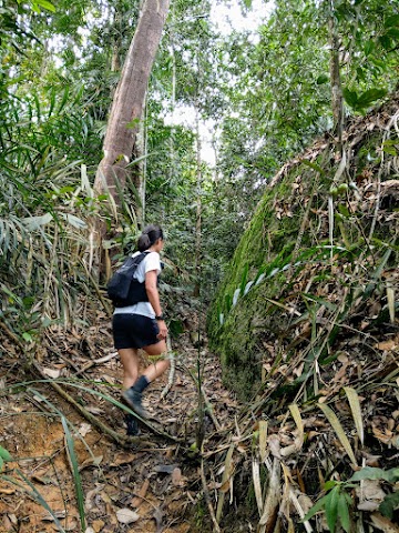
Note: Most parts of the Bukit Kutu via Pertak trail consisted of highly eroded soil, which could be very slippery on the way down.

(+10)11.35am: Checkpoint 7.

(+9)11.44am: A last wide flat checkpoint before reaching the peak.

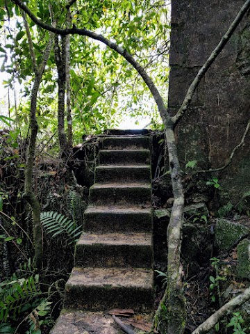
(+2)11.46am: The last few pushes to the top.
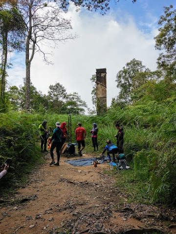
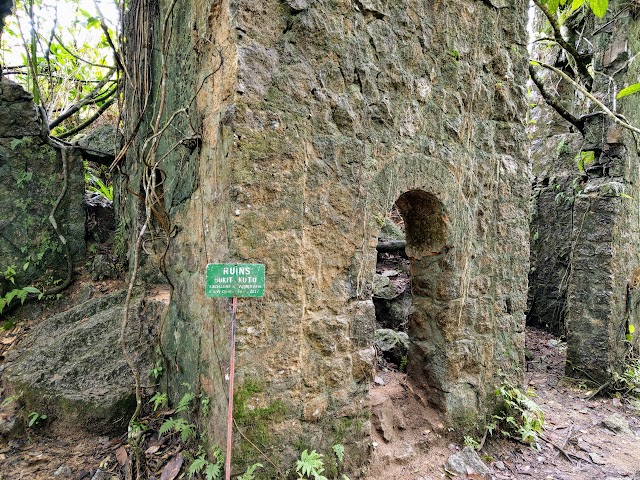
(+3)11.49am: A few minutes before reaching the peak, you will pass by this area with an old chimney built during the colonial era in Malaya. There is a well here where campers used to get clean water a long time ago. Unfortunately, the well has been polluted with trash by very irresponsible people.

(+2)11.51am: You would have to push through some thick and tall bushes to reach the frontal view of the old chimney. This chimney and a fireplace nearby is a remnant of the first of the two bungalows built on Bukit Kutu.

(+3)11.54am: Back to the previous spot and continue the trail towards the peak.
Bukit Kutu Peak (1053 meters above sea level)
(+6)12pm: Right at noon, I arrived at the peak of Bukit Kutu / Treacher’s Hill.
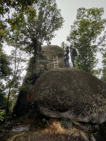
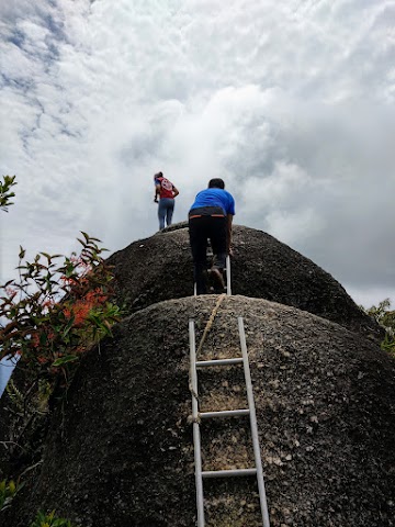
The highlight of Bukit Kutu peak is this big rock outcrop for a panoramic view of the forest. There is only one way up and down the rock with ladders, so do expect a “traffic jam” or a long queue to take turns climbing the rock.
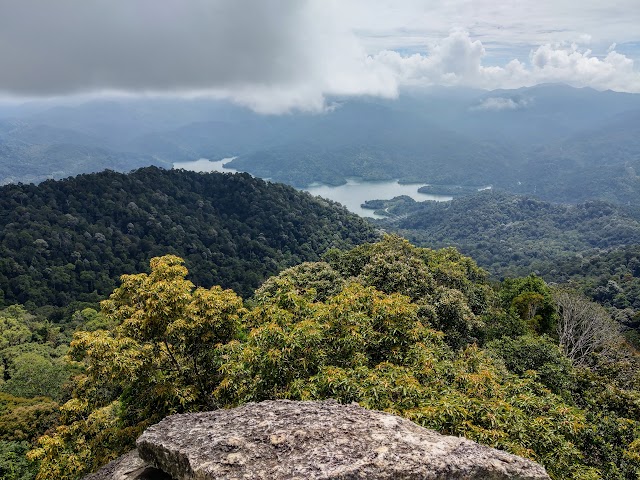
The view from the top of Bukit Kutu peak’s rock.

As you can see, the top of the rock is just a small area to stand/sit on. Don’t climb up when there is a group on top, or else they will not be able to get down until you climb back down. Also, don’t spend too much time on top trying to take the perfect photo because other people are waiting for their turn.
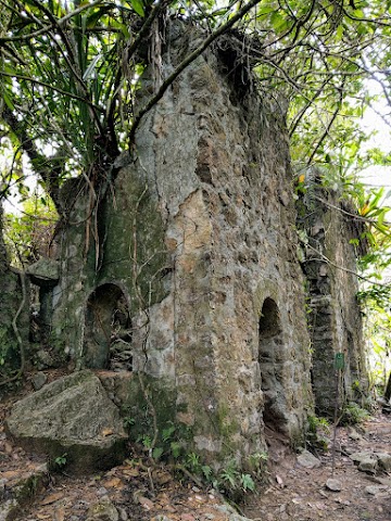
Treacher Hill Bungalow (Bukit Kutu Ruins)

If you reach Bukit Kutu peak via Pertak trail, don’t head back just yet or you’ll miss another highlight, which is the colonial ruins. To get there, head down the trail opposite of where you came from Pertak. It took me 6 minutes to get to the ruins from the peak.
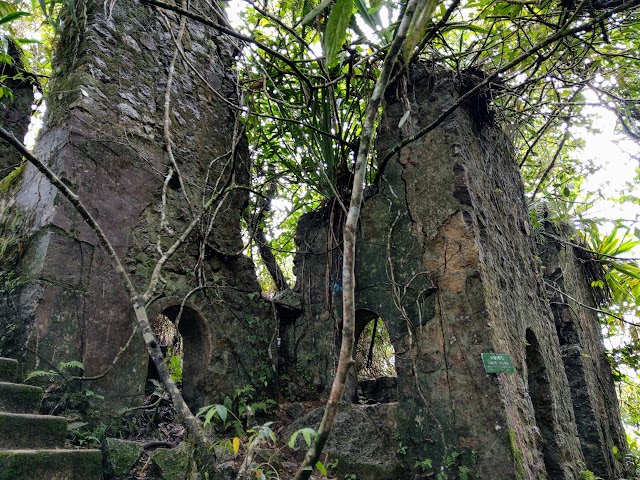
This ruin was known as the 2nd bungalow, or the ‘sanatorium’, served as the hill station of Bukit Kutu. The hill station was founded by Sir William Hood Treacher, a British colonial administrator, hence the old name ‘Treacher’s Hill’. During his inspection tour of Ulu Selangor, he commented that the hill could be a possible site for a sanatorium. The two bungalows were later built and served as lodges for visitors and government officials, with furnished facilities and a 13-14 km bridle path connecting Kuala Kubu foothill to the bungalows.
The resort ended its operation in 1932, when Fraser’s Hill became a more popular choice for visitors. At the same time, the site was facing a soil movement problem in which no aid was received from the state government. After being sold for private use in 1936, the hill station was abandoned, the bridle path was reclaimed by nature and lost in thick vegetation. Based on mixed historical data, some stated that the bungalows were bombed by the Japanese soldiers during the Japanese occupation, while some stated that the bungalows were demolished by British troop when retreating from the Japanese invasion. More details of Treacher’s Hill history can be found here.


The interiors of the hill station ruins.

One of the stone wall arches.
If you are doing the Trans Kutu route heading to Ampang Pecah via the Old Colonial Route, take the stairs of this bungalow to the back and continue the trail.
If not, return to the peak and take the other trail back to Sungai Pertak. We returned to the partially collapsed bridge at 3.55pm, right before a heavy rain came pouring down, which might have made the river uncrossable.
Bukit Kutu via Ampang Pecah (Old Colonial Route)
Parking at Cherandong Waterfall Trailhead & Starting Point
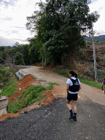
7.56am: To access Bukit Kutu via Ampang Pecah trailhead, you may park your vehicle at Cherandong Waterfall Trailhead parking area. Then continue on foot through Jalan Kampung Buluh Telur to the end of the road.

(+9)8.05am: Shortly after passing by Surau Al Firdaus, you’ll find this sepak takraw court where some blogs mentioned to park here for the hike. It is best not to, however, as it could be a little intruding, and what if the villagers decided to play a game of takraw at that time?

(+2)8.07am: At the road junction, turn right.

(+2)8.09am: End of the road where the trailhead to Bukit Kutu is.
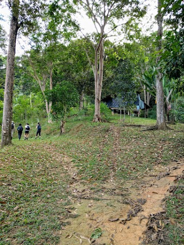
(+9)8.18am: You will first pass by some plantation fields. At the first junction, keep to the left.

(+3)8.21am: Follow the trail through the rubber tree plantations. At one point, there’s a shortcut to the right where you could see a trail cutting upward to the hill. The shortcut trail didn’t have a clear path and was quite slippery, so if you don’t feel confident you could just follow the main trail. The shortcut trail saved me only 8 minutes (compared to my group who took the main trail).
For the starting part of Bukit Kutu via Ampang Pecah trail, I recommend hikers to use OpenStreetMap powered apps, such as OutdoorActive, to make sure that you are on the right trail. In this snapshot you can see that shortcut I was referring to.

(+9)8.30am: Whether you take the shortcut or the main trail, you’ll continue on to this main trail where it was bushy for a while.

(+7)8.37am: We then reach a messy junction with 3 paths to choose from. We took the middle one (skewed to the right) and it was the correct one.

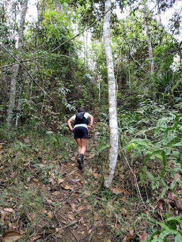
(+1)8.38am: The start of the inclination.

(+19)8.57am: Then, a short section of flat trail.


(+18)9.15am: We passed by a part of the trail where there was a huge gully to the right.

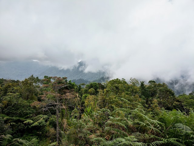
Big trees.

Shady trail.
Gold Hill Checkpoint
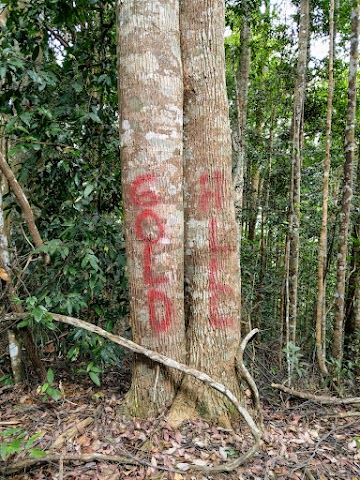
(+33)9.48am: We arrived at a checkpoint called the Gold Hill.

10.10am: After a 20-minute break and regroup, we continued on. There’s a brief section of declination.

(+5)10.15am: What goes down must come up. I guess the Gold Hill is like a minor false peak.
Bukit Kutu Waterpoint

(+7)10.22am: Half way on the steep ascent, is the last waterpoint with a flowing stream before the peak.
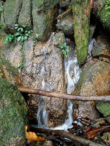
(+2)10.24am: Turn left and head down to access the water.

(+7)10.31am: Continued on to the trail.

(+22)10.53am: The first of the few big boulders we passed by.
(+1)10.54am: Steep ascent all the way but not too bad.

(+1)10.55am: Second big boulder.

(+5)11am: Third big boulder.
(+4)11.04am: Fourth big boulder.
Keep pushing on.

(+14)11.18am: Arrival at Treacher’s Hill station bungalow ruins.

Headed to the peak for a group photo. Our line up for this trip was the exact same members from our previous Mount Tahan trip 😀

On the way back to Ampang Pecah, we found some huge mushrooms the size of cotton candy.

We returned to Ampang Pecah foothill at 3.30pm.
Bukit Kutu via Kampung Pertak vs Ampang Pecah (Old Colonial Route) quick comparison
via Kampung Pertak | via Ampang Pecah (Old Colonial Route) | |
Trail features | More points of interest (river crossings, bridges, giant strangler fig, Batu Tedung) | Less soil erosion, less crowds, no river crossing. |
Intensity | Constant steep uphill after the giant strangler fig. Flatter & muddier trail after ⅔ of the journey. | Mild -> Steep -> Mild -> Steep -> Mild -> Steep stretch to the peak. |
Even though the Old Colonial Route is slightly longer than the Pertak route, I find it more enjoyable due to the less eroded trail. The intensity felt a little lighter on the Old Colonial Route for me but it’s probably similar to Pertak’s trail, just with a different kind of intensity pattern as stated above. If I want to experience more variety instead, I would take the Pertak route.
Or the better, you could do a Trans Kutu hike to explore everything in one trip. You just have to arrange someone in your group to park their cars at both trailheads, to take the group back to the starting point to their cars after exiting to the other end. I recommend starting in Kampung Pertak, as you do not have to worry about the rising river at Pertak when going down via Ampang Pecah’s Old Colonial Route, if there is rain during the hike.
Have this guide helped you? Tag @meowtainpeople in your hiking stories & posts!

*Captain Planet passing by* Remember, please take care of our environment, and please don’t destroy the Nature. Leave no trash behind and take back only photos and memories (and also some trash if you can). Walk on the designated path and stay in the middle as much as you can, so that the exposed soil doesn’t spread/corrode further. BE ONE WITH NATURE *flies away*
Affiliate Links to support this site:
Yay for transparency!: The links above are affiliate links, and at no additional cost to you, I earn a commission if you make a booking/purchase after clicking the links. I recommend only products and companies I use. Your support helps me keep the site going 🙂
Want to do the same affiliate marketing with your site? Use this AccessTrade platform link to receive RM5 reward.