
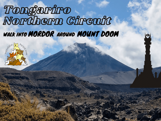
Ever wanna ‘simply walk into Mordor’ and to see Mount Doom with your own eyes? The Tongariro Northern Circuit Great Walk is the ultimate journey to turn The Lord of the Rings fantasy into reality!
The Lord of the Rings epic movie scenes of the realm of Mordor and Mount Doom are filmed right here in New Zealand’s oldest national park, Tongariro. Even if you are not a fan of LOTR, Tongariro National Park’s dual World Heritage awards will inspire your adventurer’s spirits. Tongariro holds both Natural and Cultural World Heritage status, recognized for its outstanding volcanic features and strong Māori cultural and spiritual associations.
Tongariro Northern Circuit - New Zealand Great Walk
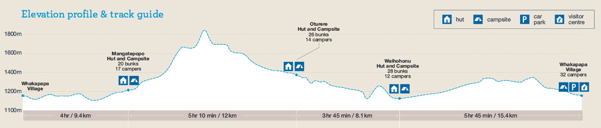
Tongariro Northern Circuit is one of New Zealand’s Great Walks. It is a 44.9km loop in the Northern half of Tongariro National Park, typically completed in 3-4 days. My initial intention was to complete the circuit in three days, but due to its popularity and limited spots (accommodation in huts/campsites), I only managed to book one campsite and did it in two strenuous days. This is only recommended for fit hikers and I had a long 12-hour hike on the first day! (That’s due to the position of my campsite at Waihohonu, if you get the one in the middle at Oturere, you could do 9 hours + 9 hours for a two-day hike)
Alternatively, you can skip the first 9.4km of the track (Whakapapa Village to Mangatepopo Hut) by taking a shuttle bus to the Tongariro Alpine Crossing starting point. I will show you in this post why I recommend skipping this first section.
Tongariro Northern Circuit Great Walk Booking
All Great Walks in New Zealand require booking in advance for the huts and campsites. Off-site camping is not allowed on the Great Walk tracks. Here is the online booking site for all Great Walk accommodations. Lookout for the opening dates of bookings for each season as the popular great walks such as Tongariro Northern Circuit tend to get fully booked as soon as they are open for booking.
If the slots are fully booked and you are flexible with your dates, you can run through the site’s booking calendar regularly to lookout for any new slots, as people often cancel their booking days/weeks/months before the trip. Don’t simply book and cancel though, here are the cancellation fees in detail.
Things I packed for Tongariro Northern Circuit
- 40L Hiking Backpack from Decathlon with rain cover and a large strong rubbish bag lined inside as additional water protection (plus a separate sackpack to carry my tent)
- Forclaz Trek 100 3 Seasons Dome Tent (heavier than most tents but very good wind resistance and waterproofing)
- PTT Outdoor’s HIGH PEAK Easy Travel Sleeping Bag (coupon code “MEOW” for RM10 off first time purchase with min RM100, within Malaysia only)
- TOMSHOO sleeping bag liner
- Inflatable mattress & pillow
- Quechua Hiking Raincoat
- Sun Protect long-sleeved running tee + Quechua Hiking Fleece Jacket + Quick dry running shorts + Kiprun running socks (for the day)
- Ski base layers top + pants + warm hiking socks + gloves from Decathlon (as sleepwear)
- Extra down jacket (didn’t use but important to bring, just in case)
- Adidas Kampung (not from Adidas, Malaysia’s trusty rubber hiking shoes)
- Flip flops (for walking around campsites / huts)
- Sun hat / scarf / sunglasses
- First Aid Kit, Compass & Whistle
- Rechargeable headlight
- Phone (with booking confirmation pdf file), powerbank & charging cables
- Food and snacks (muesli, trail mix, energy bars), paper towels, rubbish bags
- Water bottles (2L)
- HydroBlu lightweight water filter
- CuloClean portable bidet, some toilet paper
- Toothbrush, toothpaste, hand sanitizer, soap, comb
- Fire lighter (just for emergency, not needed if staying on campsite as you can’t light a fire. Useful for lighting fire wood if staying in a hut)
- Folding scissors
Yay for transparency!: Some links above are affiliate links, and at no additional cost to you, I earn a commission if you make a purchase after clicking the links. I recommend only products and companies I use. Your support helps me keep the site going 🙂 [except for the water filter and portable bidet, the other products’ link are catered to Malaysia only]
The day before: Driving to Whakapapa Village & Accommodation
Driving to and staying at Whakapapa Village the day before the hike is the best way to get a good night sleep and to start early for the hike. You would also need to obtain a free parking permit from Tongariro National Park Visitor Centre the day before the great walk if you want to start early, as they operate from 8am to 4.30pm.
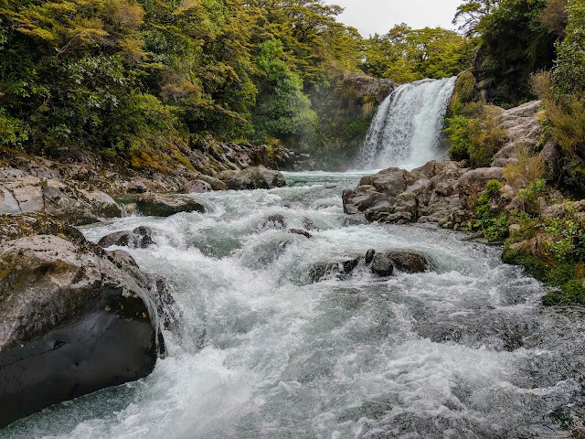
4km before reaching the village, stop by at Tawhai Falls Walk and take a 15-minute return walk to the stunning Tawhai Falls.
Tawhai Falls is also known as the Gollum’s Pool or the Forbidden Pool by LOTR fans, as this is one of the filming locations for The Lord of the Rings: The Two Towers. This is the scene where Faramir and Frodo captured Gollum, The pool at Tawhai Falls is filmed for the scene with Gollum in the water, while the shots with waterfall were filmed at a different location not far away at Mangawhero Falls.
Where to stay in Tongariro / Whakapapa Village

For a cozy well rested night with a super valued rate, I highly recommend New Zealand’s highest hotel, Skotel Alpine Resort. By booking the Backpacker Queen with Ensuite, you get your own private room with bathroom (towels provided) and small pantry with a mini fridge. The communal kitchen is just around the corner if you wanna cook your meal. Or, you can save the hassle by dining at the highly rated in-house restaurant. They also have packed lunch for those on-the-go.

Located right next to Tongariro National Park and also a few meters away from Tongariro Northern Circuit starting point, the view from the resort is just splendid!
Tongariro Northern Circuit Parking & Starting Points

Tongariro Northern Circuit free parking is located right in front of Skotel Alpine Resort at Taranaki Falls Carpark. Despite being a popular trailhead for multiple tracks (Great Walk, Taranaki Falls, Tama Lakes), it is a very small parking space that fits a very limited number of vehicles. Remember to obtain the free parking permit from Tongariro National Park Visitor Centre for your great walk.
Alternatively, if you are coming back to stay at Skotel Alpine Resort after the multi-day walk, they may let you park your vehicle in the resort for free. Else, you could pay around $10 per day for parking in the resort, if available.

Please take note that there are two trailheads for Tongariro Northern Circuit in Whakapapa Village. Although they are 100m away from each other, entering from Taranaki Falls Carpark trailhead will add an extra 3km and more elevation change to your clockwise circuit, compared to entering via Taranaki Falls Lower Track trailhead.
An alternative starting point I recommend is to take a shuttle bus (can be arranged via Skotel’s reception with similar/lower rate as other services providers) to Tongariro Alpine Crossing starting point. This method skips the first 9.4km of Tongariro Northern Circuit (doing it clockwise), saving you hours and energy on the less-impressive and heavily-eroded track. (You’ll see the track conditions below)
Tongariro Northern Circuit (Clockwise) - Day 1
Whakapapa Village to Mangatepopo Hut (9.4km)
While I was doing the circuit in a clockwise direction, I took the Taranaki Falls Carpark trailhead by accident, thus adding more distance and elevation on my walk. I started the walk at 6.45am.

(+23)7.08am

(+11)7.19am


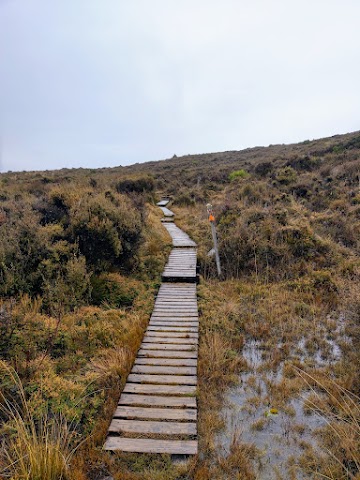
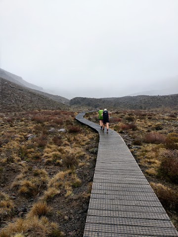
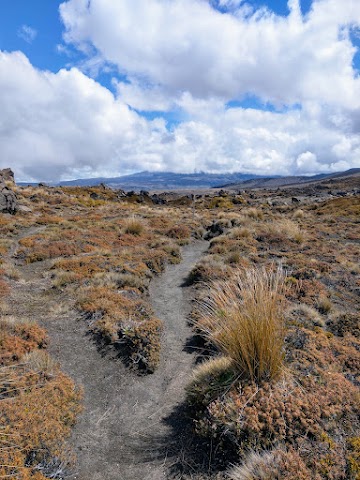
(+2)7.21am: The beginning section of track through open tussock and shrubland, crossing some bridges over streams.

(+2)7.24am: At the junction where I realized I took the long way. Here, I took the junction down to Taranaki Falls track that joins the Tongariro Northern Circuit track in order to do it in the clockwise direction.

(+1)7.25am: Taking this long route also means more elevation change because the track goes all the way down to the falls and bushline, and goes all the way up again joining the Tongariro Northern Circuit track ahead.
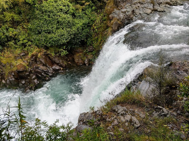
Taranaki Falls

(+3)7.28am: Taranaki Falls is a 20-meter tall waterfall running over the cliff of andesite lava flow erupted from Ruapehu 15,000 years ago, into a pool of water.


(+25)7.53am: Walk down close to the river. Turn right at the junction to Mangatepopo Hut for the Great Walk. The left turn is to Whakapapa Village (20 minutes).

(+18)8.09am: While the track is flat, the majority section of Mangatepopo track is heavily eroded. The muddy, slippery and gullied track would greatly slow you down.

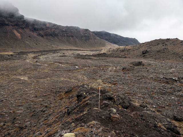
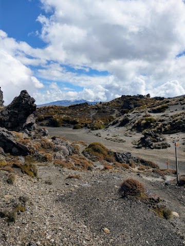
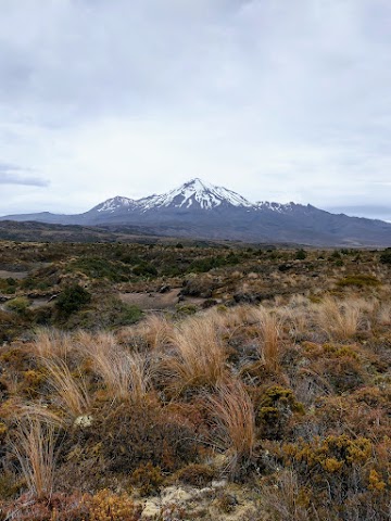
(+5)8.14am: A low scoria cone to the left is Pukeonake. Pukekaikiore on the right ahead is thought to be one of the older vents of the Tongariro complex. Both Pukeonake and Pukekaikiore witnessed the last ice age, when glaciers from Tongariro carved down through Mangatepopo Valley. On clear days, you could see Mt Tongariro and the giant cone of Mt Ngauruhoe.


(+11)8.25am: A small stream crossing. Rocks can be stepped on to avoid getting your shoes wet.


Possibly pawprints and poisoned carcass of a possum, one of New Zealand’s top destructive introduced pests that endanger native birds.
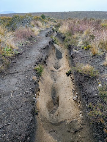

Some examples of the heavily eroded track.

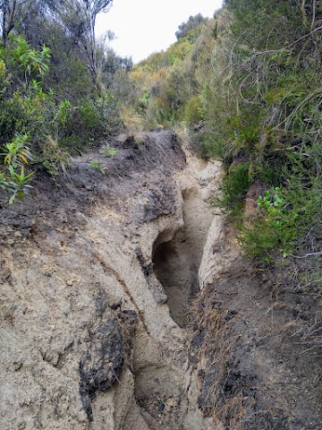
Some parts were so eroded they turned into slippery 2-meter deep gullies. This is why I recommend skipping this part and taking the shuttle bus to Tongariro Alpine Crossing starting point instead.

While it’s very tempting to just walk at the side, away from the eroded track, please refrain from doing so as the surrounding landscape is fragile.

(+113)10.18am: Arrived at the junction where Tongariro Alpine Crossing joins and shares the same path with the Northern Circuit for about 7.5km.

(+6)10.24am: Five minutes off the main track is Mangatepopo Hut and Campsite.
Mangatepopo Hut to Emerald Lakes (8km)

10.37am: After taking a break and having my ‘second breakfast’ at the outside bench by the hut, I continued my journey. On the right side of the track is the closer look of Pukekaikiore old volcanic vent.

(+15)10.52am

(+2)10.54am
The weather was still wet and foggy, though a little better than the time I did Tongariro Alpine Crossing.
(+6)11.00am

(+15)11.15am

(+4)11.19am: The junction to Soda Springs 300 meters away.

(+12)11.31am: The start of the tougher uphill sections.

(+2)11.33am
(+4)11.37am
Looking back to the views below:

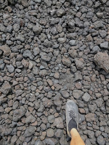
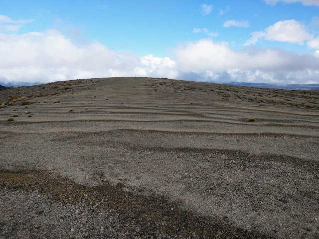
Many parts of this track consist of volcanic scree, but they’re not the difficult part as the steeper slopes are installed with steps to walk on.
(+8)11.45am: The legendary full view of ‘Mount Doom’ (Mt Ngauruhoe) can be seen here on clear days. Too bad it was a rainy day with low clouds blocking the view so I didn’t get to see it (yet). On this section the track is the closest to Mount Ngauruhoe.

(+24)12.09pm

(+2)12.11pm: A few longdrop toilets here.
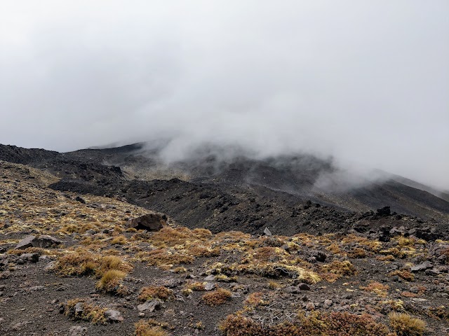
South Crater

(+5)12.16pm: The vast flat land at the South Crater. This place feels like an endless beach on foggy weather.

On clear days, you can see Mt Tongariro, Mt Ngauruhoe and its surrounding landscape:
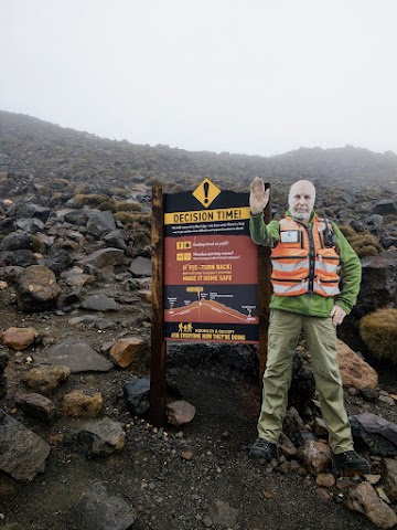
(+9)12.25pm: The final decision checkpoint before summiting the Red Crater, the highest and the most exposed point in both Tongariro Northern Circuit and Alpine Crossing track.

(+2)12.27pm: It’s one of the steepest climbs throughout the journey.

(+3)12.30pm: This is not the summit.

(+3)2.33pm: Not yet.

(+3)12.36pm: Nope.

(+9)12.45pm: Can’t see the peak yet.
Red Crater (1886m)
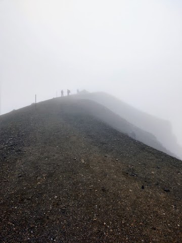
(+7)12.52pm: Here it is, the summit of Red Crater.

Again, the second time being here I still didn’t get the chance to witness the out-of-the-world crater due to the foggy weather. Maybe third time’s a charm if I come here again?
Have a look at the scene on a clear day, deep red and brown landscape caused by oxidized iron within the rocks from extreme heat. In the crater there is an interesting lava dike, where lava started to flow out of a vent, but retreated before it cooled, leaving a unique tube that was later exposed by eruptions:


(+3)12.55pm: Continuing on, descending the Red Crater is one of the trickiest parts as the track is on a loose scree slope that would keep sliding under your feet. You also have steep drop-off on both sides, especially on the right side where the deep crater is at.
Emerald Lakes


(+19)1.14pm: Some of the Emerald Lakes, which formed from explosion pits. Please do not touch or throw things into the lakes as they are considered sacred by the local Maori.

(+10)1.24pm: This junction ends the sharing track of Tongariro Northern Circuit and Tongariro Alpine Crossing. Check out what interesting track lies ahead on Tongariro Alpine Crossing post here!
Emerald Lakes to Oturere Hut (4km)

(+3)1.27pm: Passing by the last of Emerald Lakes.

(+2)1.29pm

The part of the lake where excess water flows down the stream that flows closely along the track down ahead.

(+9)1.36pm

(+3)1.39pm

(+4)1.43pm: Mostly downhill through the wide volcanic landscape.

(+3)1.46pm

(+9)1.55pm
(+1)1.56pm: The track descends steeply into Oturere Valley. A massive wall of mountains on the left.

The vast Kaimanawa Ranges and Rangipo Desert.

(+1)1.57pm: Follow the snow poles down to Oturere Valley.

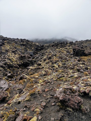
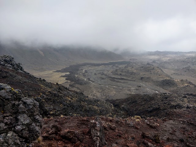
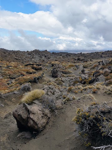
(+17)2.14pm: Walk down the track and witness the endless variety of unusual jagged lava forms.

The diversity of jagged lava forms are produced by eruptions from the Red Crater that filled Oturere Valley.

A flowing stream from the mountain wall on the left.


The distinctly amazing left and right side views on the track.

(+1)2.15pm: The center view. Look closely and you’ll see the snow poles and track in front.
(+5)2.20pm: Near the bottom of Oturere Valley.

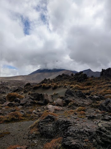
(+4)2.24pm: Finally, the sky finally started to clear up. A small pointy mountain in the distance.

(+13)2.37pm: The fuller view of the pointy mountain. Mt Ngauruhoe is behind it but was hiding in the thick clouds.

Up ahead it looked like the end of the ‘land’ with only sky beyond it.

(+3)2.40pm
(+15)2.55pm: Still no full view of Mount Doom yet…

2.55pm

(+2)2.57pm: Soon.
(+7)3.04pm

(+3)3.07pm

(+11)3.18pm: Cloud’s almost gone!
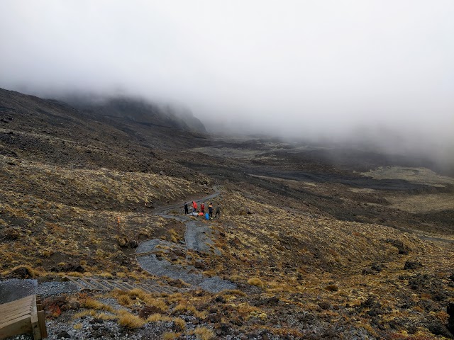
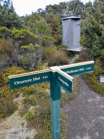
Oturere Hut & Campsite

(+5)3.23pm: Oturere Hut in sight.


(+8)3.31pm: Have a high-energy snack (lunch) break by the hut while waiting for the grand reveal of Mt Ngauruhoe.
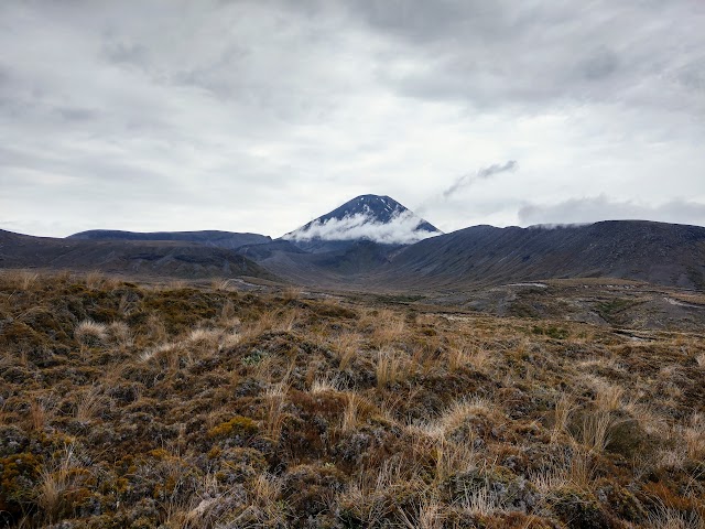
Mount Ngauruhoe (Mt Doom from The Lord of the Rings)

(+2)3.33pm: Finally, the curved peak of Mount Ngauruhoe was uncovered! About 7,000 years old, Mount Ngauruhoe is the youngest, largest and most active volcano cone in New Zealand. It is a secondary cone of Mount Tongariro volcano.

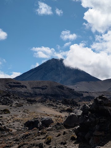
Mount Ngauruhoe was used as a stand-in for the fictional Mount Doom in the filming of The Lord of the Rings trilogy. From here I couldn’t see the reddish volcanic ash on the top, which is visible from the Alpine Crossing’s side (which was too foggy when I passed through). Yet, I’m grateful to be able to witness the full mountain after all this foggy weather.
Oturere Hut to Waihohonu Hut (8.1km)

(+8)3.41pm: Leaving Oturere Hut towards Waihohonu Hut.

(+2)3.43pm: Can’t stop looking back at Mount Ngauruhoe coz, what a precious sight!
(+3)3.46pm: A little up-and-down on the undulating track.

(+3)3.49pm: First sight of Mount Ruapehu behind the clouds.

(+8)3.57pm: Mt Ngauruhoe from another angle.

(+15)4.12pm: Another up-and-down through one of the stream valleys.

(+8)4.20pm
(+7)4.27pm: Walking through wide open gravel fields.

(+18)4.44pm

(+4)4.48pm: Crossing one of the Waihohonu Stream branches.

Once more, clouds began to cover Mt Ngauruhoe.

(+5)4.53pm: First sign of greenery up ahead. Volcanic eruptions, the high altitude, and the environment have all continuously suppressed plant growth in this area. On the broad, naked countryside, plant recolonization is slowed down by loose gravel.

(+11)5.04pm: Some uphill walk.

(+9)5.13pm: View of Mount Ngauruhoe from the South side.

(+6)5.19pm: You could get a good view of Mt Ruapehu icy range if the clouds aren’t blocking the view.


(+6)5.25pm: As you slowly descend, small plants start appearing on the track.


(+18)5.42pm: Enter the green beech clad valley.

(+5)5.47pm: At the bottom of the valley, the track was very muddy and pretty much submerged. I got my whole feet submerged in deep mud and got wet feet. Luckily I was wearing my trusty Kampung rubber shoes that I could easily rinse and dry at the campsite.
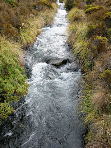
(+3)5.50pm: Crossing the Waihohonu Stream via a bridge.


(+4)5.54pm: Steep-ish climb from the bottom of the valley.

(+19)6.13pm: At the top of the climb. The climb felt pretty tiring as my legs felt a little heavier after hiking for 11+hours.

(+3)6.16pm: The climb over the ridge top brings you to the other side with a whole different view.
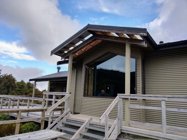
Waihohonu Hut & Campsite

(+5)6.21pm: Walking downhill again towards the next valley, where Waihohonu Hut & Campsite are located. You can see Waihohonu Hut in the distance in this photo.

(+6)6.27pm: Again, you’ll descend through another green forest track.
(+14)6.41pm: At last, I arrived at Waihohonu Campsite before dark! Fortunately, the daylight hours are longer during this time of the year.

The empty campground. The other hikers are all staying in the hut. I had one family of campers join me at the campground later that evening.
Waihohonu Hut is 3 minutes up the track.


Set up my Forclaz dome tent facing the bush, so I could potentially spot wild kiwi birds when I hear their calls. The night was quiet and I had no luck on kiwi bird spotting.

A nice cold stream is just 8-10 meters away from the campground.

After having dry muesli for dinner (weird, I know! but they’re light, compact and ready-to-eat), I walked to the hut to use the outside sink for brushing my teeth. I was surprised to see the hut is powered with indoor lights.
Tongariro Northern Circuit (Clockwise) - Day 2
Waihohonu Hut to Whakapapa Village (15.4km)

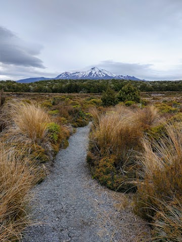
7.31am: Woke up feeling rested and had a quick stroll to see a grand view of Mount Ruapehu.

And of course, not to forget Mount Ngauruhoe on the other side.
8.53am: After having my muesli breakfast and packing up my tent, I started my 2nd and final day on Tongariro Northern Circuit track.

(+1)8.54am: At the junction near the hut, is the 1km side trip to Ohinepango Springs. That’s also the direction for the longer Round The Mountain loop (66.2km) that tracks around Mount Ruapehu.
Ohinepango Springs (side trip)

(+14)9.08am: Unique landscape on the way to Ohinepango Springs.


(+3)9.11am: A bridge crossing the clear Ohinepango Stream.

(+1)9.12am: The turning to Ohinepango Springs.

(+2)9.14am: A little stream to cross.
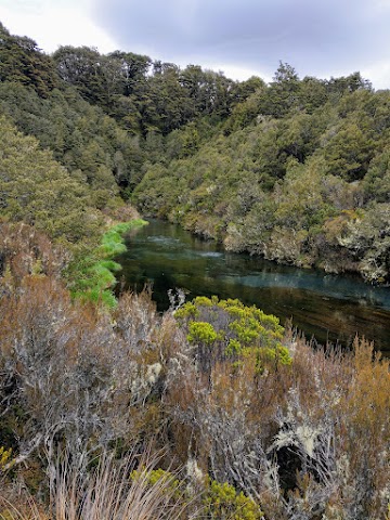

(+1)9.15am: The pristine Ohinepango Stream that flows out from underground.

(+2)9.17am: At the dead end of the track is the source of the stream. The Ohinepango Springs discharges of crystal clear cold water from old lava flow beneath the ground. You could see the water bubbling and pushing out of the ground constantly at an enormous rate.

(+19)9.36am: Back to the junction to continue my Tongariro Northern Circuit.
Old Waihohonu Hut (Historic Site)

(+6)9.42am: A short 170m side trip to the historic Old Waihohonu Hut, New Zealand’s oldest recreational mountain hut.

(+2)9.44am: The red Waihohonu old hut, the oldest surviving hut in World Heritage Tongariro National Park. A campsite was established here in 1894 for weary travelers and coach horses. With increasing tourism in Tongariro, the hut was constructed in 1904, commissioned by the Tourist and Health Resorts Department. Waihohonu Hut was a popular base for alpine skiers in the 1910s, until the focus moved to Whakapapa as skiing grew more popular. For a few years, the hut also became living quarters for seasonal shearers from nearby sheep farms.


This rustic main room with six bunks was the men’s quarters, with stone hearth fire as a welcome haven for travelers.


Bad weather often kept visitors inside the hut for days. They played cards, read, wrote diaries, carved wooden souvenirs, etc. Many left their mark carved into the woodwork of the front door, window and bunks.
The hut’s frame may be one-of-a-kind in New Zealand, built with an inner and outer layer of corrugated iron filled with pumice to keep the hut warm, while protecting it from catching fire.

This seems to be an old barometer.

This segregated room was called the ladies’ quarters, as it’s a norm in the early days for men and women to sleep separately. This ladies’ quarters is much smaller with four bunks and very basic compared to the men’s. It’s said that after several requests, the only luxury given to the women was a mirror in the quarters.

9.56am: Back to the main track, which is pretty flat and easy. The trail tracks in between the two iconic mountains. You have Mount Ruapehu to your left, and Mount Ngauruhoe to your right.

(+26)10.22am

(+11)10.33am
(+29)11.02am

(+33)11.35am: A ‘cloud hat’ appeared on the peak of Mount Ngauruhoe.

(+19)11.54am: I began to lose the views of Mount Ngauruhoe as rain clouds started to form. Here you get a little peak of the Lower Tama Lake.

(+19)12.13pm: The track gradually climbs to Tama Saddle.

(+1)12.14pm
Tama Lakes Track (Lower Tama Lake & Upper Tama Lake)

(+5)12.19pm: Slightly past the halfway point from Waihohonu to Whakapapa track end, is the side trip junction to the Tama Lakes.

(+5)12.24pm: Easy 10-minute track to Lower Tama Lake.

(+6)12.30pm: The Tama Lakes are huge explosion craters that got infilled with water. This is Lower Tama Lake (1200m). Over time, volcanic debris is slowly washing in and filling the crater of Lower Tama Lake.

(+8)12.38pm: From Lower Tama Lake viewpoint, it’s another 1.4km walk to Upper Tama Lake viewpoint. This is the view of Lower Tama Lake enroute to the upper lake.

(+6)12.44pm: It’s a steep uphill climb to the Upper Tama Lake viewpoint.

(+4)12.48pm: You can see the upper lake halfway before the final viewpoint.

(+3)12.51pm: To save some energy on the steep climb, I left my backpack near the lower lake’s viewpoint. I did take along some water, snacks and a rain jacket (as the terrain was exposed and the rain clouds were rolling in).

(+2)12.53pm: After the ‘false peak’, the final viewpoint up ahead is easier and less steep.

(+1)12.54pm: This is the view of Upper Tama Lake from the ‘false peak’, with the clouds rolling in and Mount Ngauruhoe completely hidden in them. What a sight!

(+3)12.57pm: Continuing on to the final viewpoint through a short ridgeline.

(+5)1.02pm: The view of Upper Tama Lake (1314m) from the final viewpoint.

You can also see Lower Tama Lake on the other side from here.
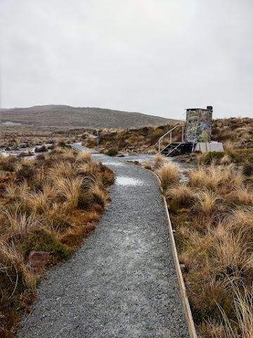
(+38)1.40pm: Back to the junction of the main track as it’s starting to get foggy, raining on and off as I go. There is a longdrop toilet nearby.

(+5)1.45pm: A wide but shallow stream crossing with rocks to step on.

(+10)1.55pm

(+31)2.26pm

(+6)2.32pm
Taranaki Falls Track

(+10)2.42pm: The junction turning to Taranaki Falls. This is the junction I took at the beginning of day 1 as I took the wrong starting trailhead (details in day 1 section above). You can take the direct path ahead to return to Whakapapa but then you’ll miss Taranaki Falls.
(+4)2.46pm: Taranaki Falls

(+25)3.11pm: Down to the next junction. Straight ahead to Whakapapa track end / turn right to Tongariro Northern Circuit (Mangatepopo).

(+3)3.14pm: Flat track leaving the tall trees forest to the low bush section. You could already see the buildings at Whakapapa Village.

(+20)3.34pm: Follow the car park sign to the exit.

(+2)3.36pm: Finally, ending my Tongariro Great Walk journey at the trailhead where I should have started the walk here. The other trailhead with the car park is just a 3-minute walk up the road.
If you have another day to explore Tongariro National Park, check out the Tongariro Alpine Crossing!
Have this guide helped you? Tag @meowtainpeople in your hiking stories & posts!

*Captain Planet passing by* Remember, please take care of our environment, and please don’t destroy the Nature. Leave no trash behind and take back only photos and memories (and also some trash if you can). Walk on the designated path and stay in the middle as much as you can, so that the exposed soil doesn’t spread/corrode further. BE ONE WITH NATURE *flies away*
Affiliate Links to support this site:
Yay for transparency!: The links above are affiliate links, and at no additional cost to you, I earn a commission if you make a booking/purchase after clicking the links. I recommend only products and companies I use. Your support helps me keep the site going 🙂
Want to do the same affiliate marketing with your site? Use this AccessTrade platform link to receive RM5 reward.