
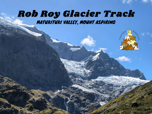
Rob Roy Glacier Track is a relatively easy walk to the dramatic closeup views of glaciers, waterfalls, sheer rock cliffs and the alpine environment of Mount Aspiring National Park.
Rob Roy Glacier Track Car Park & Trailhead
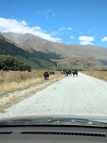
Rob Roy Glacier Track trailhead is located right next to Raspberry Flat Carpark (free parking). To get there, expect to drive on 30km of unseal gravel road. I drove a normal 2WD car and it went alright, despite the shaky ride and thick dust cloud flying off the back of cars. There were some mini fords which wouldn’t be an issue during fine weather. However, the last 10km is a fine-weather-only-road, as there could be flooded creeks or washouts during wet periods.
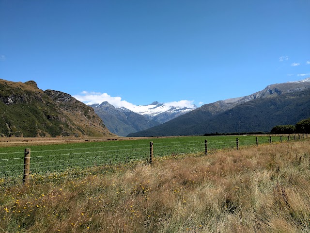
Do drive slowly as driving on unsealed roads is less stable and you can swerve easily if driving/turning too fast. You are also driving past active farmlands so beware of people and livestock. Expect to spend almost an hour driving on the gravel road. Don’t forget to enjoy the scenery while traveling through the valley!

12.43pm: The start of Rob Roy Glacier Track from the car park.
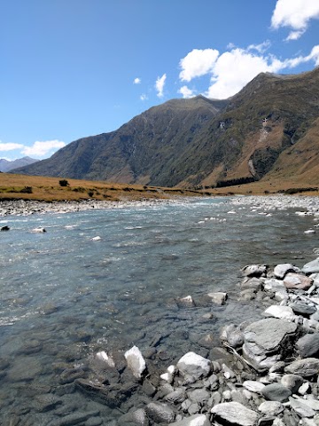
(+7)12.50pm: Matukituki River next to the track.

(+4)12.54pm: Keas sculpture

(+6)1.00pm

The rushing water of the Matukituki River.

(+6)1.06pm: Arrived at the swingbridge to Rob Roy Glacier Track. There is another track on the left without crossing the bridge, that leads to the more advanced tracks: West Matukituki Track, Liverpool Track, and French Ridge Track.
Rob Roy Track - Matukituki River Bridge

The view from the swingbridge, looking west towards the alps.

Looking east towards the car park direction.

(+3)1.09pm: Into the shaded forest right after crossing the bridge.

(+5)1.14pm: A rest stop bench with a view!


Track conditions: Mostly shaded along the way; gentle and consistent uphill climb.

(+12)1.26pm: River far below the track.

(+4)1.30pm: A large protruding rock right above the path.
Rob Roy Glacier Lower Lookout


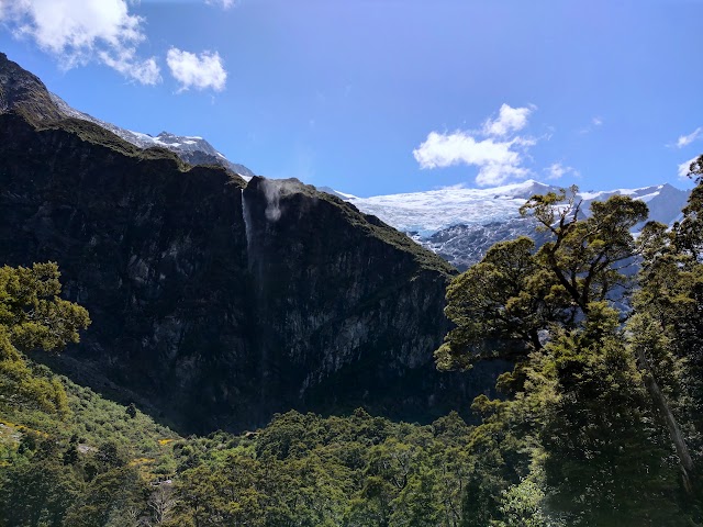
(+23)1.53pm: Arrived at the Lower Lookout point of Rob Roy Glacier. Rob Roy Glacier and Bridal Veil Falls can be seen from here (Lower Lookout) but not as dramatic as the Upper Lookout. During colder months from May to November, however, this would be the furthest point you could go due to avalanche risk up ahead.
(+12)2.05pm: A better view as I continued towards the Upper Lookout.

(+2)2.07pm

(+2)2.09pm

(+5)2.14pm: A longdrop toilet.

(+3)2.17pm: Getting close!
Rob Roy Glacier Upper Lookout
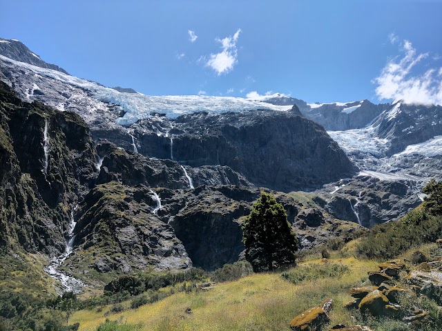
(+3)2.20pm: Arrived at the upper section! Here, the views of glaciers are so much closer than Roys Peak!

Closer shot of the glacier above. The towering rock mountains of Rob Roy are mostly schist, formed by layers of sand and mud with intense heat and pressure. Scientists guess the sediment that created these mountains were from parts of Antarctica, which were nearby 200 million years ago. These sediments were then thrusted upwards along the fractures in the earth’s crust about 5 million years ago, creating a 20 kilometers fault.
Even now, the Southern Alps continue to rise at a staggering rate of 10-20mm every year! However, erosion is keeping the height of the mountains more or less consistent.


(+4)2.24pm: Climb further up to the lookout point with informational signboards.

Wide shot from Rob Roy Glacier Upper Lookout point. Bridal Veil Falls on the left, and Rob Roy Waterfalls to the right.


Zoomed in shots of the glacier


Further ahead from a different angle. Peaks not covered by glaciers are jagged and sharp, while the rock faces that have been submerged under the grinding impact of glaciers are smooth.
The metamorphosed Torlesse greywacke (Haast Schist), exposed to weather and freeze-thaw circles, is prone to splitting and crumbling. This explains the piles of rubble, scree slopes, and teetering towers around the lookout.

Bridal Veil Falls

Some goat tracks lead closer to the glacier and waterfall.
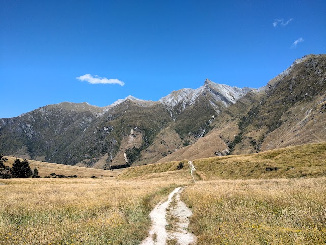

4.15pm: Back to the car park.
帖子有帮到您吗?在您的登山故事和帖子中标记 @meowtainpeople 吧!

*地球队长经过* 记住,请保护我们的环境,请勿破坏大自然。不要留下任何垃圾,只带回照片和回忆(如果可以的话,还可以捡走一些垃圾)。请在指定的路径上行走,并尽量保持在中间行走,以使裸露的土壤不会进一步扩散/腐蚀。与大自然融为一体吧 *飞走了*
支持本网站的附属链接:
透明度万岁!:以上链接是会员链接,如果您用此链接购买或预订的话,我可以赚取佣金, 而你也不会被收取额外费用。 我只推荐我使用的产品和公司。您的支持可以帮助我保持网站的运行,让我继续用心分享🙂
想在您的网站进行相同的联属网络营销吗?用这个 AccessTrade 平台链接 获取 RM5 奖励。