
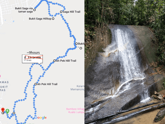
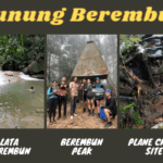
The Ah Pek trails and Saga trails are two of the most well-known and popular hiking spots in Kuala Lumpur, located right beside Ketumbar Hill, which is also a popular hiking place because of the wild boars.
Ah Pek and Saga are connected, with waterfalls in the middle. These trails are very suitable for a wide range of people, as there are easy and short trails for beginners, while more experienced hikers could also spend most of a day doing the challenging full loops.
There are actually many interconnected paths within Ah Pek and Saga trails but to make it simple, we will use the only visible paths from Google Maps.
Quick Walkthrough
8.40am: Entrance (Ah Pek)
8.50am: Ah Pek Junction 1
9.23am: Ah Pek Hill Station 2
9.56am: Ah Pek Hill Station 6
10.08am: Apek Hill Station 5
11.15am: Ah Pek Hill upper Waterfall
12.06am: Bukit Saga Waterfall (rest)
1.27pm: Junction (Saga Hill)
1.33pm: Bukit Saga Hilltop (rest)
2.53pm: Exit & Re-enter (Bukit Saga via Taman Saga)
5.17pm: Return to Apek Hill Station 5
5.29pm: Ah Pek Hill Station 3A
5.38pm: Apek Hill Station 3
5.59pm: Apek Hill Station 1
6.16pm: Return to Ah Pek Junction 1
6.29pm: Exit (Ah Pek)
Time Spent: 8 hours and 49 minutes
Additional Tours:
Detailed Walkthrough
Ah Pek Trail Entrance
Where to park your car
There are multiple entrances to Ah Pek trails, the one with a visible path in Google Maps is Ah Pek Hill Trail Head (Awana).
Most of the people park their car at the spot in Google Maps called Apek Hill Car Park, it is not a actual parking spot but people park along this road as long as it does not cause any inconvenience to the traffic and the residents. The best place is to park your car near the 99 Speedmart parking lots. Do not park into the residential area, the residents are being considerate for crowds passing by to enter the trailhead so we need to appreciate that and not causing more disturbance to them.
Entering Ah Pek Trail
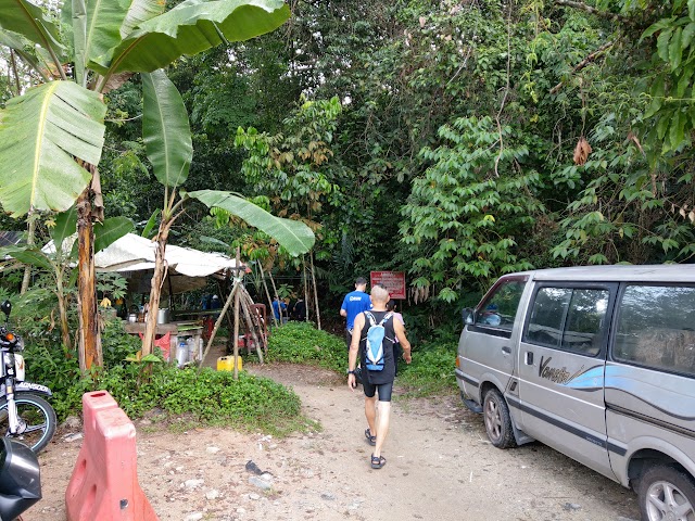
8.40am: Trailhead with drinks stalls nearby

Follow the main path, or turn right to the steeper shortcut which only saves you a couple minutes of walking.
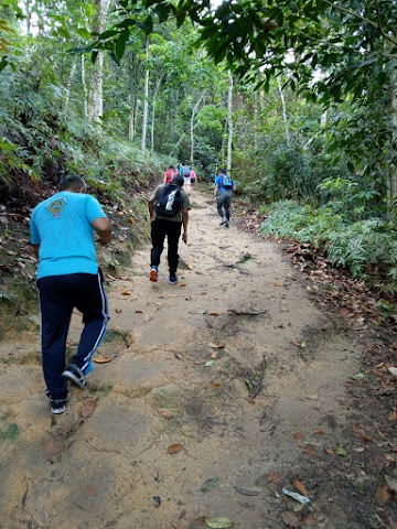
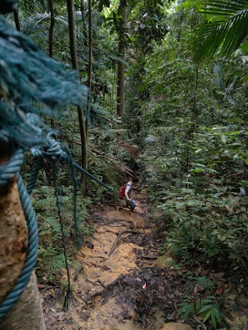
(+4)8.44am: The trail is rather steep right away so make sure you do some warm ups and stretchings on your legs before starting the hike.
Ah Pek Trail Junction 1


(+6)8.50am: The first junction. Here we will proceed to the left. For new hikers I recommend using the path to the right as it is easier and more straightforward. The path to the left is quite confusing if you want to follow Google Maps’ path, as we somehow got off course away from the path and had to make some turns to return to the path.
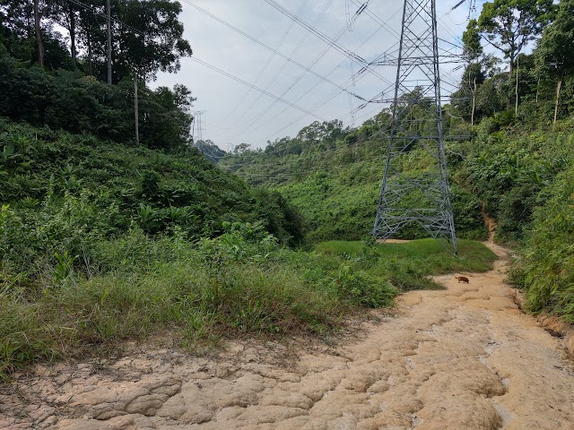

(+16)9.06am: After following the trail, we reached this open area with the telecommunication towers and noticed we were away from the Google Maps’ path, so we crossed this area to reach to the other side on the right.

(+4)9.10am: Steep and slippery path going up here.
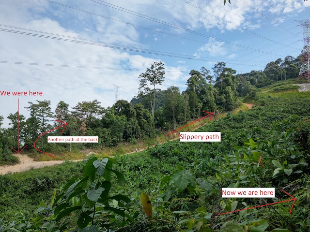
(+5)9.15am: Now we are at the other side, on the path of Google Maps. As you can see, there is a straight way up there but it is slippery because of the corroded soil to the towers. There is also another easier path from the place we came from which you can use if you are not following Google Maps’ path.
Ah Pek Hill Station 2
(+8)9.23am: Ah Pek Hill Station 2


(+13)9.36am: Rest stop with water station (this place is a little further away from the Google Maps’ ‘rest stop’ location.
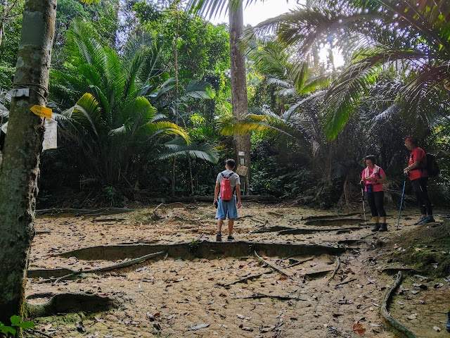
Ah Pek Hill Station 6 / Tea Station

(+20)9.56am: We reached Station 6, a.k.a Tea Station.
There is some exercise equipment and a snack store here.

(+4)10.00am: After a short break, we continued our journey and headed to the path left side of the store.
Apek Hill Station 5

(+9)10.17am: This looks like many trees combined into one.

(+3)10.20am: Follow the direction to the waterfall.

(+8)10.08am: Station 5; turn left at the junction to continue the way to the waterfall / Saga Hill. Turning to the right will lead you back to the Awana entrance, that is the path you will go through if you take the path to the right from the first junction.
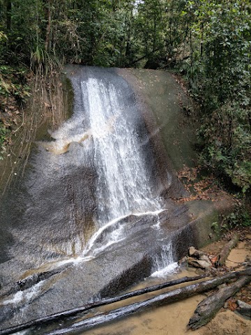
Ah Pek Hill upper Waterfall
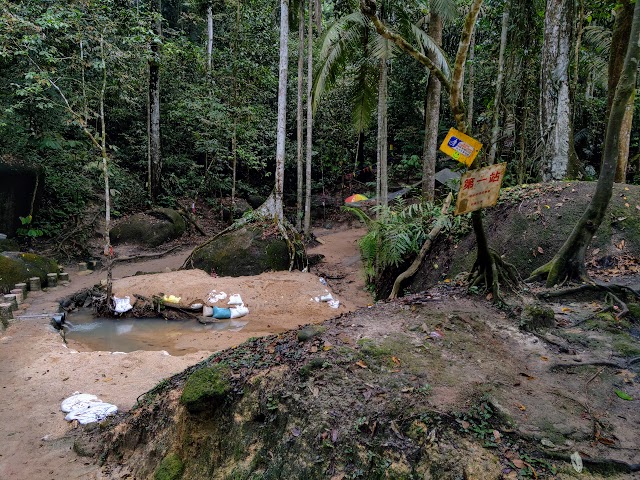
Before reaching Bukit Saga Waterfall (BW arrow), there is a junction to the right (yellow sign) going down to the other waterfall, which we later discovered is Ah Pek Hill waterfall.

(+12)10.42am: The way down to Ah Pek Hill Waterfall is very steep and slippery.

(+22)11.04am: Took us a long time to slowly go down to the waterfall.
(+11)11.15am: Ah Pek Hill Waterfall
(+10)11.25am: After taking a rest here, we head back up through the same steep path.
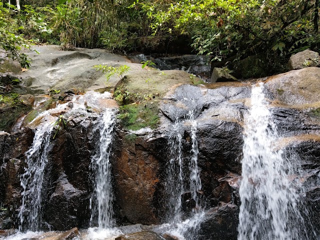
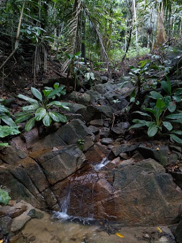
Bukit Saga Waterfall
(+24)11.49am: We were back to this spot again. This time, we followed the BW arrow to Bukit Saga Waterfall.

(+2)11.51am: Very soon after going forward, we have to head down again.

(+6)11.57am: Follow the tree trunk down to the waterfall.
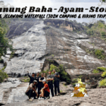
(+9)12.06am: Saga Hill Waterfall
Closeup Slow-mo
Waterfall to Saga Hill

(+31)12.37pm: We took a long break here before continuing the journey to Saga Hill. Go back up from the waterfall but this time, head to the right side which leads to Saga Hill. (The left leads back to Ah Pek trails)

(+4)12.41pm: Once on top, follow the rope across the stream.

(+3)12.45pm: Walk into the trail and there is a part where it is difficult to see where to go next. You have to walk up to these rocks here.
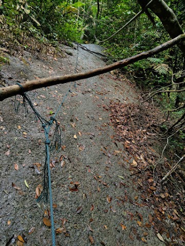
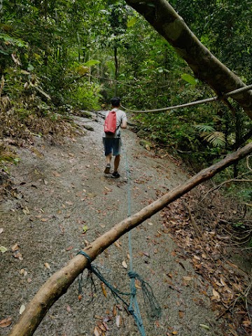
(+3)12.48pm: You will have to cross this tilted rockface. Make sure you hold on to the rope because a slip or fall here would be serious.


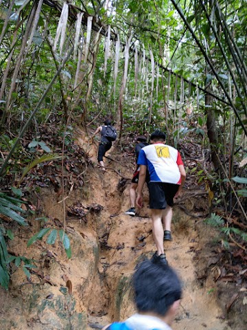
(+11)12.59pm: There was quite a series of steep incline going to Saga Hill.

(+28)1.27pm: Finally, we reached the junction of Saga Hill, both paths can take us to the Saga exit point but to reach the hilltop you need to take the left junction (take right at the first junction if you are coming in from Saga).

You got to leave the Google Maps path a little to go to the hilltop, then come back to the path later on to continue to trail to the exit.
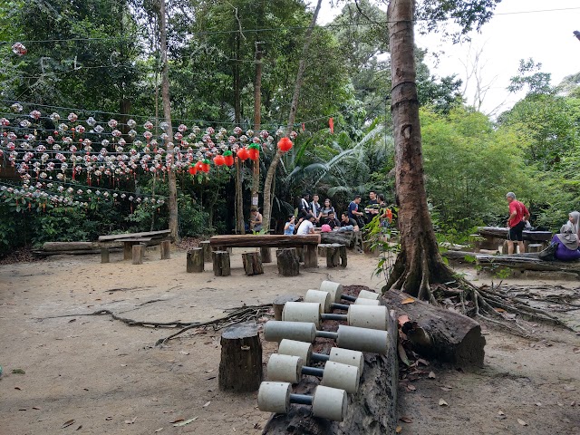
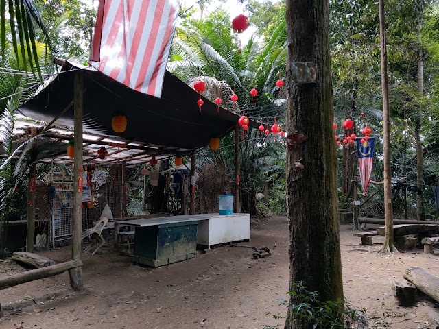
Bukit Saga Hilltop

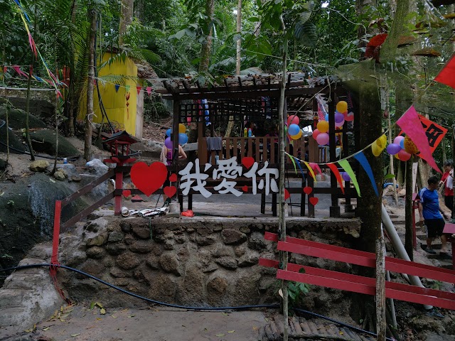
(+6)1.33pm: The hilltop is a large rest area with exercise equipment, wooden log benches, hammocks, and huts (one of them is called 吹水站 (‘blow water’ station, means a place to talk nonsense stuffs haha).
(+30)2.13pm: It started raining heavily so we took a long break at the hilltop before continuing our hike in the rain again.

(+12)2.25pm: One of the rest stops we passed by walking down to the exit.

(+5)2.30pm: Constant downhill to the exit (uphill if you are coming up from Saga entrance/exit)
Entrance/Exit: Bukit Saga via Taman Saga

(+13)2.43pm: First thing you see once you reach the exit – ongoing construction of the highway. The construction workers allowed us to walk past this area as long as there is no ongoing activity that could pose danger to the people nearby. We are not sure when this area would start its active construction work and hence blocking off access to Saga Hill.

(+4)2.47pm: Just follow the muddy construction road to the exit.

(+6)2.53pm: We reached the outside. To reach this place, search ‘Bukit Saga via Taman Saga’ on Google Maps.

(+1)2.54pm: This is the entrance, time to head back in again and complete the return route. This time using the left path to Saga Hill.
Return: Apek Hill Station 5
(+143)5.17pm: After 2⅓ hours of return loop through Saga Hill and Bukit Saga Waterfall (without going down to Ah Pek Hill upper waterfall), here we are again at the junction of Station 5.
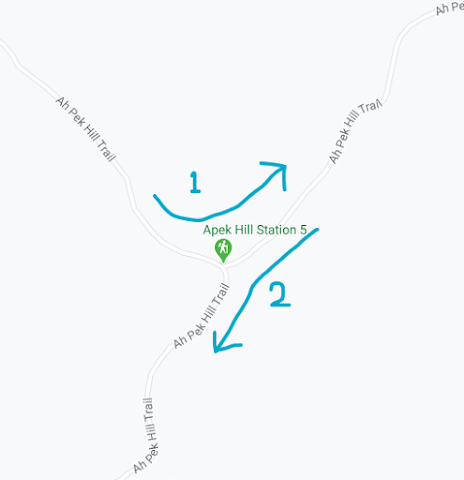
Since we came from the junction from the right, this time we head to the left path which is the easier way.
Ah Pek Hill Station 3A

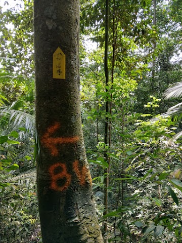
(+12)5.29pm: Station 3A; took some time before I understand why it is called 3A hahaha, because Chinese XD


(+5)5.34pm: Continue the path and there is a path branches out to the left going to Ah Pek Hill Rock Jungle (石林). Here we continue straight but in the last section I will take an additional tour and show you the place along with the other points of interest.
Apek Hill Station 3

(+4)5.38pm: Station 3


(+1)5.39pm: From station 3 you have two paths to choose, both take you to the exit. To follow Google Maps’ path, we took the one on the left with a ‘轻松路’(easy way) sign.

+12)5.52pm: The easy way is pretty easy to walk. We followed the ‘exit to station 1’ sign. Find out about 山水站 in the additional tour section.


(+2)5.54pm: When you reach here, do not head out there. Instead, head to the right where you can see a tree with the arrow and the number ‘1’.
Apek Hill Station 1
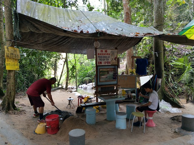
(+5)5.59pm: First thing you will see in station 1 on the way to the exit: A char kuey teow stall in the forest.


There are some exercise equipment, tables and benches, a basketball net, and a mini pond/stream.


(+3)6.02pm: Head up toward the exit to an open area with some telecommunication towers.


(+2)6.04pm: Take one of the paths here.


(+6)6.10pm: Follow the exit sign to Cheras Awana.

(+6)6.16pm: We reached the very first junction we have encountered in the beginning of the hike. Keep left.

(+6)6.22pm: Walking back down to the entrance/exit.

(+7)6.29pm: After passing by the residential area near the entrance/exit, we were back to the main road. Most of the hikers/cars have left.
Time Spent for the Google Maps loop plus Ah Pek Hill upper Waterfall and Bukit Saga Hilltop detours and breaks: 8 hours and 49 minutes
Ah Pek Trails: Additional Tours
Mountain Water Station (山水站)

From Apek Hill Station 1, continue your journey as if you are heading to the waterfalls by passing by the char koay teow stall.

(+8)You will pass by this tree with huge parasite roots.

(+1)Near the tree, there is a split junction. The left one will bring you to Station 5 and the waterfalls.Take the right junction to go to the mountain water station and the rock jungle.

(+5)You will pass by a mini waterfall.

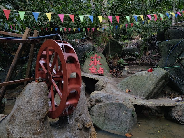
(+9)This is the Mountain Water Station (山水站). It is quite a well decorated area will a pool with artistic wall drawing, a water wheel, and a mini restaurant.
Ah Pek Hill Rock Jungle (石林)

To go to the rock jungle from the mountain water station, head to the trail on the right side of the wallpaper behind the pool. Please note that this path is quite steep and slippery, you can also choose to visit the rock jungle via the junction here or from Station 3.


Follow the ‘石林’ sign

(+12)Here is the rock jungle. The name probably comes from the structures here which are nicely built with rocks.

From the rock jungle, you can use the more obvious path to Station 3

Or you can use this less obvious incline to go up to the junction between station 3 and station 3A here which I will show you next.

The path to the junction between 3 & 3A is less popular hence it is tougher than the common path to station 3.

(+9)This is the junction exit point to the station 3 (left) and station 3A (right). To exit, go left; To the waterfalls and deeper part of the jungle, go right.
Epilogue
While the Saga trails were used to be the more popular entry point, it is now better to hike from the Ah Pek trails due to the highway construction works at Bukit Saga trailhead. Still, you can walk through the construction site to the trailhead of Bukit Saga via Taman Saga but we are uncertain of how accessible it is during and after the construction.
Ranged from an easy 30 minutes hike, to a 6-10 hours power hike; No matter which level of fitness you have, Saga hill and Ah Pek trails are good hiking spots for you. To reach the waterfalls, however, you will need sturdy legs and good stamina but with a strong will, even beginners can achieve this. Enjoy!
Have this guide helped you? Tag @meowtainpeople in your hiking stories & posts!
Affiliate Links to support this site:
Yay for transparency!: The links above are affiliate links, and at no additional cost to you, I earn a commission if you make a booking/purchase after clicking the links. I recommend only products and companies I use. Your support helps me keep the site going 🙂
Want to do the same affiliate marketing with your site? Use this AccessTrade platform link to receive RM5 reward.

*Captain Planet passing by* Remember, please take care of our environment, and please don’t destroy the Nature. Leave no trash behind and take back only photos and memories (and also some trash if you can). Walk on the designated path and stay in the middle as much as you can, so that the exposed soil doesn’t spread/corrode further. BE ONE WITH NATURE *flies away*
Hi,
Are we able to engage a guide to hike Ah Pek saga hills?
Hi Vivien, you may try contacting the friendly mountain guide Reena (+60 12-666 4026) for any weekend hikes in KL & Selangor. 🙂