
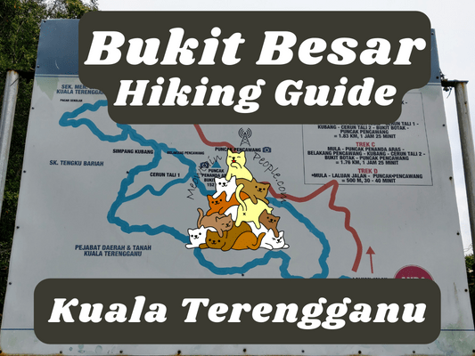
Bukit Besar is Kuala Terengganu’s main hiking spot and is a favorite trail for hikers around the state capital of Terengganu. Bukit Besar offers beginner’s level trails that connect to the telecommunication tower and the other peaks, such as Bukit Botok, and Bukit Tobak. Do note that although it is considered an easy hiking spot, some parts of the trail, especially in Track A, may prove challenging due to the trails disappearing or turning slippery due to infrequent usage (to be covered below).
Bukit Besar Hiking Trail Map
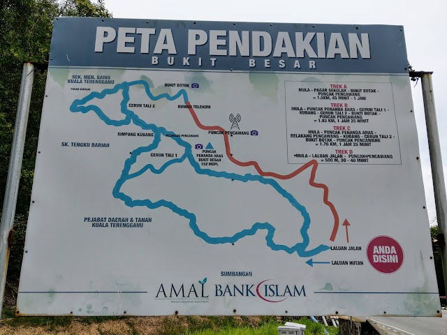
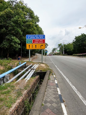
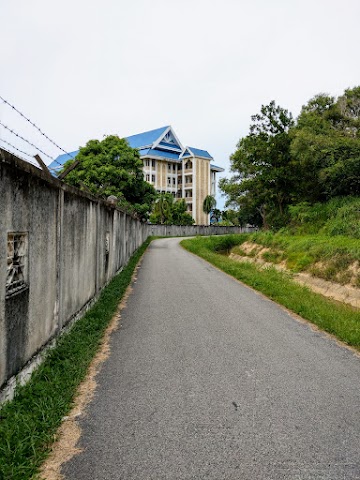
There are plenty of parking spots in front of Kuala Terengganu District and Land office 这里. The three trailheads are easily accessible from this location. A big signboard of the hiking trails can be found near the starting point.
Track D (orange line), is the tarmac road, which is the shortest and the most direct way to the telecommunication tower.
Tracks B and C (middle blue lines) start at this trail near the tarmac road entrance of Track D, facing the opposite direction. This is the more common trail taken by hikers and is easy to follow.
Bukit Besar Track A Starting Point

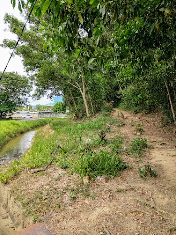
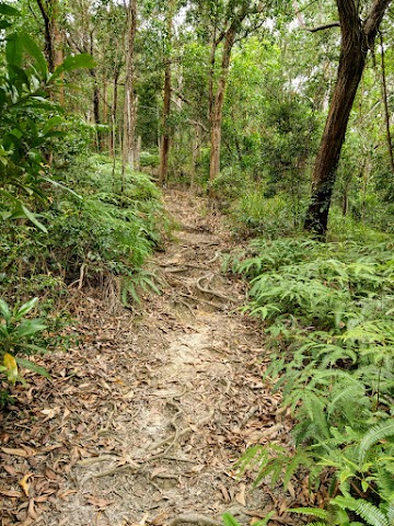
2.09pm: I chose Track A’s trailhead (left blue line), which I later found some tricky parts of the trail. This path starts by following the road by the side of the building.

(+6)2.15pm: Walk until you see a concrete bridge and cross over to the other side of the drain.

Follow the trail that is wide and obvious (for now).

(+5)2.20pm: Then, I reached an open wide space and had to roam around looking for the trails. This is the place with a junction to Simpang Kubang (left) or to Cerun Tali 1 (right). I wanted to take the path on the left but couldn’t figure out where exactly the trail was. I found one that looked like a trail but without a clear direction.
Cerun Tali 1


In the end, I found the Cerun Tali 1 (Slope Rope 1) trail to the right, where I could see a rope hanging down a slope from afar.


(+6)2.26pm: This was the start of the Cerun Tali 1 trail, climbing straight up to the top of Bukit Besar.

(+3)2.29pm: I reckon this trail was the least beaten path because it didn’t have an obvious trail. Thankfully there were ropes along the way to guide me in the right direction. Also, the slope was rather steep, and made more challenging with slippery dead leaves.

(+1)2.30pm: The slippery part is over and the path joins the main trail of Track B & C, cutting through Cerun Tali 1 from Track A (the signage arrow is pointing toward Cerun Tali 1 to Track A entrance). The signage of Bukit Besar peak (125 meters above sea level) could be nearby at the right but I didn’t find any. I continued the trail to the left, towards Simpang Kubang.

(+2)2.32pm: This is probably the junction of Simpang Kubang. I took the upward path to the right as the left would take me back down to the office building trail.

(+9)2.41pm: This part of the trail is called ‘Belakang Pencawang’ (behind substation) because it passes near the back of the telecommunication station. There is a mini split path which joins back, the path to the right brings you to this view behind the station.
Simpang Y (Y Junction)

(+6)2.47pm: A rest stop on the trail.

(+1)2.48pm: There is a junction at this rest stop, continue on by taking the trail on the right, over this water box.
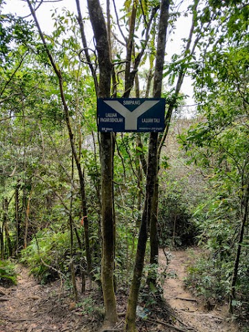
(+3)2.51pm: You will then encounter this Y-Junction. The left will take you to ‘Laluan Pagar Sekolah’ (School Gate Path) to the back of a school. I took the path to the right to Cerun Tali 2 (Rope Slope 2), which leads to Bukit Botok.

(+2)2.53pm: The trail of Cerun Tali 2 goes down…

(+2)2.55pm: …and then goes back up again.

(+2)2.57pm: Almost there…
Bukit Botok Terengganu
(+1)2.58pm: The peak of Bukit Botok in Bukit Besar.

The view from Bukit Botok, overlooking the town of Kuala Terengganu and the coast.

There is a trail to ‘Laluan Pagar Sekolah’ (School Gate Path) from Bukit Botok.
3.02pm: For me, I took the trail towards the telecommunication towers.

(+2)3.04pm: Up the hill towards the telecommunication towers.


(+3)3.07pm: Walk along the fence of the first small telco tower. Then, follow the concrete road to the main towers.
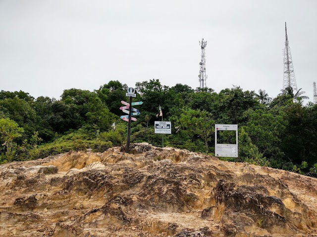
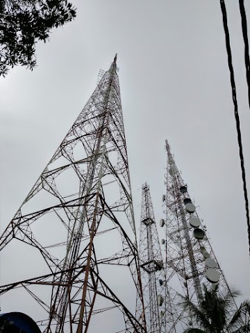
Bukit Besar Telecommunication Towers
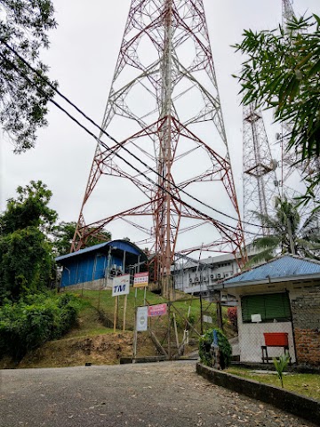
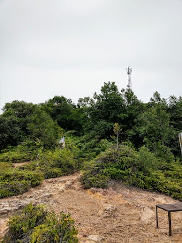
(+3)3.10pm: Reaching the ‘Puncak Pencawang’ (Substation Peak) with the telco facilities.
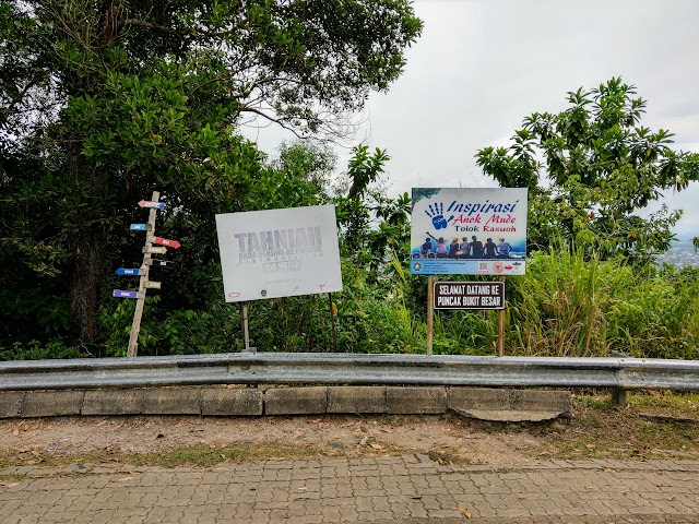
Some signboards on the peak at Bukit Besar.

(+1)3.11pm: After that, I decided to head down using the tarmac road.
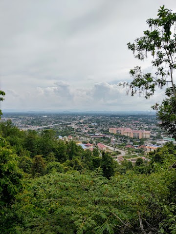
(+2)3.13pm: At some points of the road, there are some city viewpoints.

(+4)3.17pm: Passing by a big signboard with Jawi characters.

(+5)3.22pm: Back to the main entrance.
Masjid Kristal Kuala Terengganu

At night, I visited the nearby mosque, Masjid Kristal (or the Crystal Mosque), made of steel, glass and crystal.
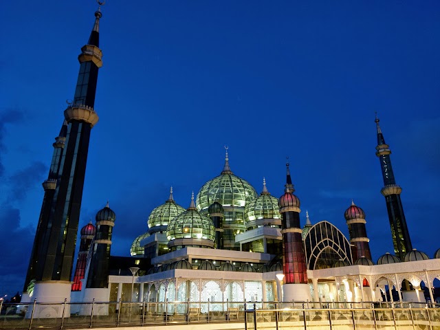
The look of the mosque would be different between day and night. During the day, the sun’s reflections cause the glass panels of the qubba (dome) to look like solid steel panels. At night, they become transparent.
Place to Stay in Kuala Terengganu - Leisure Lodge Hostel


我住在 Leisure Lodge during my trip in Kuala Terengganu. It was a nice cozy place with a variety of games to play (eg. foosball, congkak, snooker, carrom, PlayStation).
帖子有帮到您吗?在您的登山故事和帖子中标记 @meowtainpeople 吧!
透明度万岁!:这里某些链接是会员链接,如果您用此链接预订的话,我可以赚取佣金, 而你也不会被收取额外费用。 我只推荐我使用的产品和公司。您的支持可以帮助我保持网站的运行,让我继续用心分享🙂

*地球队长经过* 记住,请保护我们的环境,请勿破坏大自然。不要留下任何垃圾,只带回照片和回忆(如果可以的话,还可以捡走一些垃圾)。请在指定的路径上行走,并尽量保持在中间行走,以使裸露的土壤不会进一步扩散/腐蚀。与大自然融为一体吧 *飞走了*
bukit ni mmg xde org ke? atau ni weekdays? tq
ye saya pergi masa weekday, hari Khamis