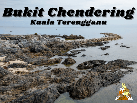
Bukit Chendering is a small peak for a quick hike in Kuala Terengganu. Situated by the beach of Pantai Chendering, it is about 20 minutes drive from the heart of Kuala Terengganu.
Bukit Chendering Trailhead - Where to start & where to park?
The starting point or trailhead of Bukit Chendering is located 这里, right beside the entrance of the port (Pelabuhan LKIM Chendering). The port lets hikers drive into its facility and park inside, with a parking fee of RM1 per car, or 50sen per motorbike. The staff in the guard post of the port also get hikers to register their details before the hike, making sure they return safely. Sweet!
10.01am: Crossing the log at the starting point.
(+1)10.02am: Walk ahead and enter the trail.
(+1)10.03am: Reaching a makeshift ‘Bukit Chendering’ welcome sign.
(+1)10.04am: I took the trail to the right, which was pretty steep and slippery due to the post-rain wet leaves. The main path up is probably on the left.
(+2)10.06am: Anyway, the path I took joined back to the railway-like main trail very soon.
Bukit Chendering Peak
(+1)10.07am: And voilà, I reached the peak of Bukit Chendering in just 6 minutes. It is indeed a small hill, my body hasn’t even warmed up yet! The view from the peak wasn’t amazing, but the following journey would be more interesting.
(+2)10.09am: So, continuing on the trail past the peak, passing a cement platform with a lighthouse structure. This trail heads down toward the beach.
(+6)10.15am: The trail heading down was quite slippery. Every place I stepped on that wasn’t a rock felt like I was going to slide. There were also a lot of aggressive mosquitos at this part of the trail.
Rocky Beach of Pantai Chendering
(+3)10.18am: And then, the trail leads to a cliff. A rope hanging down the rock face to aid hikers in climbing up and down the cliff. Although it may not be as difficult as it looks, it’s not for the faint-hearted.
(+2)10.20am: Down to the rocky Chendering beach.
The rocky beach view.
Looking back to the cliff I just came down from, thinking if I should go back using the same return route. There were two demotivators: the aggressive mosquitos up there, and the slippery path down towards the starting point.
In the end, I decided to try a different path instead. Based on the map, I could probably head North to the beach, and walk back to the port using the road. The path, however, was separated by a gap, which I couldn’t cross over without swimming over it. The water was pretty deep too.
(+11)10.31am: Not wanting to get into the sea, I decided to walk over the rocky beach Southward. To my relief, there was this sandy beach over the other side.
(+6)10.37am: After the sandy beach is a stretch of breakwater rocks. You can see the Chendering North Breakwater Lighthouse at the far end.
(+1)10.36am: Slowly walking over the large rocks under the hot morning sun.
(+8)10.44am: Then it became a flat concrete road with cubes of breakwater structures all the way to the lighthouse.
Chendering Lighthouse
(+6)10.50am: Nothing much to see around the lighthouse. There were people fishing here.
(+8)10.58am: To complete the loop, I turned back leaving the lighthouse, and followed the road to the left, back to the port through the back road. After reporting back at the entrance guard post, I headed to Marang Jetty for my boat transfer to Kapas Island.
What to eat in Pantai Chendering: If you are around here in the evening, do check out SCT Sotong Celop Tepung to enjoy some fried squid by the beach!
Or, bring home some fish satays you used to buy from the motorbike by the roadside, straight from the supplier at Kedai Sate Ikan Kak Ning Chendering!
帖子有帮到您吗?在您的登山故事和帖子中标记 @meowtainpeople 吧!
*地球队长经过* 记住,请保护我们的环境,请勿破坏大自然。不要留下任何垃圾,只带回照片和回忆(如果可以的话,还可以捡走一些垃圾)。请在指定的路径上行走,并尽量保持在中间行走,以使裸露的土壤不会进一步扩散/腐蚀。与大自然融为一体吧 *飞走了*
透明度万岁!:这里某些链接是会员链接,如果您用此链接预订的话,我可以赚取佣金, 而你也不会被收取额外费用。 我只推荐我使用的产品和公司。您的支持可以帮助我保持网站的运行,让我继续用心分享🙂


