
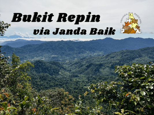
Despite its name, Bukit Repin (Repin Hill) could actually be categorized as a mountain with a height of 1341 meters above sea level. Moreover, this ‘tall hill’ shall not be underestimated, as it could easily be tougher than the neighboring Gunung Nuang via Janda Baik. Although the peak is located in Selangor, the most common and shortest route (~5km one way) is via Janda Baik, in Bentong, Pahang. Other routes include the long via Kemensah trail (~15km one way), via Lepoh Waterfall (~6km), or even through Trans Nuang – Lentang Legong – Repin.
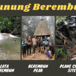
Bukit Repin via Janda Baik
Hiking Permit Application
To enter Bukit Repin via Janda Baik trail, you need to apply for a forest permit from Bentong Forestry. Their online permit application system, Sistem e-Eko Rimba, currently doesn’t have the selection for Bukit Repin. In this case, you have to contact Bentong District Forest Office directly to apply for the permit. The staff might share with you a contact number of the officer who handles the permit applications. Upon approval, a guide (standard fee rate of RM170 as of 2022) will be assigned to your group.
Bukit Repin via Janda Baik Trailhead / Starting Point

8.18am: The trailhead to Bukit Repin via Janda Baik starts 这里 beside a road. There was enough space to park a few cars right by the road beside the trailhead.
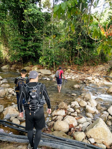
(+1)8.19am: Immediately, you will reach the first river crossing. Feet will be wet, so most hikers would wear their shoes after crossing this river.


(+6)8.25am: The trail passes through some Orang Asli plantations.


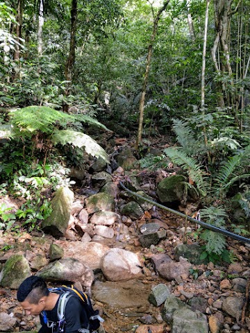
(+17)8.42am: A stream crossing, followed by more dirt and rocks kampung trails.
(+6)8.48am: Another stream crossing. We met a group of Orang Asli and their dogs. Notice a smol doggo standing on the rock.

(+15)8.57am: Covering some final stretch of the deforested area for farming.

(+9)9.06am: Finally, we entered the forest trail. The atmosphere immediately turned cool and fresh.
As Bukit Repin is not a very popular hiking spot, most parts of the trail became unclear. Thanks to our guide, we had no issue passing through.
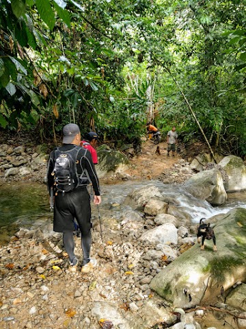
Last Stream Crossing - The Starting Point of the Real Challenge
(+25)9.31am: Here is the last stream crossing before the most challenging part of Repin Hill Trail. We had a break on the rocks and removed so many leeches from our shoes!
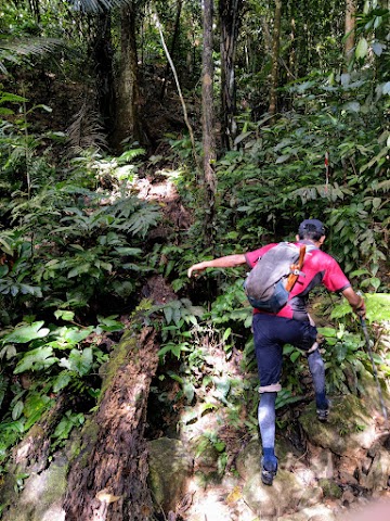
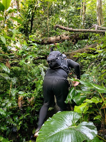
9.44am: After the break, we headed on. The trail right after the last stream was very very steep and slippery without much to hold on to.

Most parts of the trail looked like this, it is a rather steep uphill climb all the way to the peak. Somehow, with the cool and fresh air, we didn’t actually feel very exhausted, even with our battered legs from yesterday’s hike at Nuang. We just kept climbing non-stop with a steady pace. It was the slipperiness on the steep trail that was challenging, plus the distracting leeches that kept coming.
Bukit Repin Peak (1341 meters above sea level)
(+79)11.03am: After 2 hours and 45 minutes from the starting point, we summited Bukit Repin.

There is a mountain view area near the peak.
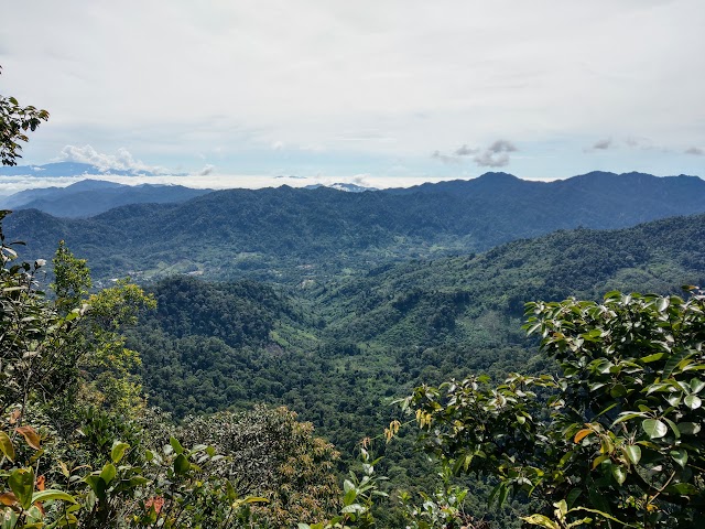
The mountainous view from Bukit Repin.

You can see the peak of Gunung Nuang and Lentang Legong here.
11.53am: After having our meal at the peak, we started heading back down. The journey was so much harder going down, because it was so slippery. Every step felt like I was going to slip down the slope. The worst part was coming down before the stream crossing, it was the steepest and most slippery, with almost nothing to hold on to. Comparing it with our hike the day before, Gunung Nuang had a little more physical / endurance challenge, while Bukit Repin was overloaded with mental challenge for trying not to slip and get hurt. My brain felt very tired during and after the hike.
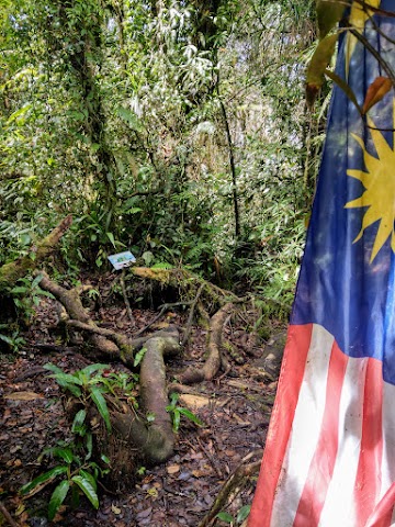
Bukit Repin Big Tree
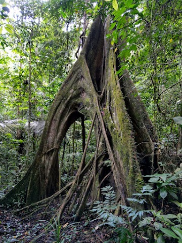

(+156) 2.29pm: I had a very slow descent. The trail got much better after the first stream crossing when coming down. We stopped by this big tree to take a few pictures. I was just standing there for about 10 seconds to take a couple of photos, and guess what? Another three more leeches climbed onto my shoes!
(+55)3.24pm: An hour later, we exited the trailhead and completed our journey.
帖子有帮到您吗?在您的登山故事和帖子中标记 @meowtainpeople 吧!

*地球队长经过* 记住,请保护我们的环境,请勿破坏大自然。不要留下任何垃圾,只带回照片和回忆(如果可以的话,还可以捡走一些垃圾)。请在指定的路径上行走,并尽量保持在中间行走,以使裸露的土壤不会进一步扩散/腐蚀。与大自然融为一体吧 *飞走了*
支持本网站的附属链接:
透明度万岁!:以上链接是会员链接,如果您用此链接购买或预订的话,我可以赚取佣金, 而你也不会被收取额外费用。 我只推荐我使用的产品和公司。您的支持可以帮助我保持网站的运行,让我继续用心分享🙂
想在您的网站进行相同的联属网络营销吗?用这个 AccessTrade 平台链接 获取 RM5 奖励。
Hi…how to hire a nature guide to lead us in this mountain ? Tq
Hi Allen, the details are in the ‘Hiking Permit Application’ part above. A nature guide will be assigned to you by the forestry after they give you the permit.