
Holding both the titles for one of the best day hikes in New Zealand and one of the best Great Walks is the Tongariro National Park in the Central North Island region. Tongariro Alpine Crossing is a 19.4km one-way day hike. The track passes between the significant Mount Tongariro and Mount Ngauruhoe, across the volcanic alpine landscape of dramatic contrasts.
The Tongariro Northern Circuit Great Walk, on the other hand, shares half of the Alpine Crossing track, plus a big loop around Mount Ngauruhoe (Mount Doom). It also passes between Mount Ngauruhoe and Mount Ruapehu, the highest peak in the North Island. This Great Walk is typically done in 2-4 days. Read about my Tongariro Northern Circuit 2-Day Great Walk here.
Naturally, people often wonder if both hikes share similar features, and if they should do one instead of the other. Many recommend that you should decide based on the time you have, such as doing the Alpine Crossing if you are short of time, as if both journeys are the same. While this is logically true, I would suggest to any capable hikers to do both of the hikes (on separate trips), as each has its own unique charm, even though they share a part of the track.
This post focuses on the journey and the logistics/transportation guides for Tongariro Alpine Crossing, and its distinct track that the Northern Circuit misses. The Tongariro Northern Circuit journey is featured in a separate post here.
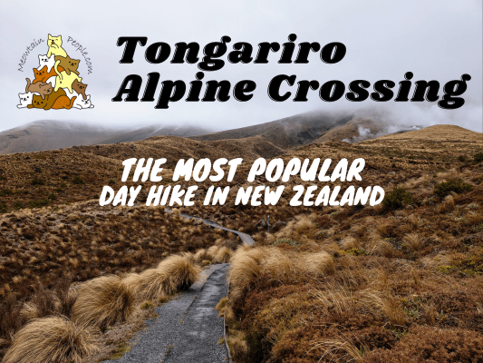
Tongariro Alpine Crossing: The Most Popular Day Hike in New Zealand
The Tongariro Alpine Crossing journey is best done during the Great Walk season, and between November to May, for the common hikers. Risky winter hazards are present during the winter months and the journey should be done only by experienced alpine climbers or with professional guides. Check the weather forecast and warnings for Tongariro National Park. Do check out this informative video on preparing your journey and to know if you are ready for the Tongariro Alpine Crossing:
Tongariro Alpine Crossing Parking & Transportation Options
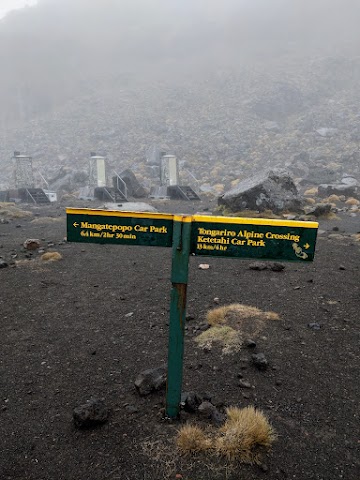
The hike typically starts at Mangatepopo Car Park, where parking is restricted during the Great Walk season. The other end is the Ketetahi Car Park, it also has a 4-hour parking restriction, which obviously isn’t sufficient for this 7-8 hours one-way hike. The highway along both the road ends do not have proper parking space and even if you find one unofficial space by the road, it could be quite far away, and you still need a way to get back to your car when you cross to the other end (it’s a long 5-hour walk on the highway from end to end). Hitchhiking is a possible method, though that part of the highway can be quiet at times. Opposite the Ketetahi road end is a paid Tongariro Alpine Crossing car park that offers shuttle services, which I will be recommending next.
Unless you have someone to drop you off and pick you up, the best option is to book a shuttle service. There are multiple transportation services for Tongariro Alpine Crossing, and I highly recommend National Park Shuttles based on my experience of their services. As I am driving, I booked their parking + one-way shuttle transfer, which I parked my car at Ketetahi Car Park, and rode the shuttle bus to Tongariro Alpine Crossing starting point at Mangatepopo Car Park. What stands out was the top-notch service I received. As soon as I made the booking, I received a call from the driver, notifying me about the not-so-great weather outlook for my climbing date, and to make sure that I bring my wet weather gear. I also got the option to change the date to a day with a better forecast but I didn’t. On the climb day, I was late from looking for a petrol station that is open in the early hours. I notified the driver about the delay, and he let me take the next scheduled trip without issue (the passenger count was very low due to the bad weather forecast). If you couldn’t complete the crossing and had to turn back due to the weather or fatigue, you can also contact the driver to pick you up from the starting point.
Tongariro Alpine Crossing Starting Point - Mangatepopo Car Park (1120m)
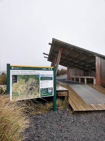
8.35am: A 35-minute shuttle ride took a few of us passengers from Ketetahi Car Park to Mangatepopo Car Park, the starting point of Tongariro Alpine Crossing.
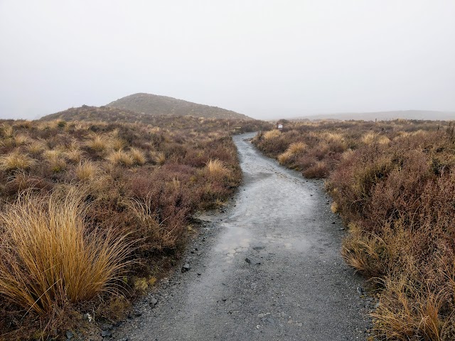
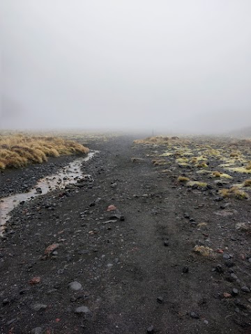
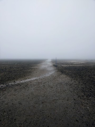
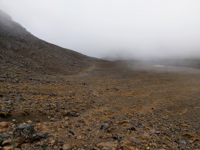
(+15)8.50am: The first section passes through a flat Mangatepopo Valley (It was raining and visibility was very low that day).
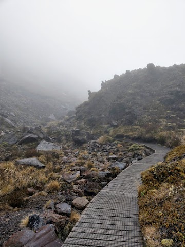
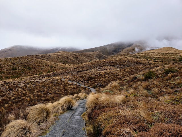
(+20)9.10am: Some minor inclines toward the saddle. Nice wooden walkways are installed.
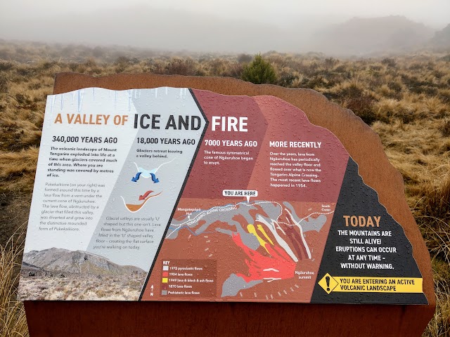

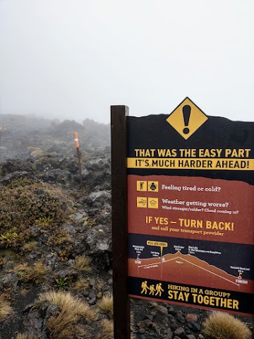
(+5)9.15am: Interesting infographics along the track.

While having clear weather would be great, the foggy sceneries gave the track a mystic vibe.


(+14)9.29am: End of the wooden walkway at 4km mark.
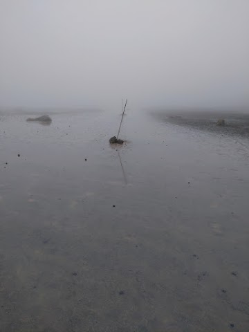
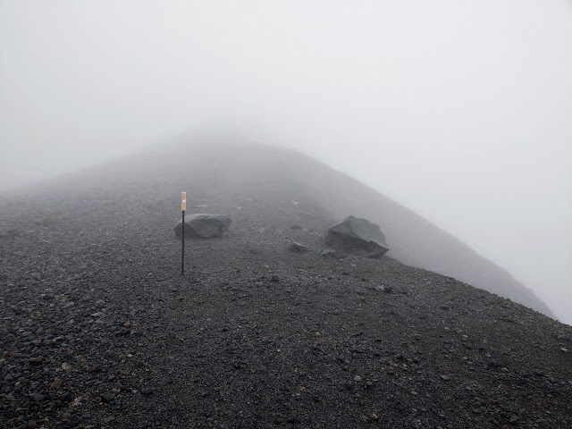
(+3)9.32am: When it’s foggy, stay alert and look out for the snow poles to stay on the right track. I found a group of novice hikers who got lost in the fog for 40 minutes trying to return to the main track from what was supposed to be a 5-minute sidetrack to Soda Springs.
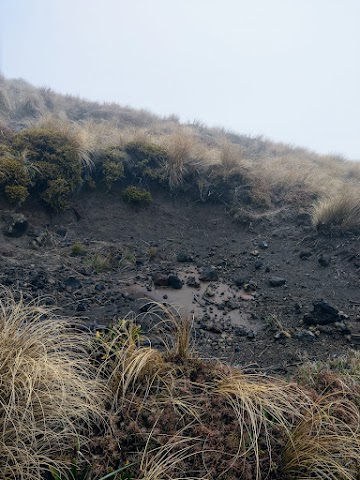
Soda Springs (1400m)


(+3)9.35am: A side track to Soda Springs, a cold water spring that creates a small oasis of lush yellow mountain buttercups and white foxgloves in the summer.

(+11)9.46am: Back to the main track.

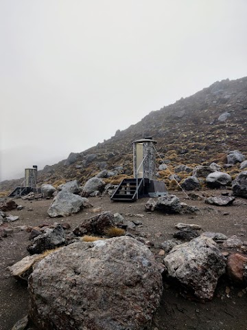
(+4)9.50am: This marks the end of the first section. There are some longdrop toilets before crossing the metal bridge.
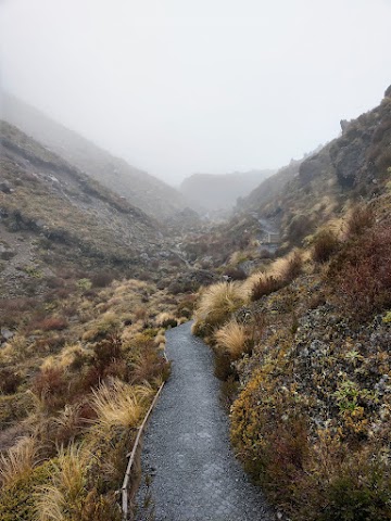
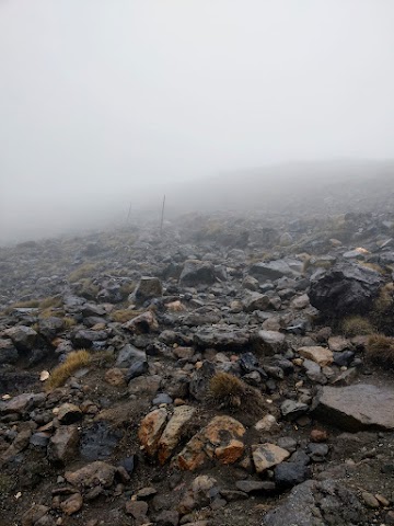
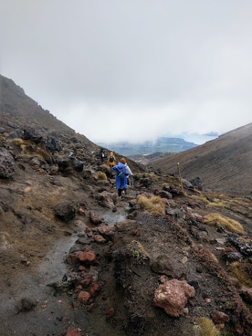
(+9)9.59am: The 5km mark is where the track becomes more challenging.
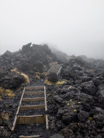
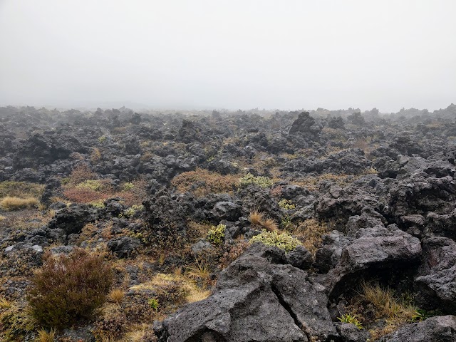
It is a mixture of volcanic rock track and some wooden steps to assist your climb.
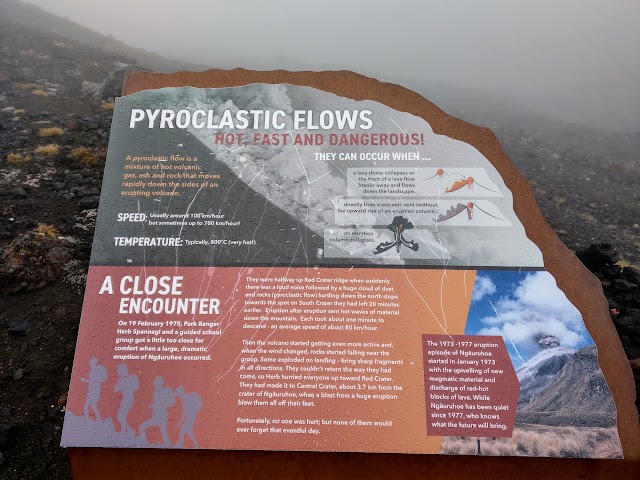
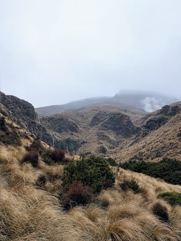
(+21)10.20am: A rip-roaring event when a guided school group found themselves caught in a dangerous scenario. A sudden dramatic eruption of Mount Ngauruhoe hurtled superheated ashes and rocks down the slope where the group had left 20 minutes earlier. Exploding rocks with sharp fragments were falling near the group. With the way back no longer an option, the park ranger guide managed to hurried everyone up toward Red Crater, to Central Crater, about 3.7km from Mount Ngauruhoe’s crater, when a blast from a huge eruption blew them off their feet. By happy chance, no one was hurt in this hair-raising event.
South Crater
(+10)10.30am: Reaching the South Crater section. The South Crater is not an actual crater, but a drainage basin between the surrounding volcanic landforms. There are a few longdrop toilets here.
(+8)10.38am: Walking through the South Crater in this fog was a surreal experience. It felt like I was walking on a borderless flat beach, with the poles guiding the direction.
This is what you would see on a clear day, with a clear view of Mt Tongariro:
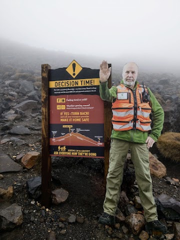
(+9)10.47am: Another decision making checkpoint before the hard ascent to Red Crater. The path ahead is like climbing a hill laying with volcanic rocks.


(+5)10.52am: With the low visibility, several times I found myself climbing up what-thought-to-be-the-peak, and realizing there is another higher spot from the false peak.
(+17)11.09am: Almost reaching the peak of Red Crater. There are loose slopes on both sides of the track, and the blasting wind was making it a little harder to walk straight. It was still pouring and it was literally a ‘horizontal rain’ with the strong wind going on.
Red Crater - Highest Point of Tongariro Alpine Crossing (1868m)
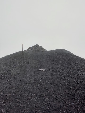
(+2)11.11am: Reaching Red Crater with a large cairn.
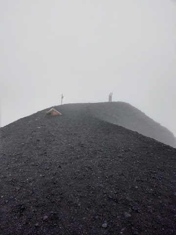
(+2)11.13am: Further up is the highest point with an infographic board about Red Crater.
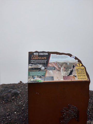
(+1)11.14am: The view behind this infographic board was supposed to be the grand highlight of the crossing: The astonishing Red Crater.
Below is what you would see on a clear day, an out-of-the-world deep red and brown landscape, caused by oxidized iron within the rocks from extreme heat. In the crater there is an interesting lava dike, where lava started to flow out of a vent, but retreated before it cooled, leaving a unique tube that was later exposed by eruptions:

(+8)11.22am: After the Red Crater, comes the trickiest part of the crossing, descending the loose scree down towards the Emerald Lakes.
Snake your way down the slippery ridge-like trail, with loose scree slopes on both sides. Be extra careful and not walk too close to the sides. It’s a long slide down and almost impossible to climb back up carrying load. Who knows where the hidden hot vents are down the crater.
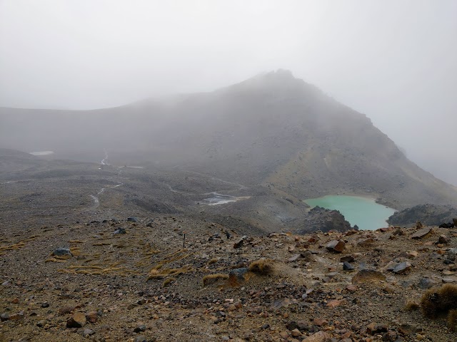
Emerald Lakes Tongariro

(+17)11.39am: Descended down to the Emerald Lakes. All waterways on Tongariro are sacred to the local Maori, so it’s important to stay on track and not to touch or throw rocks into the lakes.
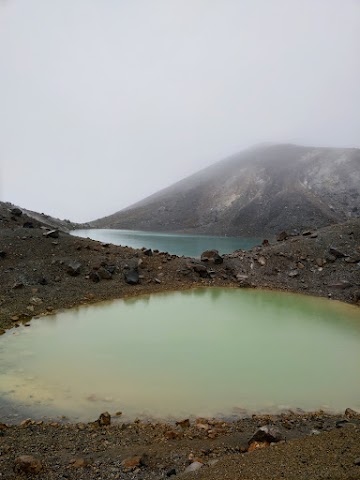
(+2) 11.41am: More of the Emerald Lakes, known as Nga Rotopounamu (greenstone-hued lakes). Some look turquoise blue while the others look emerald green.

Steam coming out from the ground can be spotted along the way. Again, it’s important to keep to the track as there may be unstable hot ground off the track.
(+1)11.42am: Continue the descent, following the poles and the tracks.
Tongariro Alpine Crossing & Northern Circuit Crossroad
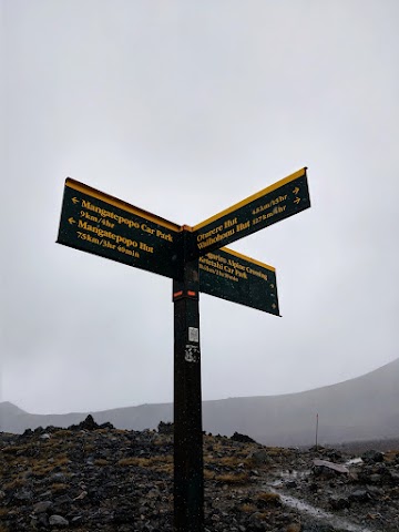
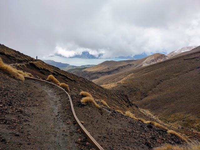
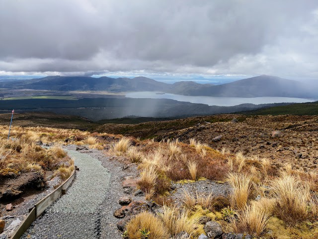
(+7)11.49am: Here is the crossroad that separates Tongariro Alpine Crossing and Tongariro Northern Circuit tracks.

You’d start to see markings of the distance traveled on the Tongariro Alpine Crossing track. Here’s the 9km mark.
(+1)11.50am: While the Tongariro Alpine Crossing shares the same track with Tongariro Northern Circuit Great Walk up until here, the remaining 10km+ of Tongariro Alpine Crossing is what the great walk misses, hence making it a worthy day hike even if you have done or will be doing the Tongariro Great Walk. Also, read the Tongariro Northern Circuit post to see what lies ahead of the great walk journey!
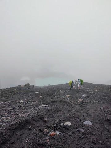
(+14)12.04pm: Trekking through the vast volcanic landscape of Tongariro National Park (see the tiny humans in the distance). From this photo the track is difficult to spot but it was actually pretty obvious at the location. There are many snow poles to guide you too (if you look closely you’ll see many poles in this photo, somehow they just look tiny and blend into this shot).
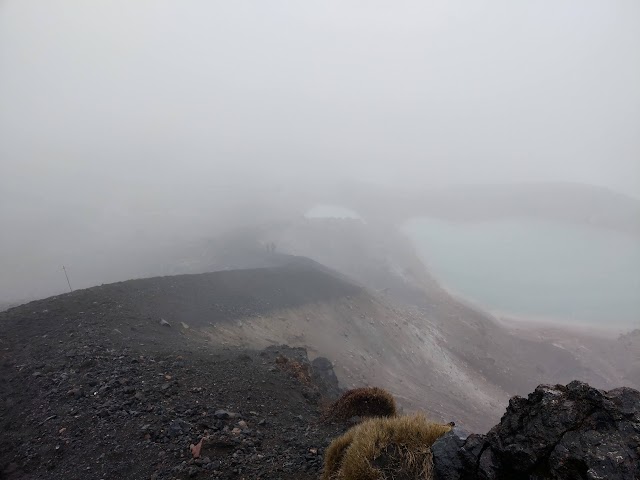
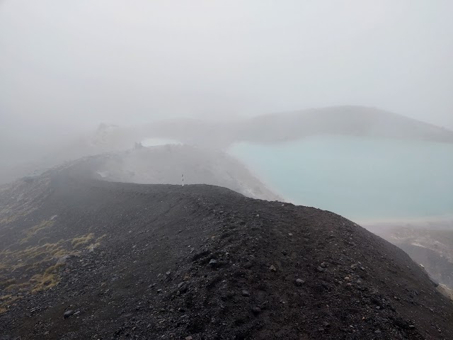
Tongariro Blue Lake (1725m)

(+11)12.15pm: Passing by Blue Lake to your right, and Central Crater to your left. The Blue Lake, also known as Te Wai-whakaata-o-te-Rangihiroa (Rangihiroa’s mirror), would look pretty ‘blue’ if it wasn’t foggy.
Here’s how it would look on a fine day:

Here’s the final part that involves a little bit of uphill walking.

(+4)12.19pm: 10km mark. The rest of the track would be flat/downhill from here.
(+4)12.23pm: Some long drop toilets.
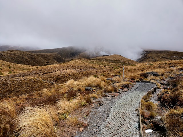
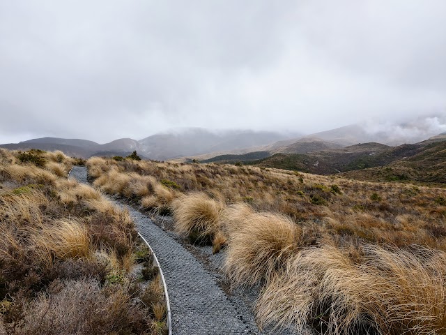
(+6)12.29pm: Starting the long descent down the mountains with beautiful views.
(+20)12.49pm: The next 20 minutes or so is the breathtaking scenic track along the mountainside.

Some eroded paths looked a little doggy so do take care when passing through.
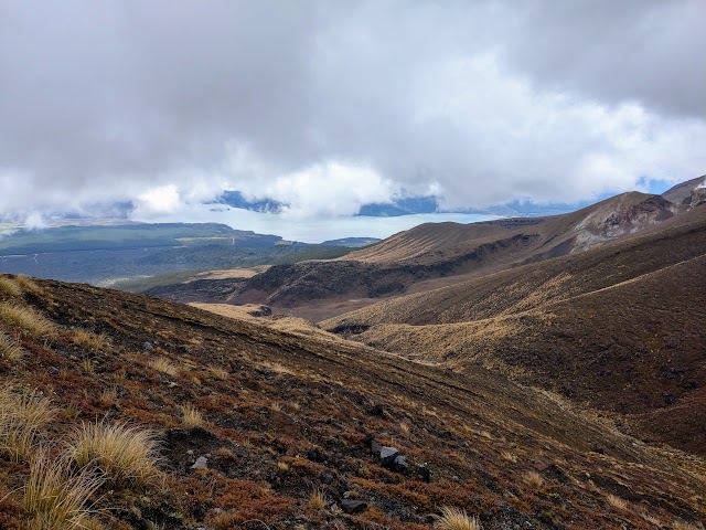
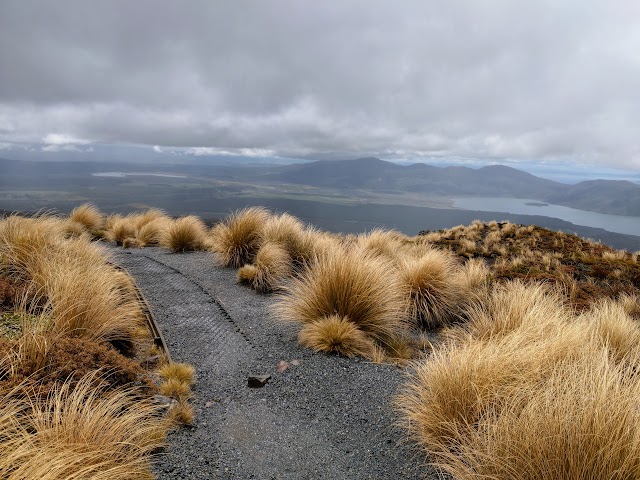
Lake Rotoaira can be seen from the mountainside track. On clear days, you might even see Lake Taupo, the largest lake in New Zealand.
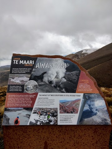
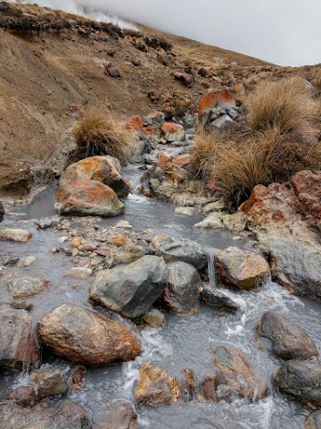
(+6)12.55pm: The Upper Te Maari crater, erupted three months after the last eruption of Tongariro in 2012 after over a century of slumber. Its explosion sent rocks flying up to 2.3km away, all around Tongariro Alpine Crossing, damaging the track and the now gone Ketetahi Hut.

Steam can be seen coming out of the crater.
The Zig-Zags down the mountains (Ketetahi bushline 1040m)
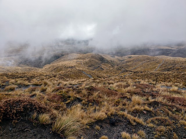
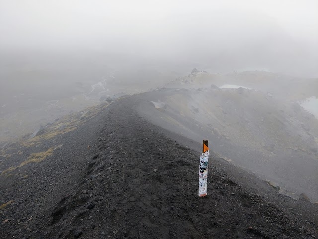
(+4)12.59pm: Once done with the mountainside crossing, the track zigzags onto lower elevation. The zig zags are big and while it is tempting to cut through the meadows in a straight line down the (steep & slippery) slope, it is important to stick to the track as the surrounding landscape is vulnerable.

(+19)1.18pm: 13 km mark, 6.4km left till Ketetahi car park.

The Ketetahi Hut used to be somewhere here, until the 2012’s Te Maari eruption sent rocks smashing through its roof, bunks and floor. Fortunately, this occurred on a cold winter’s night and no one was staying in the hut. Multiple fatalities could have occurred had this happened during the summer walking season. The severely damaged hut was then removed and will not be rebuilt due to its position within striking distance of future Te Maari eruptions.


(+2)1.20pm: A mini shelter and a couple of long drop toilets here.
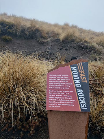
(+2)1.22pm: At the side of the track here is one of the many impact craters created by flying rocks from the 2012’s Te Maari eruption.

(+18)1.40pm: Trekking down to the valley, waterfalls and steam can be seen from a distance.

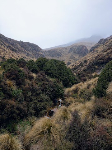
(+1)1.41pm: At the bottom of the valley, a bridge crosses the stream, over to the next mountainside.
(+5)1.46pm: A little bit of uphill walk from the valley, and it’s flat/downhill again.
(+2)1.48pm: Crossing a small stream, probably flowing down from the steaming ground (hot spring?) above.
(+2)1.50pm: The meadow-volcanic landscapes are just breathtaking!
Some patchy rains in the distance. You can see Lake Rotoaira, and the giant Lake Taupo behind a row of mountains.
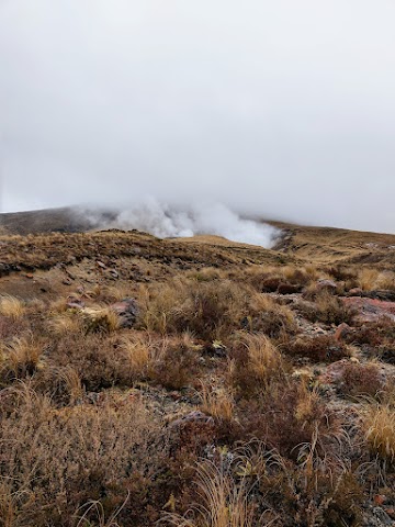
A big cloud of geothermal steam in the view ahead.

(+15)2.05pm: As you gradually lose altitude, you’ll start to see small trees around, and they get bigger as you go lower.


(+9)2.14pm: 16 km mark.

(+5)2.19pm: The last 3.1km until Ketetahi Road ends.

Here comes the patchy rain clouds again.
Green forest track

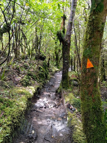
(+2)2.21pm: The track quickly turns into lush green forest as you enter the lowest altitude at the last section.
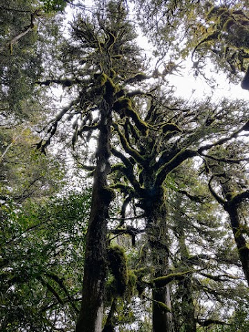
Pretty mossy trees can be seen above.

(+11)2.32pm: 17 km mark.
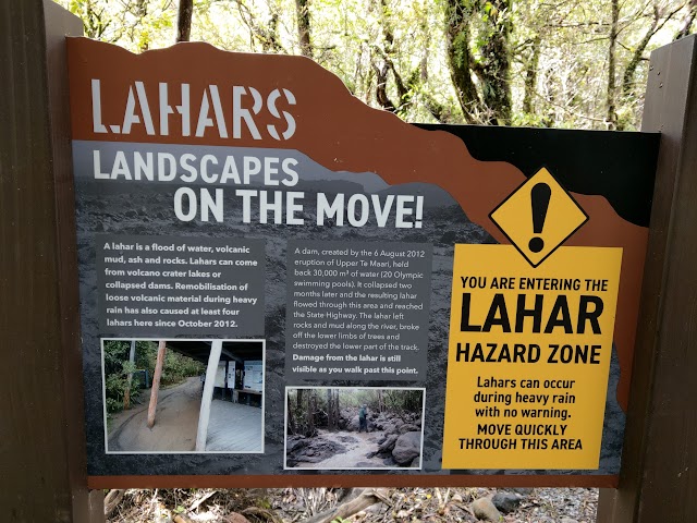
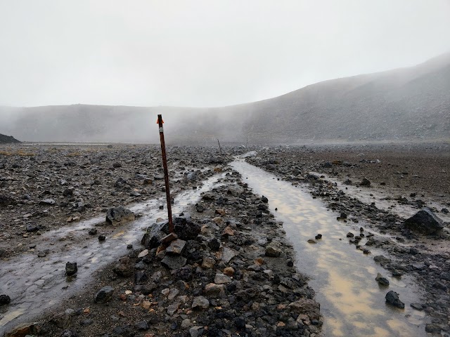
(+20)2.52pm: Entering the lahar (flood of water, volcanic mud, ash and rocks) hazard zone.
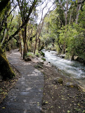
(+3)2.55pm: The track follows beside a fast flowing stream.
Ketetahi Falls

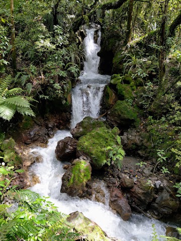
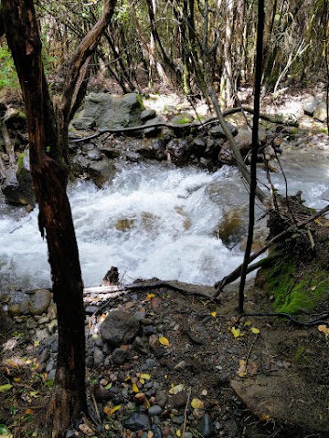
(+7)3.02pm: A one-minute sidetrack from the main track to Ketetahi Falls, a small creek-fed cascade waterfall. Look out for the ‘viewing’ sign at the main track to reach the waterfall.

(+7)3.09pm: 19 km mark. Almost there.
End of the Tongariro Alpine Crossing, Ketetahi road (760m)
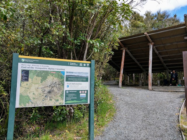
(+5)3.14pm: Finally, at the end of Tongariro Alpine Crossing track. Completion within 7 hours.
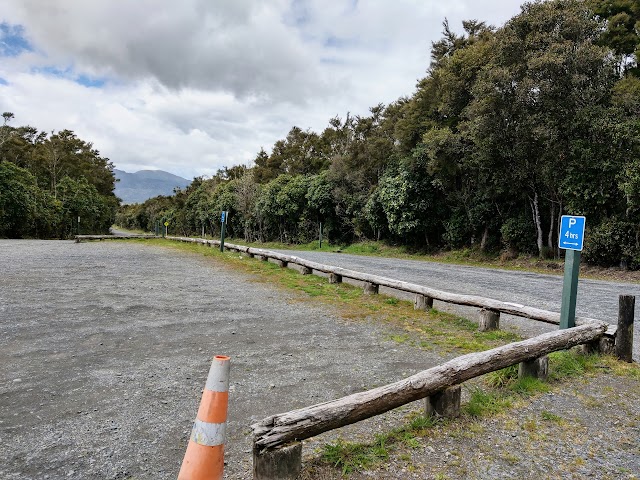
Ketetahi road car park, with its maximum 4 hours parking restriction. This is also the shuttle bus pick up zone if you have booked one.

As recommended on the signboard, it’s best to start Tongariro Alpine Crossing at Mangatepopo road end, as the crossing from Ketetahi adds a 350 meter climb, making it more exhausting.

(+6)3.20pm: As I only booked the one-way shuttle bus trip, I still have to walk another kilometer of Ketetahi road to my car.

Looking back at Tongariro National Park from the road and the weather seemed to be clear now. Perhaps I’ll be back for a clear sunny day hike?
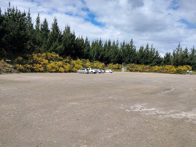
(+15)3.35pm: Reached the state highway and crossed to the opposite’s Ketetahi car park. Only a few cars due to the bad weather.
Now that you’ve seen Tongariro Alpine Crossing, continue on reading about Tongariro Northern Circuit!
帖子有帮到您吗?在您的登山故事和帖子中标记 @meowtainpeople 吧!


*地球队长经过* 记住,请保护我们的环境,请勿破坏大自然。不要留下任何垃圾,只带回照片和回忆(如果可以的话,还可以捡走一些垃圾)。请在指定的路径上行走,并尽量保持在中间行走,以使裸露的土壤不会进一步扩散/腐蚀。与大自然融为一体吧 *飞走了*
支持本网站的附属链接:
透明度万岁!:以上链接是会员链接,如果您用此链接购买或预订的话,我可以赚取佣金, 而你也不会被收取额外费用。 我只推荐我使用的产品和公司。您的支持可以帮助我保持网站的运行,让我继续用心分享🙂
想在您的网站进行相同的联属网络营销吗?用这个 AccessTrade 平台链接 获取 RM5 奖励。