
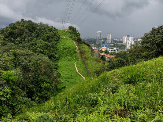
The Sri Bintang Hill Trail is a popular hiking spot for the residents around the area of Bukit Sri Bintang. Although it is not as well known as other hiking spots in KL, such as Bukit Gasing or Apek Hill, there are always a good number of hikers around. It is a small area to explore with relatively easy hiking trails. While there are straightforward main paths to reach the peaks, you can also explore different subroutes and even loops, as there are many split paths in the area.
While it may be confusing at first, the split paths are mostly connected to the same destinations (eg. peaks / entrance). You can easily guess your desired paths by its general direction, so a simple study of the area and a compass would be useful. One can test their navigation and orientation skills here, with minimal risk of getting lost. Below was my first attempt of hiking Bukit Sri Bintang Hill trails, and I did a loop covering some highlights:

Bukit Sri Bintang Hiking Trails
Trailhead / Entrance


This is the trailhead at Sri Bintang Hill. There were some spots to park your vehicles around the area but please make sure it does not cause any blockage or inconvenience to the neighborhood.
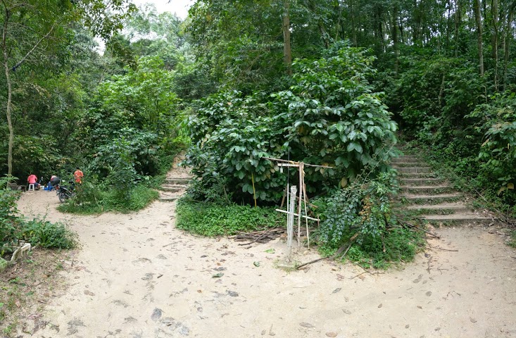
First, following the main path, you’ll find two paths in the beginning. Both paths bring you to the peak. There is also an area on the left, with water and brushes to clean your shoes after the hike.


There were quite a few split paths right at the beginning. At first I took about two lefts.


Then, I saw an opening to switch to another path on the right. Turned out the path on the right side is the more direct / main route to the peaks.
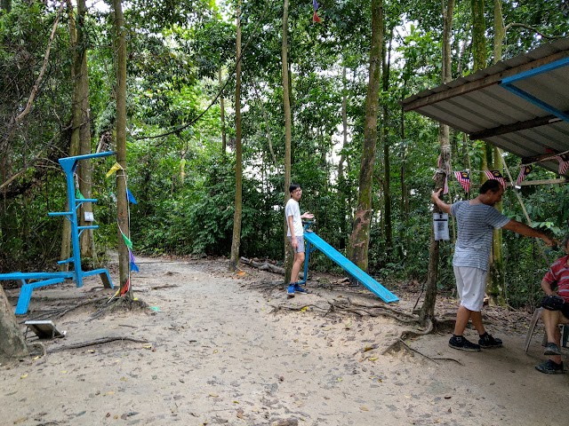
A rest stop with exercise equipment.
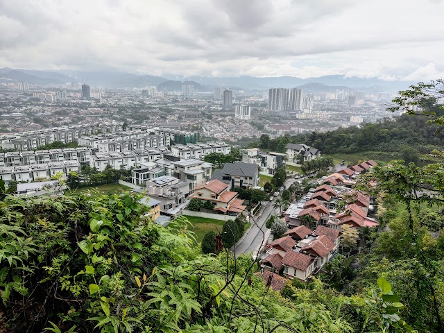
Bukit Sri Bintang Peak 1


Using the direct path, it took me only about 10 minutes from the start to reach the first peak. You can see the second peak from here.

Another side of the view on Bukit Sri Bintang Peak 1. It’s raining, hence it’s blurry.
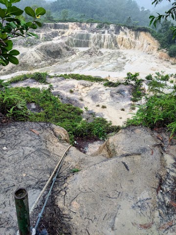
There was this steep path with ropes to assist hikers to go down to the deforested area. I did not go down but later on I appeared on the other side of this area.


My next destination is the second peak. You could either take the open path from the first peak, or head a little back to the trail and take the first small path on the left. Both are similarly easy.


Then it’s another 10 minutes hike up to the second peak.
Bukit Sri Bintang Peak 2

The views at the second peak of Sri Bintang Hill.


Passing by a ‘mini farm’ by the hill, I passed by a makeshift rest hut. My first thought was to head back to the first peak and exit the trail, but I saw more trails at the back of the hut.


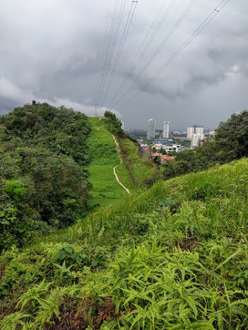
I explored the trails at the back and saw a glimpse of the highway on the South. Stumbled upon this trail by the drain and followed it.


I later learned that people named this the ‘Highway Stairs’. I walked to the bottom to find a dead end with the highway at the side.


Just before the dead end there is a path at the side (on the right side when coming up). I took it.


Multiple split paths on the way. I took mostly the right to reach the deforested land.
Stacked Rocks
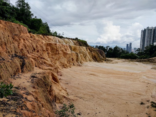
Soon, I reached the deforested area. You could see the first peak at the opposite end.

I went for a detour to the path at the right.
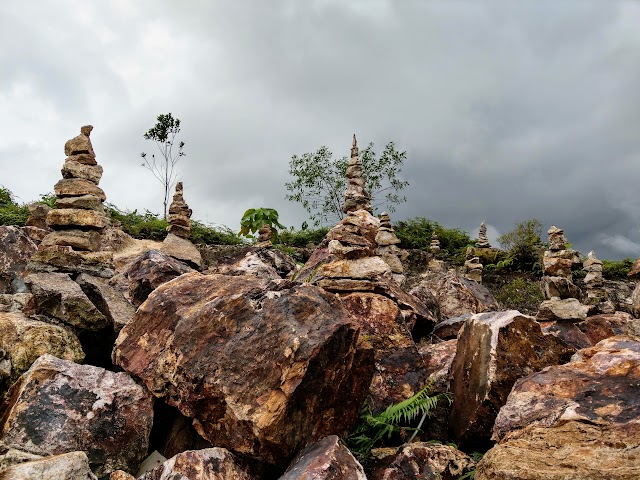
To my surprise, I found a lot of stacked rocks around the area.
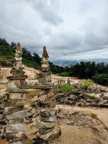
A representation of Petronas Twin Towers.
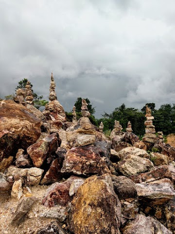
They are everywhere!


I made a u-turn and continued the trail. More split paths where I usually take the right, but some bring you back to the deforested area at a different spot (but they are short and easy to backtrack).

Then, the trail led me back to the first peak.


Time to leave, but this time I decided to use a different path. I took a path at the back of this rest hut. It has more split paths and junctions but are easy to guess, based on their general directions.

Finally, I popped out from a small trail to the main path near the exit. I spend almost one and a half hours exploring the trails and completing the loop.
P.s. What I like about this place: No mosquito!
Have this guide helped you? Tag @meowtainpeople in your hiking stories & posts!
Affiliate Links to support this site:
Yay for transparency!: The links above are affiliate links, and at no additional cost to you, I earn a commission if you make a booking/purchase after clicking the links. I recommend only products and companies I use. Your support helps me keep the site going 🙂
Want to do the same affiliate marketing with your site? Use this AccessTrade platform link to receive RM5 reward.

*Captain Planet passing by* Remember, please take care of our environment, and please don’t destroy the Nature. Leave no trash behind and take back only photos and memories (and also some trash if you can). Walk on the designated path and stay in the middle as much as you can, so that the exposed soil doesn’t spread/corrode further. BE ONE WITH NATURE *flies away*
wah…menariknya pengalaman you hiking…teringin nak hiking jugak lepas2 covid ni..
Terima kasih Yusuf, selamat mendaki! 😀
thanks for the info Jenn. cute lah nama Meowtain haha😂🐱
Thank you haha, glad that you find the info useful
tghari ni nak try yg way thru the longkang all the way to highway…is it hard to find?
Hmm… Not too hard I guess, maybe some luck and keep more to the right as go head down from the back of the hut.