
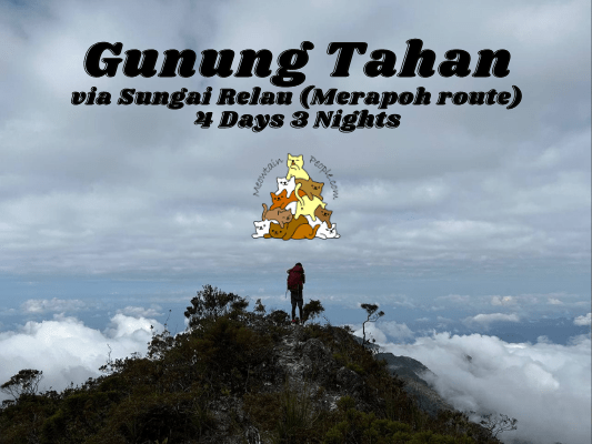
Mount Tahan, with a height of 2,187 meters above sea level, is the highest point in Peninsular Malaysia. It is a to-go place for many seasoned hikers who target the highest mountains in Malaysia. There are two official routes to summit Mount Tahan: via Merapoh Trail which is the shorter and easier route, typically consists of a 4-days-3-nights return trip; On the other hand, Kuala Tahan Trail would take 7 days if you descent via Merapoh route, and more if you are doing a return trip back to Kuala Tahan.
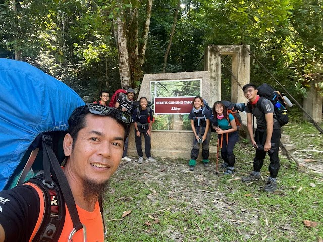
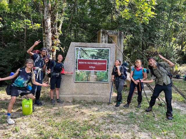
On this trip, I took the 4D3N Merapoh – Merapoh Route to Gunung Tahan, in an awesome team of six, plus our epic, chill and friendly Abang Sabri the Guide. Special thanks to my friend Lucy for planning and gathering us for the trip!
What To Bring For Mount Tahan via Merapoh Trip & Pre-Hike Items Check

On the first day of Gunung Tahan trip, before entering the trail, you are required to present all items you are bringing into the forest. The forestry officers will check and record the number of items you have, and to check again when you exit the forest at the end of your trip, to make sure you do not leave anything behind in the forest. Each single plastic wrapper, container, plaster (band aid), etc. will be counted and a heavy fine will be imposed for each lost item (RM50 per lost item).
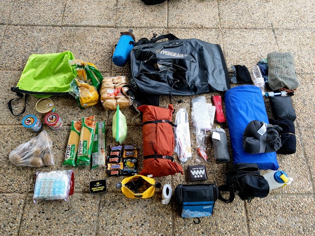
Here are the items I bought for Gunung Tahan Merapoh Route for your reference:
- Hiking Bag: I lend my 40 liter mountain hiking backpack to one of my teammates, leaving me with my 30 liter Hypergear waterproof backpack. It was enough for my personal items but left me no space for the food items. Recommended minimum bag size to bring: 40 liter.
- Additional Waist Attachments: One Bottle pouch with pocket for phone. One simple large bottle pouch.
- One Large Dry Bag: An additional carry-on to compensate for my small backpack, to carry the shared food items.
- Water Bottles: One 1-liter bottle of water for drinking. One 1.5-liter empty bottle for carrying additional water for cooking / filtration uses. One 500ml bottle attached with a powerful portable bidet sprayer.
- Clothes: One set of light hiking clothes worn on the body (recommended shorts: Kalenji Run Dry Shorts with integrated brief). One set of after-bath light clothes for sleeping. Lightweight fleece jacket, lightweight fleece blanket, head scarf, hiking raincoat, lightweight microfibre towel.
- Hiking Shoes: I wore a pair of Adidas Kampung, hence I do not have to worry about wet shoes when crossing the river.
- Camping Gears: Tent, ultralight weight large ground sheet, air mattress, air pillow.
- Portable mini water filter: I use and recommend HydroBlu Versa Flow. You will be crossing the river multiple times and passing through some water points throughout the journey. Also, each campsite of the night has a water source, so you do not have to carry too much water during the hike. There is only one longer stretch of route with no water source, which you would need to carry a full bottle of water for drinking, and extra water if needed for lunchtime cooking.
- Shower Bag with personal hygiene items & toiletries (wet tissue is not allowed – it is bad for the environment)
- First Aid Kit: For this trip, I have 1 tube of antibacterial cream, 1 tube of hydrocortisone, 1 pair of surgical gloves, 4 waterproof dressing films, 12 strips of plasters, some gauze pads, surgical tape, elastic bandages, ibuprofen tablets, anti diarrhea tablets, anti allergy / acid reflux tablets, and a mini tweezers for any thorns stuck in fingers.
- Smart Phone: There will be charges of camera fee (RM5) for each device that can be used for photography.
- Rechargeable Headlight: You need it when moving around at dark.
- Powerbank and charger cables
- 4-in-1 compass & whistler
- Trowel: To dig your own toilet. I did not have a light trowel so I brought a random piece of light aluminum flat-bladed thingy. I thought of using sticks found in the forest but it would be too difficult to dig a proper hole.
- Portable Bidet: I use this mini yet powerful CuloClean portable bidet after I answered the nature calls.
- Minyak Cap Kapak: An effective leeches repellent. You can also use it to soothe headache, dizziness, stuffy nose, muscle pain, etc.
- Extra plastic / ziplock bags for keeping trash / food / miscellaneous items
- Food Items: We planned and shared the load of the food among our group. We also brought camping stoves, gas canisters, pots and utensils.
- Our guide brought a large flysheet and groundsheet for us to share.
Yay for transparency!: Some of the links here are affiliate links, and at no additional cost to you, I earn a commission if you make a booking. I recommend only products and companies I use. Your support helps me keep the site going 🙂
Info & tips for a better loadout for Mount Tahan via Merapoh:
- Having a sleeping bag would be a better option. With that you can skip bringing the air mattress and blanket mentioned above.
- I brought my waterproof backpack, so I do not have to worry about getting my stuff wet during river crossings. As hiking backpacks in general are not waterproof, you need to line a large dry bag, or a heavy duty garbage bag in your backpack, to store items that must be kept dry at all cost (such as sleeping bag and clothes)!
- During our trip, there was a new Covid SOP where each hiker is required to bring their own tent. It will be checked at the office before they allow you to enter the forest.
How to book for your Mount Tahan via Merapoh trip
For our trip, our members directly contacted the Forestry Department (tnsgrelau@wildlife.gov.my for Mount Tahan via Kuala Juram – Merapoh; and tnp@wildlife.gov.my for Mount Tahan via Kuala Tahan) and a guide whom they met before, to make the bookings and arrangements.
However, starting from January 2022 as part of Taman Negara’s Service & Safety Enhancement Campaign, you would need to go through one of the agencies appointed by the National Park to make your bookings. Below are the agencies listed and contacts provided by the National Park as of February 2022:
- Sgi Outdoor: +6017 907 4241 (Pn.Fauziana / Sukri)
- R.A Adventure: +6013 605 6941 / +6017 706 5470 (Cik Laila); +6017 915 3034 (Pak Teh Lan) / +6010 420 6899 (En.Fairul)
Still, you can also contact our guide, Abang Sabri (+6014 290 5289), and he would make the booking and arrangements for you, which could be cheaper than going through a ‘Gogo’ or agency, and he could include additional bonus trips and activities for you.
In addition, you may check out Sungai Relau (Merapoh) page and Kuala Tahan page for some useful information (though they may not be up to date).
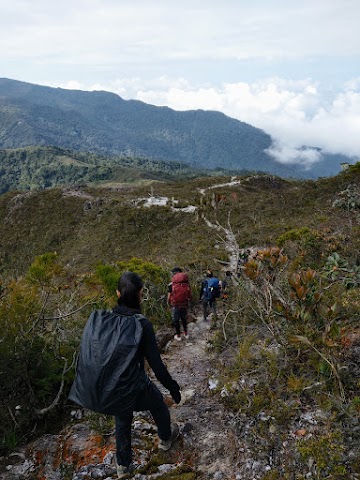
Mount Tahan via Merapoh - Day 1
0 km - Kuala Juram (309m altitude)

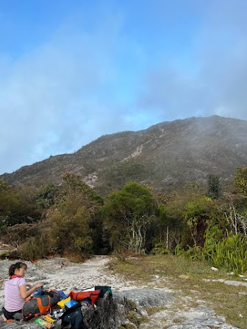
After the item checks and briefing at the forestry office, we got up the 4×4 and took a 20-25 minutes 13km ride to the starting point of the hike at Kuala Juram.
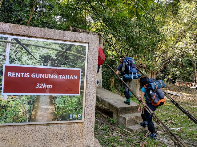
10.42am: After the final briefing by our guide, we began our journey by crossing a small hanging bridge.
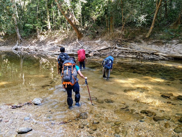
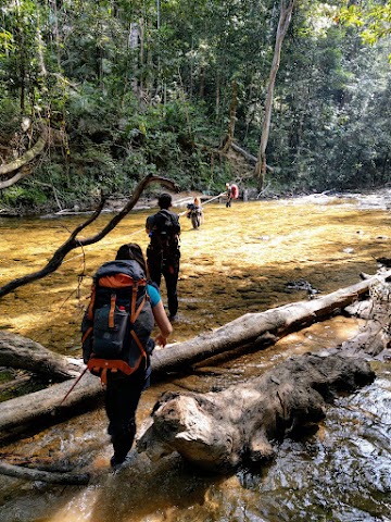
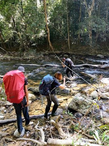
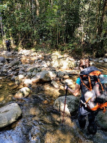
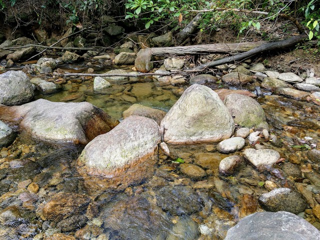
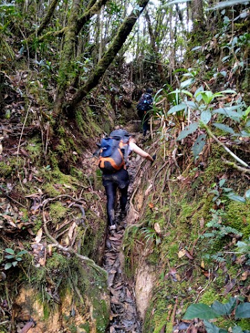
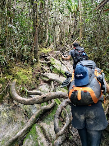
(+12)10.54am: First river crossing. We will be crossing the same Sungai Relau river multiple times.

(+7)11.01am: Second river crossing after a short hike. So far not very deep.

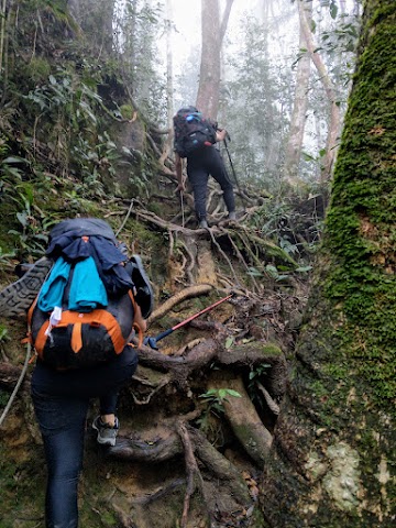
(+11)11.12am: Passing by a big Tualang tree.
(+31)11.43am: Third river crossing.

(+14)11.57am: So far the trail was pretty flat with some mild inclines.
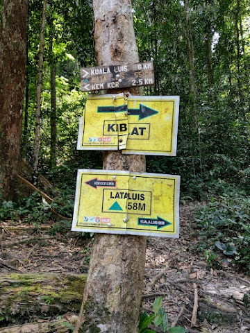
5 km - Kuala Luis (306m altitude)
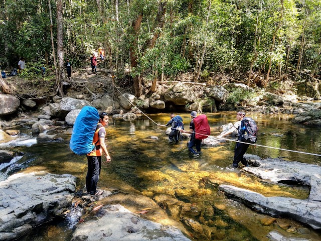
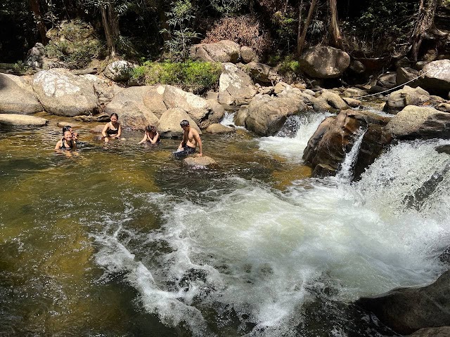
(+15)12.12pm: Our fourth river crossing at Kuala Luis, which would be the deepest one to cross. The deepest part went up almost to our waist area. (It was a dry season / end of monsoon season during the time of our trip)
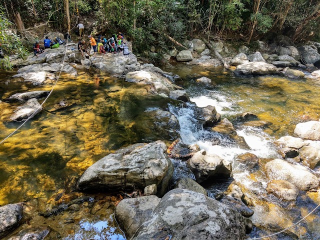
Here, we met the group that was coming down on their last day of their Gunung Tahan trip. We crossed the river and took a rest while looking around the area.

A nice spot upstream.
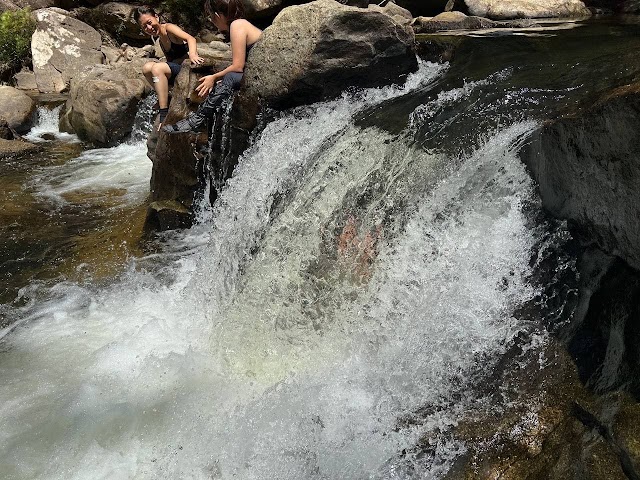
A nice mini cascade and pool area downstream, where we took a dip when we returned on our last day.


12.47pm: After a half an hour break, we headed on towards Lata Luis for lunch.
11 km - Lata Luis (558m altitude)

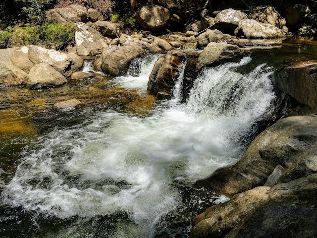
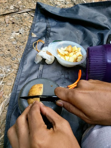
(+1 hour 18 minutes)2.05pm: After an hour plus of mild uphill hikes, we reached Lata Luis and had a lunch stop here. We had pre-boiled eggs and pita bread with jackfruit rendang curry.
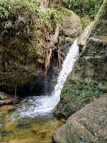
From this camp site, you can hike down a little bit, to reach a nice pool with a small waterfall for water supply.

There were quite a lot of reddish stingless bees attached to us at Lata Luis.


3.26pm: After lunch break, we continued our hike towards our campsite for the first night. We did our fifth river crossing.
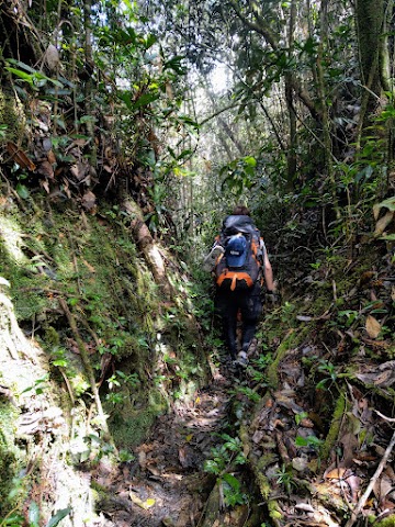
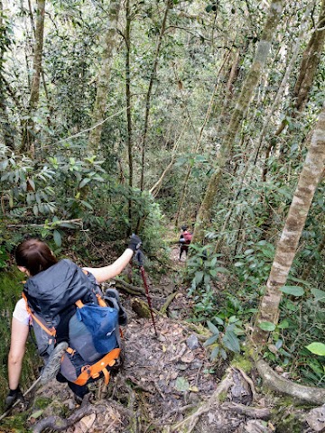
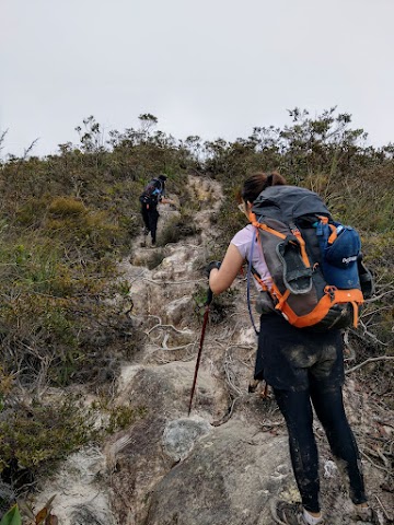
(+9)3.35pm: The following stretch of trail consists of some steep uphill climbs that give you the heart-pumping cardio rush, especially with the full weight of your backpack and all the food supplies.
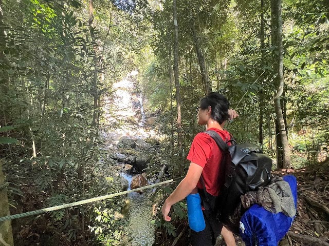
(+4)3.39pm: A waterfall viewpoint to catch your breath from the steep climb, before continuing on with more inclines.

Spotted some unique looking plants with paint-like dotted patterns.
(+38)4.17pm: Our sixth and final river crossing of the day.
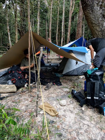
13.5 km - Kem Kor (750m altitude)
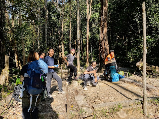
(+9)4.26pm: Happy faces reaching the campsite of our first and last night – Kem Kor.

Setting up our common space.

The Tahan Ladies
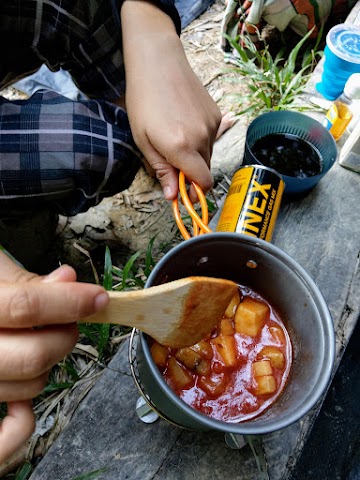
Mini kitchen in action!

Kem Kor features a nice flowing river with nice pools to take a nice cold bath.
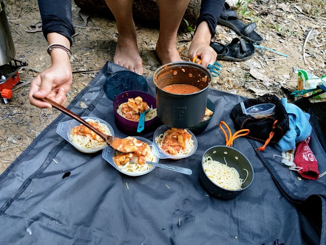
Dinner for the first day: Rounds of boat noodles with Western fusion.
Mount Tahan via Merapoh - Day 2


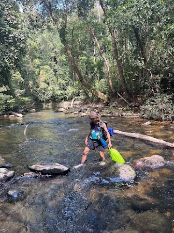
8.27am: After our quick breakfast, we started our hike from Kem Kor on day 2. There would be some shallow river crossings at the beginning, where you could step on the rocks without getting your shoes wet.

The second day of Gunung Tahan Merapoh route would be the toughest, as we need to take on a longer distance (16km) with steep inclines from Kem Kor, all the way up to Bukit Botak. The first day was an easy 13.5km hike from Kuala Juram to Kem Kor. (Image obtained from tamannegara.asia)


Incline hikes right after we left the river.
16 km - Permatang (874m altitude)
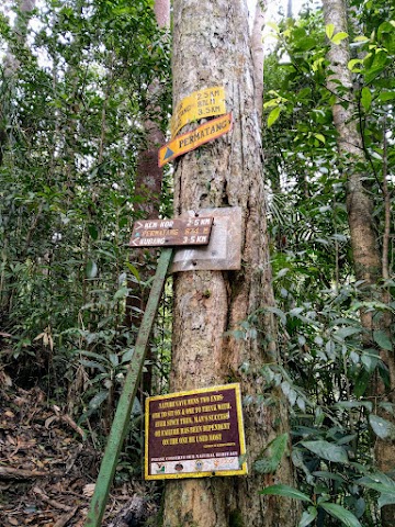
(+51)9.18am: We reached Permatang from Kem Kor within one hour.

(+12)9.30am: We took a 10-minute break at Permatang, ate some dried fruits to re-energize ourselves before continuing our journey.
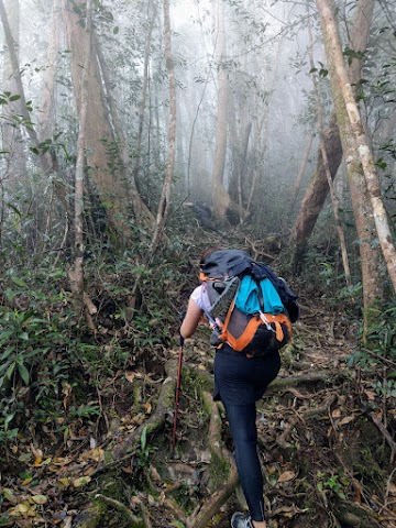
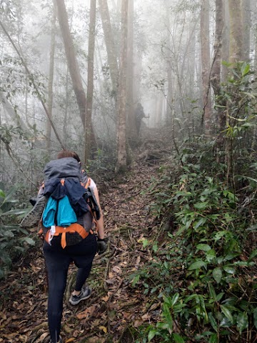
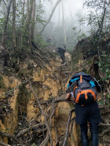
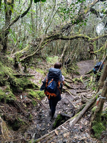
(+32)10.02am: Eventually, as we gained altitude, the forest became misty and mossy.
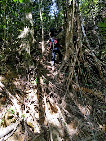
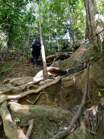
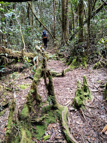
(+19)10.21am: Lots of tree roots climbing.

(+14)10.35am: The first appearance of a ladder.
(+32)11.07am: More roots climbing.
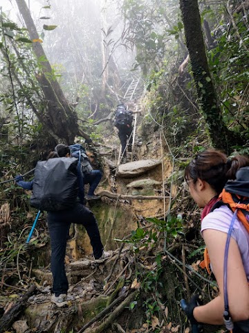
(+8)11.15am: The next set of ladders.
19.5 km - Kubang (1406m altitude)
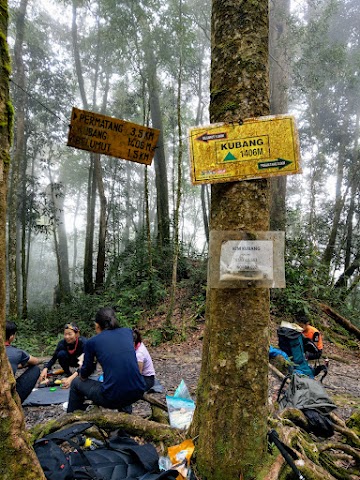
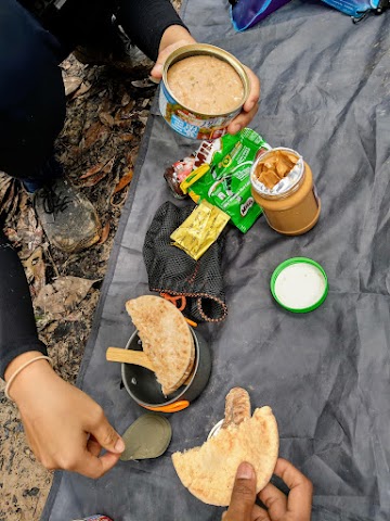
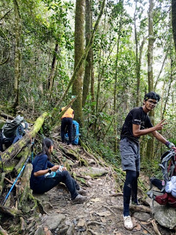
(+17)11.32am: Next, we managed to reach Kubang before noon and stopped for an early lunch break. I love this spot as it was misty, mossy, cooling, and no leeches! We had pita bread with tuna spread, peanut butter, and mixed hot drinks.
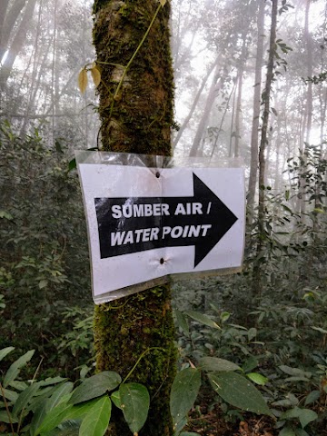
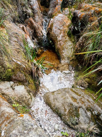
Nearby Kubang, there is a water point to refill water if needed. Just follow the water point signs.

After 5 minutes following the trail, you will reach an area that looks like another campsite.

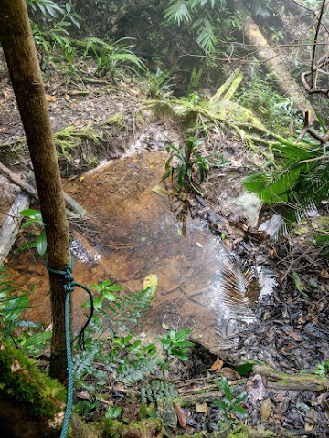
Find the last sign and walk down the slippery trail down to the water point.
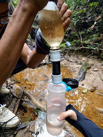
The water here was pretty murky and brown, so you would need some sort of water filter (such as this HydroBlu Versa Flow) to clean the water.
12.38pm: Back to Kubang, we resumed our journey towards Belumut. This stretch of trail wasn’t too steep and we had a nice, chilled hike.
21 km - Belumut (1493m altitude)
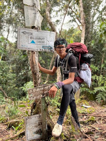
(+39)1.17pm: We managed to cover the 1.5 km trail within 40 minutes. (In photo: Our teammate, Jebat the Legend)
According to our guide, this spot used to be very beautiful, before the surrounding trees had to be cut down for helicopter rescue/evacuation operations.


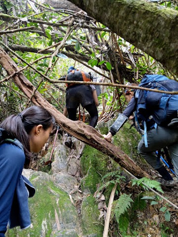
1.31pm: After our break and dried fruits snacking, we started our long 5.5km hike towards Bonsai, passing by some muddy trails.
Bukit V - Last water point before Bukit Botak

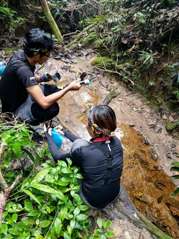
(+44)2.15pm: After one point of the trail, after a big drop, we reach Bukit V. There was a V-junction: the main trail towards the top on the left, and a water point to the right. This would be the last water source from here until the final one at Bukit Botak campsite. It was trickling water, so it took some time for us to refill our water.
2.51pm: After a break at Bukit V and had our water refilled, we continued on our journey toward the next checkpoint at Bonsai.
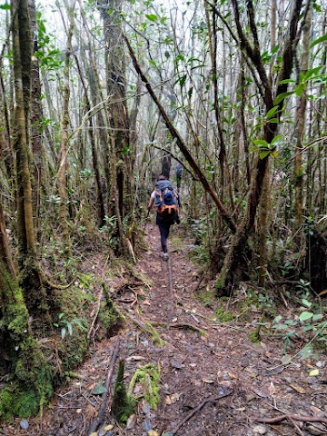
(+43)3.34pm: More mossy and muddy trails.


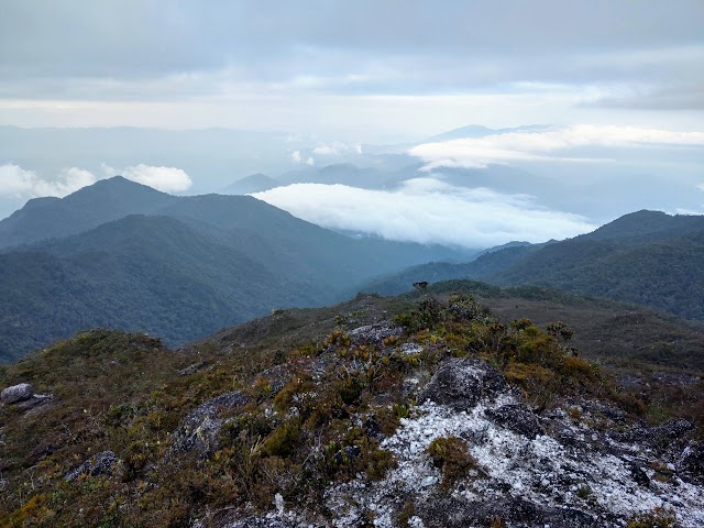
(+33)4.09pm: Here we got our first rare glimpse of an open sky view, after hiking through dense forest.
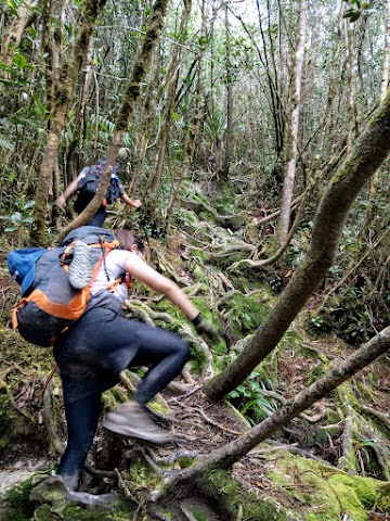
(+22)4.31pm: More climbing through tree roots.
26.5 km - Bonsai (1705m altitude)
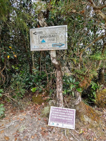

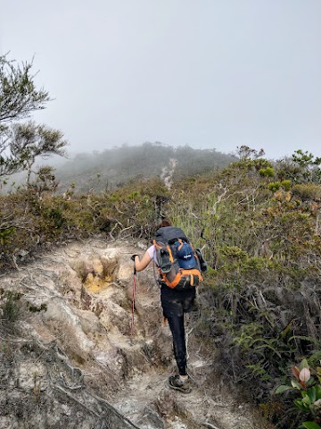
(+19)4.50pm: After a long 13km hike throughout the day, we reached Bonsai, the last checkpoint before our campsite. The name Bonsai probably comes from a nice tree at this checkpoint. At this point, we were quite exhausted already. From here, we still have three more kilometers to cover before Bukit Botak.


5.09pm: After a 20-minute break and a quick snack of dried fruits, we pushed on. The trail here obviously changed, turning into a high-altitude forest.
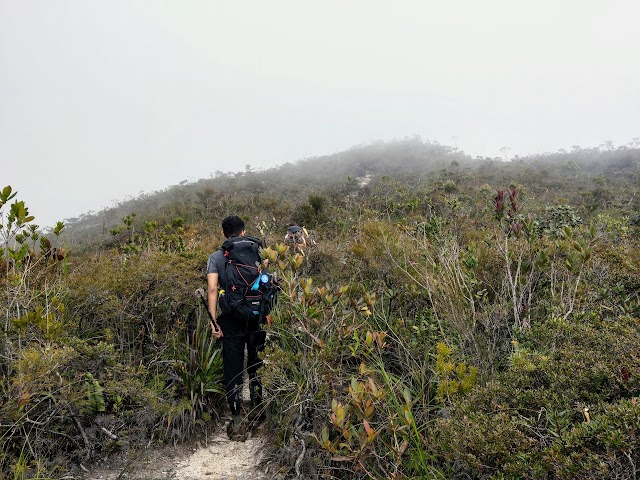
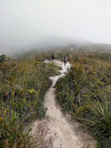
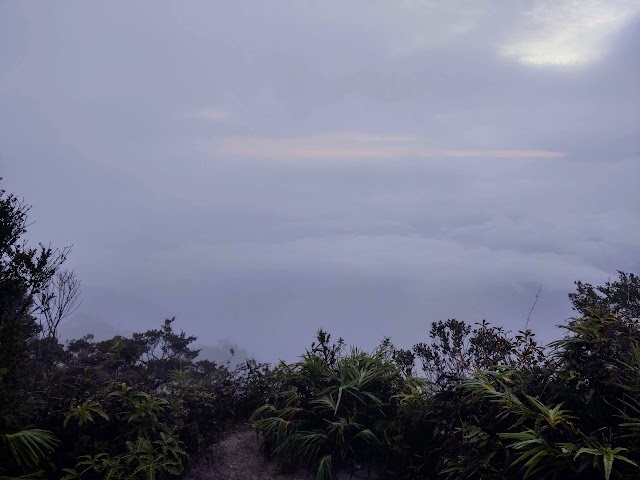
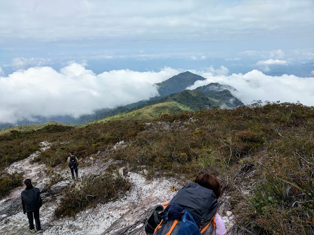
(+29)5.40pm: We started hiking underneath the open sky, with the misty clouds occasionally blowing over us, blurring out our views.
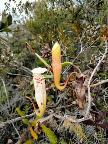
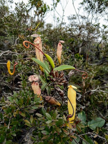
We spotted many pitcher plants / monkey cups along the way.
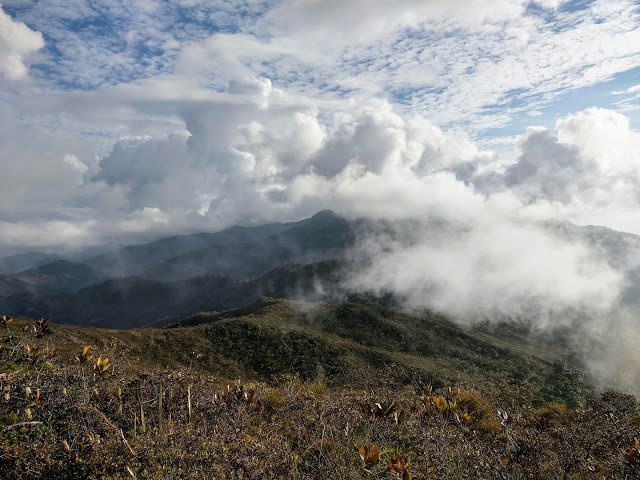
(+19)5.59pm: The cloudy mountainous view was just breathtaking!
“Are we there yet?”
The journey here was a physical challenge with an exhausting mind game of ‘is that the last peak?’. We kept seeing one hill in front of us, but once we reached the top, we then saw the next taller peak in front of us, and it just kept going!
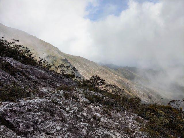

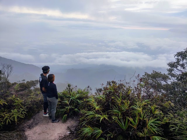
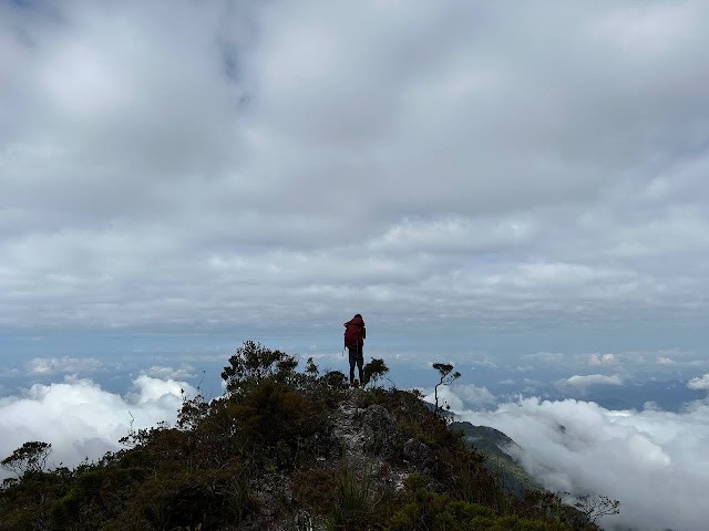
No matter how tired we were, the views were definitely worth it! We were so close to the clouds!

(+30)6.29pm: Saw a pole structure ahead, is that the campsite?
(+2)6.31pm: Nope, it’s a rainfall recording device.

(+5)6.36pm: This looks like good news, is that it?
29.5 km - Bukit Botak (1943m altitude)
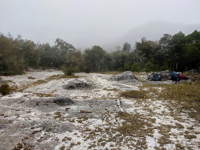
(+2)6.37pm: Yes! Finally, we reached our second night’s campsite at Bukit Botak before the sun was down!
The peak of Mount Tahan is behind this hill (plus other hills blocked by this hill), where we will ascend the next day early in the morning. Now, time to set camp, wash up and get ready for dinner.
Our trusty water source, 1.9km above sea level at Bukit Botak Campsite.
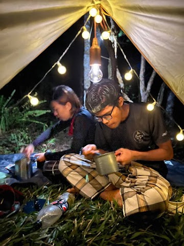
We had hot dinner under the tarp with fancy lights, thanks to the one and only Jebat, who carried the lights all the way up here haha.
Mount Tahan via Merapoh - Day 3
5.45am: After enduring a bone-chilling 8℃ night, we woke up early at 5am-ish. We got ready and started climbing in the dark toward Mount Tahan peak. (P.s.: Highly recommended to bring a good sleeping bag and a pair of warm socks. I touched my exposed toes in the middle of the night and it felt like touching ice! I ended up with numb toes for 2 weeks, probably had my nerve endings killed off by the cold.)
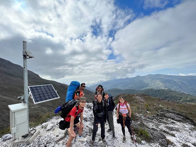
31.9km - Gunung Tahan (2187m altitude)
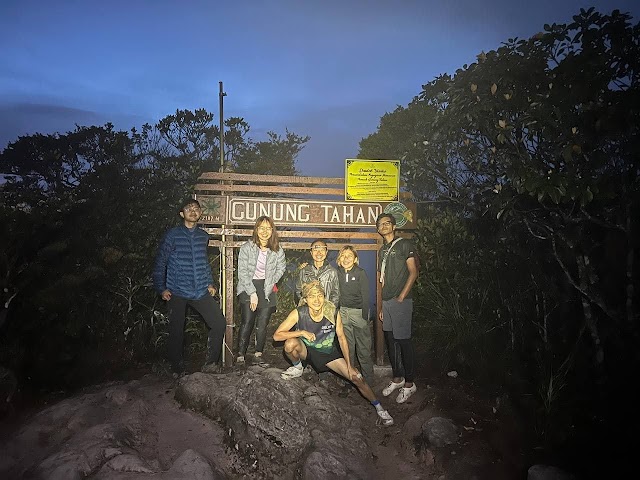
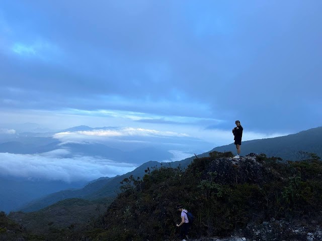
(+50)6.35am: Within an hour of hiking under the bright moonlight and chilling breeze, we summited Mount Tahan, the highest peak in Peninsular Malaysia! Usually I get pretty warm when I hike, hence the singlet & shorts combo. I did wear back my fleece jacket when I cool down at the peak, waiting for the sunrise.
7.05am: The sun was up but due to the cloudy weather, we didn’t get to witness the sunrise. Anyway, we were already very happy and satisfied. According to the guide, one could see Kenyir Lake from here during a really clear day. Of all the many Mount Tahan guides he did, he got to witness that view only twice.
7.40am: We got a very nice view when the day got brighter. Check out the top part of the sky, we got our own ‘aurora’!
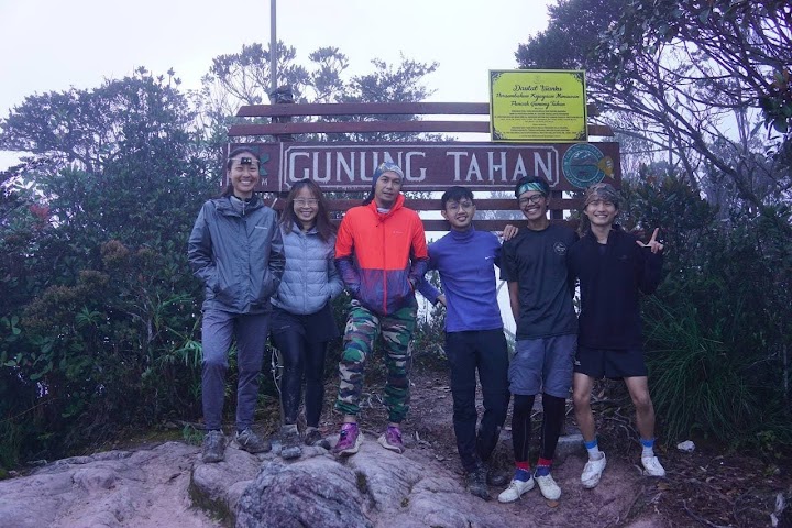
Photo session with Abang Sabri, our awesome guide.
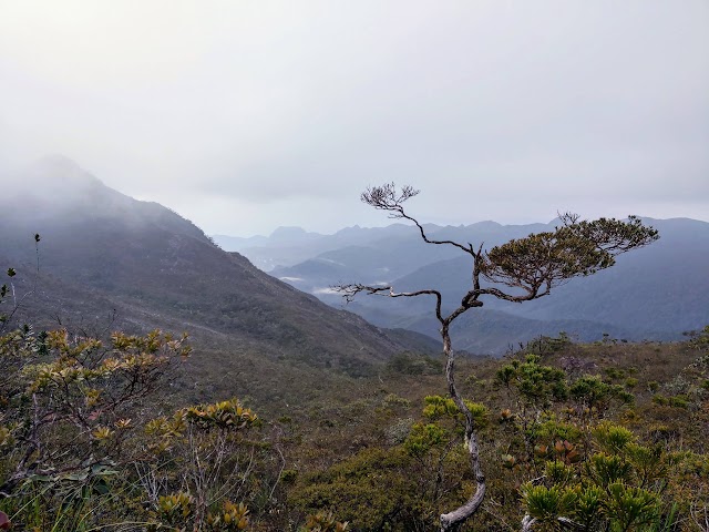
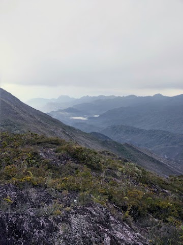
We started heading back down to Bukit Botak campsite at 7.48am. Below are some of the magnificent views of the mountain range we saw:


Heading back to Bukit Botak campsite where we could see at the bottom.
10.10am: After breakfast, we packed our stuff and began our return journey down the mountain.
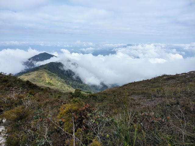
Once again, we were in awe of more stunning views on the way down from Bukit Botak.
50.3 km - Back to Kem Kor (750m altitude)
(+9 hours)7.10pm: After a long and steady hike down the mountain range, we managed to get back to Kem Kor before dark.


The dinner of our last camping night was the most luxurious one. While we had our noodles, our guide cooked extra and treated us with his delicious dishes of sauté cockles, appetizing spicy soup and rice!
Mount Tahan via Merapoh - Day 4

On our last day, we had a slow morning getting up and making breakfast as we did not need to rush. We packed everything and left the campsite at 11.11am.
58.8 km - Back to Kuala Luis (306m altitude)
12.38pm: With our lightened backpacks with the food consumed, we moved swiftly through the 8.5 km forest and reached Kuala Luis within one and a half hour to have a simple lunch break and fun at the river.
A mini waterfall where you can actually hide behind the curtains of water.
63.8 km - Back to Kuala Juram (exit)
Another 5km of hiking and a few river crossings later, we exited the trail at 3.50pm. A pickup truck took us back to Sungai Relau forestry office for item checks, fortunately we did not lose any item and get any fine. We collected our Mount Tahan via Merapoh certificates and off we went!
Have this guide helped you? Tag @meowtainpeople in your hiking stories & posts!
Affiliate Links to support this site:
Yay for transparency!: The links above are affiliate links, and at no additional cost to you, I earn a commission if you make a booking/purchase after clicking the links. I recommend only products and companies I use. Your support helps me keep the site going 🙂
Want to do the same affiliate marketing with your site? Use this AccessTrade platform link to receive RM5 reward.

*Captain Planet passing by* Remember, please take care of our environment, and please don’t destroy the Nature. Leave no trash behind and take back only photos and memories (and also some trash if you can). Walk on the designated path and stay in the middle as much as you can, so that the exposed soil doesn’t spread/corrode further. BE ONE WITH NATURE *flies away*

Hi do you organise hike to Gunung tahan again?
Hi Poh Lin, I would like to do Gunung Tahan via Kuala Tahan someday but I am not an organizer/guide though.
You may refer to the contacts above for your bookings. Thanks!
Wonderful post with so many details and photos! ^^ Do you happen to know if tents are available for rent from the forestry office or around the area? Thanks!
Thanks for reading the post!
The last time I checked before my trip, there wasn’t any tents available for rent from the forestry office or nearby areas.
May I know the rough budget for the trip? ( minus tools and gears) How much do we need to pay for the entrance and do we need licenses or permission to hike there?
You may check the pricings with the contacts I shared in the post 🙂
The package I got from Abg Sabri at that time was RM250 per pax for a group of 10 (without chef and ration)
Hi we’re a group of minimum 4. Looking for hiking 5 days via Merapoh enter and exit. Appreciate the itinerary and price. Thanks.
Hi Chin. I am not the organizer. Please refer to the details and consult with the contacts given in the post above. Thanks.
Awesome story
I can relate it fully bcoz went there one month b4 your trip
U didn’t mention rain except telling us some muddy trails, so u n buddy should be fortunate enough to endure a nice hike, just like me(only some short n light shower during night time at Kem Kor n Kem Botak)
Love to do a K2M but too tough for an old man like me(61 now), hahaha !
Thank You very much for sharing a great hiking journey
Awesome! Well done Abduh! Hope I can be as tough as you when I’m at your age
Yeah we were fortunate to have the nice weather on our trip 😀
What a great story and so many details. As a Malaysian who now calls Australia home, I found the comment of 8C and freezing funny. 😉 Really good story and I note all the rules with the National Park which is great to protect and maintain nature.
Hahahaha 8c for you now in Australia is probably a normal day in the South I guess.
Thanks for reading, Kevin!