
Bukit Besi Hiking Trails at Alam Damai, Cheras (2022 update - Additional Forest Reserve)
Cheras is a good district to find hiking spots, there are the well known Saga Hill, Apek Trails, Ketumbar Hill, and also the less known Bukit Besi, which sometimes residents around the area don’t know about. The name (Besi = Iron) comes from the neighboring Sungai Besi which was a historical mining town.
Bukit Besi Trailhead
The trailhead of Bukit Besi starts here:
You can park your vehicle around OCBC Bank, if the parking is full around the shop lots, there is a huge parking area at the back.
Bukit Besi Hiking Guide
Quick Walkthrough
9.47am: Trailhead / Entrance
10.00am: Viewpoints
10.32am: Hammocks Rest Stop
10.42am: Peak – Telecommunication Tower
10.47am: Forest Trails
11.21am: Mini Waterfall
11.42am: Taman Orkid Desa Exit
12.14pm: Loop Exit
Detailed Walkthrough
Bukit Besi Trailhead / Entrance
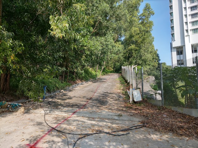

9.47am: Walk up the tarmac road all the way to the top. With the recent additional forest reserve, you could see some poles with red tip along the way on the left side. These poles mark the border of the additional forest reserve on the left side, which you should avoid trespassing. If you want to be extra sure, our friend Peter has created a very useful map to show the area of the new forest reserve border in this Komoot GPS app, which you can track your position to avoid trespassing the area.


(+2)9.49am: You will pass by the first water tank. Follow the tarmac road to the left. There is an opening beside that you can also use but has less viewpoints (we will exit from here later).


(+2)9.51am: Very soon, you’ll reach the second water tank. From here, walk to the right side of the water tank. (The left side used to be the preferred path, but it is now a forest reserve border on that side.)


(+3)9.53am: Walk through a bushy and steep trail for a short while.


At this junction, keep to the right. The left side is towards the forest reserve and there was a tape to block hikers from passing through.
Bukit Besi Viewpoints

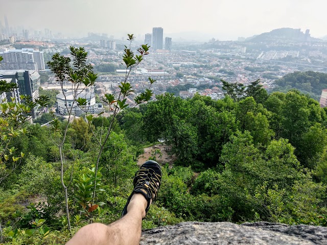
(+7)10.00am: Follow the trail and you’ll reach the first viewpoint pretty quickly.

+0)10.00am: City view from here

(+3)10.03am: Continue the hike from the viewpoint through here.
The short steep climb starts here.


(+2)10.05am: The steep stretch

(+2)10.07am: Top of this stretch is a rock with city view
(+2)10.09am: A good place to sit and enjoy the scenery


Some colorful bugs along the trails.

(+2)10.11am: Walk a little further, you’ll find another little spot for city view


(+2)10.13am: Continue to walk and there is a spacious viewpoint


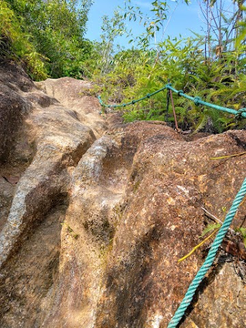
(+4)10.17am: Unique rock cliffs

(+4)10.21am: Going further up via the left path, there is this little spot to climb.

(+1)10.22am: Standing on the top gives you another wide viewpoint

(+5)10.27am: Head back to the previous spacious viewpoint, enter this middle path.
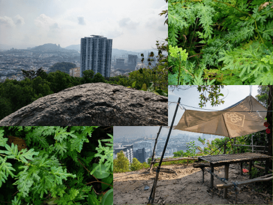
Hammocks Rest Stop

(+2)10.29am: Take the left path going up


(+3)10.32am: More fake flowers placed by someone, the rest stop is near.

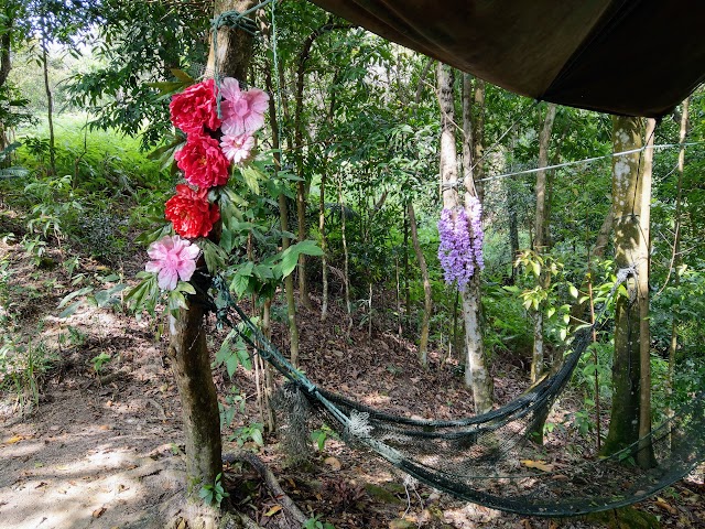
(+0)10.32am: A rest stop with makeshift benches, hammocks and dumbbells.
Bukit Besi Peak: Telecommunication Tower

(+3)10.35am: Continue the hike after a short break.

(+4)10.39am: At the following split path, take the left.

(+3)10.42am: Very soon you’ll reach the peak, indicated by a telecommunication tower. (Picture from 2020)

Latest picture taken in late 2021. The side towards the tower is now blocked by military blockade.

(+2)10.44am: You can either turn back, or if you have more time and energy, enter the trail at the side of the tower to complete a loop.
Bukit Besi Forest Trails

(+1)10.45am: Walk along the side of the fence, turn right and go down at the opening.

Go down here


(+2)10.47am: The paths get shady and cooler here.


Don’t forget to enjoy the environment, look up to the canopy and down to the bushes around you. There were monkeys swinging around making noises on the trees.
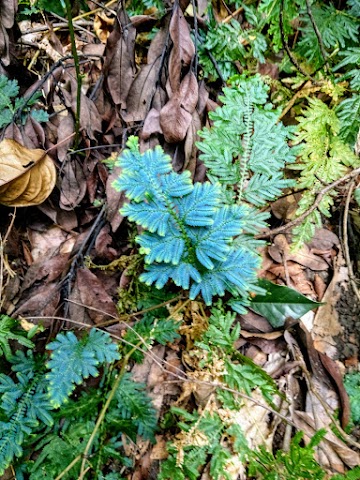

You may notice some of the plants glowing in blue under the sun

We saw some fresh chewed up wood pieces a couple times along the way, possibly by rodents or even wild boars.

(+24)11.11am: Reach a tree with ‘PEJA SOKOK’ written on it.

(+4)11.15am: Passing a mini stream


(+2)11.17am: Not long after the mini stream, there is a split path. The left looked easier but it’s a less used path that is difficult and slippery. Take the right path up to get to the ‘mini waterfall’.
Bukit Besi ‘Mini Waterfall’

(+3)11.20am: At the next split path, take the left path where you can hear the sound of water.

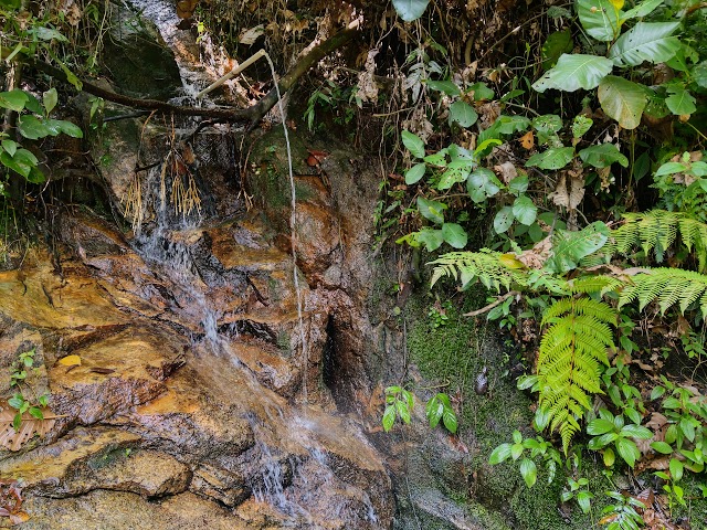
(+1)11.21am: The ‘mini waterfall’

(+7)11.28am: After the mini waterfall, there is a split path, take the left. The right would take you back to the top of the hill.
Taman Orkid Desa Exit

(+4)11.32am: Another split path here, you should take the right to head back to where you started. Let me show you where the left path leads below.

The path down is steep and slippery.

(+10)11.42am: It takes you out of the forest to Taman Orkid Desa Fasa 2
(+8)11.50am: Now, going back to the split path, showing you the correct path to the right.

There was this ‘PACE ULTRA’ sticker here.


(+1)11.51am: The path going up is pretty steep.

(+6)11.57am: After that, a brief flat path.

(+3)12.00pm: Next, you’ll reach this area with a cliff view.
Loop Exit

(+3)12.03pm: We’re out in the open again. Take the left.
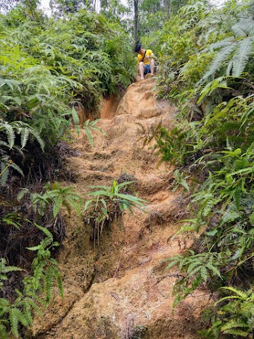
(+6)12.09pm: Go down the sandy slope carefully
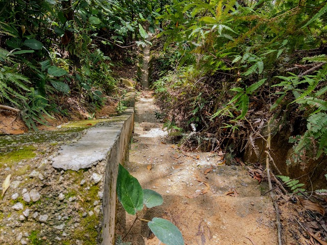
(+3)12.12pm: Then, there are these drainage stairs you can follow down to the exit. Be careful though, as these steps are tilted and slippery.

(+2)12.14pm: End of the stairs.

You’ll pop out from here, where we walked past at the start.

Down to the exit

We spotted two Malayan vine snakes along the fences at two different spots.
Epilogue
Bukit Besi hiking trails provide easy to moderate paths. You can choose just to hike up to some viewpoints, or further explore the forest by doing various loops. Compared to other hiking spots in Cheras, Bukit Besi had the least crowd but could get pretty popular during the weekends. It could get quite hot at some less shady areas so do get prepared and bring more water. Oh and also, there were A LOT of ants and mosquitos in the forest trails (apply mosquito repellent).
Have this guide helped you? Tag @meowtainpeople in your hiking stories & posts!
Affiliate Links to support this site:
Yay for transparency!: The links above are affiliate links, and at no additional cost to you, I earn a commission if you make a booking/purchase after clicking the links. I recommend only products and companies I use. Your support helps me keep the site going 🙂
Want to do the same affiliate marketing with your site? Use this AccessTrade platform link to receive RM5 reward.


*Captain Planet passing by* Remember, please take care of our environment, and please don’t destroy the Nature. Leave no trash behind and take back only photos and memories (and also some trash if you can). Walk on the designated path and stay in the middle as much as you can, so that the exposed soil doesn’t spread/corrode further. BE ONE WITH NATURE *flies away*
Yay for transparency!: Some of the links here are affiliate links, and at no additional cost to you, I earn a commission if you make a booking. I recommend only products and companies I use. Your support helps me keep the site going 🙂
wah….menariknya baca pengalaman hiking you…teringin nak hiking jugak lepas2 covid ni…